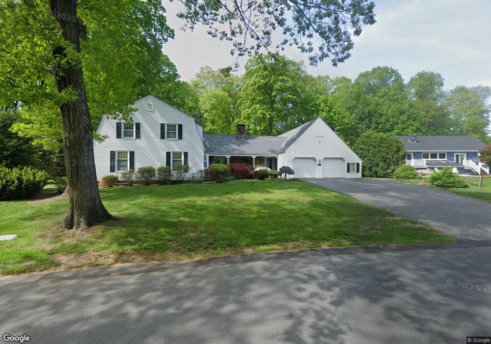
103 Bretton Rd West Springfield, MA 01089
Estimated Value: $557,777 - $630,000
5
Beds
4
Baths
3,417
Sq Ft
$177/Sq Ft
Est. Value
About This Home
This home is located at 103 Bretton Rd, West Springfield, MA 01089 and is currently estimated at $605,944, approximately $177 per square foot. 103 Bretton Rd is a home located in Hampden County with nearby schools including West Springfield High School, Hampden Charter School of Science West, and St Thomas The Apostle School.
Ownership History
Date
Name
Owned For
Owner Type
Purchase Details
Closed on
Aug 15, 2025
Sold by
Rossman Sandra L
Bought by
Rossman Andrew L
Current Estimated Value
Home Financials for this Owner
Home Financials are based on the most recent Mortgage that was taken out on this home.
Original Mortgage
$326,400
Outstanding Balance
$325,539
Interest Rate
6.67%
Mortgage Type
Purchase Money Mortgage
Estimated Equity
$280,405
Purchase Details
Closed on
Aug 2, 2001
Sold by
Mitchell Janet M
Bought by
Rossman Todd W and Rossman Sandra L
Create a Home Valuation Report for This Property
The Home Valuation Report is an in-depth analysis detailing your home's value as well as a comparison with similar homes in the area
Home Values in the Area
Average Home Value in this Area
Purchase History
| Date | Buyer | Sale Price | Title Company |
|---|---|---|---|
| Rossman Andrew L | -- | -- | |
| Rossman Andrew L | -- | -- | |
| Rossman Todd W | $225,000 | -- | |
| Rossman Todd W | $225,000 | -- |
Source: Public Records
Mortgage History
| Date | Status | Borrower | Loan Amount |
|---|---|---|---|
| Open | Rossman Andrew L | $326,400 | |
| Closed | Rossman Andrew L | $326,400 | |
| Previous Owner | Rossman Todd W | $175,000 |
Source: Public Records
Tax History
| Year | Tax Paid | Tax Assessment Tax Assessment Total Assessment is a certain percentage of the fair market value that is determined by local assessors to be the total taxable value of land and additions on the property. | Land | Improvement |
|---|---|---|---|---|
| 2025 | $7,111 | $478,200 | $136,400 | $341,800 |
| 2024 | $6,704 | $452,700 | $136,400 | $316,300 |
| 2023 | $6,522 | $419,700 | $143,300 | $276,400 |
| 2022 | $5,959 | $378,100 | $130,100 | $248,000 |
| 2021 | $6,005 | $355,300 | $122,800 | $232,500 |
| 2020 | $6,023 | $354,500 | $122,800 | $231,700 |
| 2019 | $6,012 | $354,500 | $122,800 | $231,700 |
| 2018 | $6,044 | $354,500 | $122,800 | $231,700 |
| 2017 | $6,044 | $354,500 | $122,800 | $231,700 |
| 2016 | $6,120 | $360,200 | $118,100 | $242,100 |
| 2015 | $6,004 | $353,400 | $115,900 | $237,500 |
| 2014 | $1,460 | $353,400 | $115,900 | $237,500 |
Source: Public Records
Map
Nearby Homes
- 117 Sibley Ave
- 34 Pebble Path Ln
- 1996 Westfield St
- 88 Verdugo St
- 65 Verdugo St
- 34 High Meadow Dr
- 66 Penrose Dr
- 240 Morton St
- 0 Ahiska Rd Unit 73477754
- 32 Glenview Dr
- 791 Morgan Rd
- 132 Lincoln St
- 17 Vincent Dr
- 0 E Mountain Rd
- 189 Springfield Rd Unit 23
- 81 Chestnut St
- 0 Feeding Hills Rd
- 242 Eastwood Dr
- 32 Maple St
- 128 Hampden St
- 115 Bretton Rd
- 93 Bretton Rd
- 81 Brewster Rd
- 123 Bretton Rd
- 88 Bretton Rd
- 85 Bretton Rd
- 71 Brewster Rd
- 225 Butternut Hollow Rd
- 219 Butternut Hollow Rd
- 77 Bretton Rd
- 78 Bretton Rd
- 137 Bretton Rd
- 132 Bretton Rd
- 84 Brewster Rd
- 63 Brewster Rd
- 67 Bretton Rd
- 65 Bretton Rd
- 205 Butternut Hollow Rd
- 5 Havenhurst Rd
- 62 Bretton Rd
Your Personal Tour Guide
Ask me questions while you tour the home.