Estimated Value: $138,000 - $190,000
About This Home
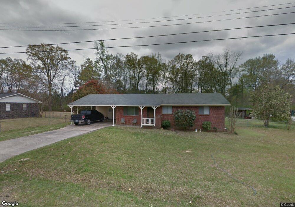
This home is located at 103 Bryant St, Petal, MS 39465 and is currently estimated at $170,571, approximately $152 per square foot. 103 Bryant St is a home located in Forrest County with nearby schools including Petal Primary School, Petal Elementary School, and Petal Middle School.
Ownership History
We collect this data history from publicly available records. To have your information removed, we recommend requesting removal directly through your county’s website.
Purchase Details
Home Financials for this Owner
Home Financials are based on the most recent Mortgage that was taken out on this home.Purchase Details
Home Financials for this Owner
Home Financials are based on the most recent Mortgage that was taken out on this home.Purchase Details
Home Values in the Area
Average Home Value in this Area
Purchase History
We collect this data history from publicly available records. To have your information removed, we recommend requesting removal directly through your county’s website.
| Date | Buyer | Sale Price | Title Company |
|---|---|---|---|
| -- | -- | ||
| -- | -- | ||
| -- | -- |
Mortgage History
We collect this data history from publicly available records. To have your information removed, we recommend requesting removal directly through your county’s website.
| Date | Status | Borrower | Loan Amount |
|---|---|---|---|
| Open | $100,505 | ||
| Previous Owner | $88,804 |
Tax History
We collect this data history from publicly available records. To have your information removed, we recommend requesting removal directly through your county’s website.
| Year | Tax Paid | Tax Assessment Tax Assessment Total Assessment is a certain percentage of the fair market value that is determined by local assessors to be the total taxable value of land and additions on the property. | Land | Improvement |
|---|---|---|---|---|
| 2025 | $1,026 | $7,509 | $0 | $0 |
| 2024 | $1,026 | $6,372 | $0 | $0 |
| 2023 | $866 | $63,720 | $0 | $0 |
| 2022 | $834 | $6,372 | $0 | $0 |
| 2021 | $839 | $6,372 | $0 | $0 |
| 2020 | $824 | $6,216 | $0 | $0 |
| 2019 | $823 | $6,216 | $0 | $0 |
| 2018 | $824 | $6,216 | $0 | $0 |
| 2017 | $836 | $6,216 | $0 | $0 |
| 2016 | $807 | $6,072 | $0 | $0 |
| 2015 | $792 | $60,724 | $0 | $0 |
| 2014 | $783 | $6,072 | $0 | $0 |
Map
- 115 Mcaulay Dr
- 900 Old Richton Rd
- 000 King Blvd
- 324 Garden Ln
- 107 Fairview Dr
- 69 Fairview Dr
- 1862 Old Richton Rd
- 205 Sunset Dr
- 1115 Evelyn Gandy Pkwy
- 000 Valley Dr
- 700 Old Richton Rd
- 1910 Old Richton Rd
- 533 Old Richton Rd
- 12+/- Ac Evelyn Gandy Pkwy
- 000 Crossroads Place
- 43 Apple Cove
- 522 Old Richton Rd
- 113 1/2 Norman Dr
- 6.69 acres Leeville Rd
- 5.5 +/- Evelyn Gandy Pkwy
Ask me questions while you tour the home.