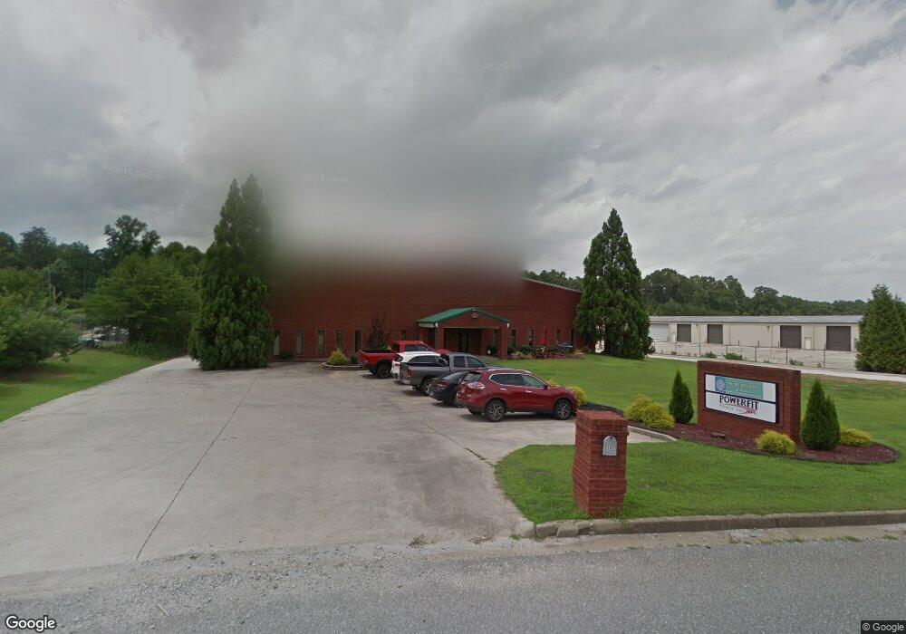
103 Chestatee Industrial Park Dr Dahlonega, GA 30533
--
Bed
--
Bath
8,000
Sq Ft
1
Acres
About This Home
This home is located at 103 Chestatee Industrial Park Dr, Dahlonega, GA 30533. 103 Chestatee Industrial Park Dr is a home located in Lumpkin County with nearby schools including Lumpkin County High School.
Ownership History
Date
Name
Owned For
Owner Type
Purchase Details
Closed on
Nov 24, 2014
Sold by
Advanced Applications Grp
Bought by
Aq Properties Llc
Home Financials for this Owner
Home Financials are based on the most recent Mortgage that was taken out on this home.
Original Mortgage
$488,750
Interest Rate
3.95%
Mortgage Type
Commercial
Purchase Details
Closed on
Oct 18, 2004
Sold by
Sims Claude D
Bought by
Advanced Applications Group Inc
Purchase Details
Closed on
Jun 26, 2002
Sold by
Kennedy Cliff
Bought by
Sims Claude D
Purchase Details
Closed on
Dec 15, 1999
Sold by
Fleming Joe
Bought by
Kennedy Cliff
Create a Home Valuation Report for This Property
The Home Valuation Report is an in-depth analysis detailing your home's value as well as a comparison with similar homes in the area
Home Values in the Area
Average Home Value in this Area
Purchase History
| Date | Buyer | Sale Price | Title Company |
|---|---|---|---|
| Aq Properties Llc | $575,000 | -- | |
| Advanced Applications Group Inc | $530,000 | -- | |
| Sims Claude D | $78,900 | -- | |
| Kennedy Cliff | -- | -- |
Source: Public Records
Mortgage History
| Date | Status | Borrower | Loan Amount |
|---|---|---|---|
| Closed | Aq Properties Llc | $488,750 |
Source: Public Records
Tax History Compared to Growth
Tax History
| Year | Tax Paid | Tax Assessment Tax Assessment Total Assessment is a certain percentage of the fair market value that is determined by local assessors to be the total taxable value of land and additions on the property. | Land | Improvement |
|---|---|---|---|---|
| 2024 | $5,208 | $234,473 | $27,878 | $206,595 |
| 2023 | $5,515 | $234,473 | $27,878 | $206,595 |
| 2022 | $5,873 | $237,216 | $27,878 | $209,338 |
| 2021 | $5,063 | $197,795 | $27,878 | $169,917 |
| 2020 | $5,218 | $197,795 | $27,878 | $169,917 |
| 2019 | $5,266 | $197,795 | $27,878 | $169,917 |
| 2018 | $5,612 | $197,795 | $27,878 | $169,917 |
| 2017 | $5,740 | $198,426 | $27,878 | $170,548 |
| 2016 | $5,934 | $198,426 | $27,878 | $170,548 |
| 2015 | $5,268 | $198,427 | $27,878 | $170,548 |
| 2014 | $5,268 | $199,835 | $27,878 | $171,956 |
| 2013 | -- | $201,903 | $27,878 | $174,024 |
Source: Public Records
Map
Nearby Homes
- 307 Eagle Overlook Dr
- 328 Jennifer Ct
- 1 Grey Swan Way
- 7-/+ Charlie Lemley Rd
- 0 Charlie Lemley Rd Unit 7693340
- 0 Charlie Lemley Rd Unit 10658696
- 1405 Burnt Stand Rd
- 0 Eagle Rest Rd Unit 13519388
- 70 Deerwood Cir
- 334 Silas Rd
- 55 Flat Rock Pointe
- 201 Whelchel Valley Dr
- TRACT1 Panorama Dr
- 35 Kitchen Way W
- 5195 S Chestatee
- 0 Long Branch Rd Unit 10271720
- 0 Long Branch Rd Unit 10271266
- 0 Long Branch Rd Unit 7357871
- 00 Long Branch Rd
- 0 Martins Ford Rd Unit 16724292
- 0 Chestatee Ind Park Unit 5 LOTS 3067923
- 0 Chestatee Ind Park Unit 5122639
- 159 Chestatee Industrial Park Dr
- 12 Chestatee Industrial Park Dr Unit Lot 12
- 60A Brentwood Ln
- 60 Brentwood Ln Unit 60B
- 28 Lora Ln Unit B
- 40 Lora Ln
- 40 Lora Ln
- 54 Lora Ln Unit A
- 54 Lora Ln Unit B
- 27 Lora Ln Unit B
- 70A Etowah Ridge
- 70 Etowah Ridge
- 60 Brentwood Ln
- 70 Etowah Ridge
- 59 Brentwood Ln Unit B
- 59 Brentwood Ln
- 54 Etowah Ridge Unit B
- 54A Etowah Ridge Unit LANE