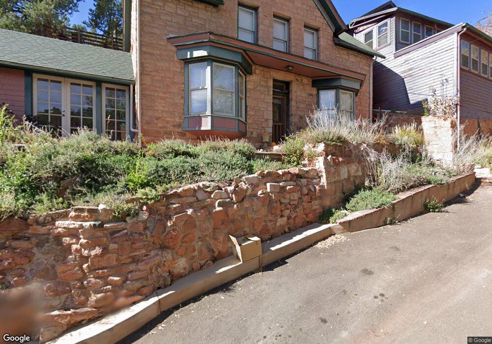
103 Cliff Rd Manitou Springs, CO 80829
Estimated Value: $598,783 - $724,000
3
Beds
3
Baths
2,202
Sq Ft
$304/Sq Ft
Est. Value
About This Home
This home is located at 103 Cliff Rd, Manitou Springs, CO 80829 and is currently estimated at $668,946, approximately $303 per square foot. 103 Cliff Rd is a home located in El Paso County with nearby schools including Manitou Springs Elementary School, Manitou Springs Middle School, and Manitou Springs High School.
Ownership History
Date
Name
Owned For
Owner Type
Purchase Details
Closed on
Jul 13, 2017
Sold by
Katspaw Llc
Bought by
Jeane Goede Donald and Jeane Farrellgoede
Current Estimated Value
Purchase Details
Closed on
May 23, 2014
Sold by
Goede Donald and Farrell Goede Jeana
Bought by
Katspaw Llc
Purchase Details
Closed on
May 22, 2014
Sold by
Katspaw Llc
Bought by
Goede Donald and Farrell Goede Jeana
Purchase Details
Closed on
Sep 19, 2012
Sold by
Katspaw Llc
Bought by
Goede Donald and Farrell Goede Jeana
Home Financials for this Owner
Home Financials are based on the most recent Mortgage that was taken out on this home.
Original Mortgage
$435,000
Interest Rate
3.62%
Mortgage Type
Seller Take Back
Purchase Details
Closed on
Mar 9, 2012
Sold by
Killoren Royann
Bought by
Katspaw Llc
Create a Home Valuation Report for This Property
The Home Valuation Report is an in-depth analysis detailing your home's value as well as a comparison with similar homes in the area
Home Values in the Area
Average Home Value in this Area
Purchase History
| Date | Buyer | Sale Price | Title Company |
|---|---|---|---|
| Jeane Goede Donald | -- | None Available | |
| Katspaw Llc | -- | None Available | |
| Goede Donald | -- | None Available | |
| Goede Donald | $450,000 | Land Title Guarantee Company | |
| Katspaw Llc | $450,000 | Land Title Guarantee Company |
Source: Public Records
Mortgage History
| Date | Status | Borrower | Loan Amount |
|---|---|---|---|
| Previous Owner | Goede Donald | $435,000 |
Source: Public Records
Tax History Compared to Growth
Tax History
| Year | Tax Paid | Tax Assessment Tax Assessment Total Assessment is a certain percentage of the fair market value that is determined by local assessors to be the total taxable value of land and additions on the property. | Land | Improvement |
|---|---|---|---|---|
| 2025 | $2,344 | $36,450 | -- | -- |
| 2024 | $2,154 | $35,570 | $3,980 | $31,590 |
| 2022 | $2,129 | $28,800 | $3,750 | $25,050 |
| 2021 | $2,220 | $29,630 | $3,860 | $25,770 |
| 2020 | $1,943 | $24,710 | $3,220 | $21,490 |
| 2019 | $2,063 | $24,710 | $3,220 | $21,490 |
| 2018 | $1,912 | $21,730 | $2,500 | $19,230 |
| 2017 | $1,690 | $21,730 | $2,500 | $19,230 |
Source: Public Records
Map
Nearby Homes
- 478 El Paso Blvd
- 34 Fountain Place
- 103 Deer Path Ave
- 135 South Path
- 105 Pawnee Ave
- 427 Bond St
- LOTS 1-10 Peakview Blvd
- 527 Canon Ave
- 529 Canon Ave
- 128 Cave Ave
- 136 Cave Ave
- 140 Cave Ave
- 0 Manitou Terrace
- 0 Charcas Rd Unit REC3377987
- 0 Charcas Rd Unit 1024513
- 18 Taos Place Unit 18
- 322 Santa fe Place Unit B
- 1107 Manitou Ave
- 1117 Manitou Ave
- 125 Ruxton Ave
- 39 Burns Rd
- 107 Cliff Rd
- 0 Burns Rd Unit 3134546
- 0 Burns Rd Unit 9191023
- 0 Burns Rd Unit 9568246
- 0 Burns Rd Unit 3152412
- 0 Burns Rd Unit 1875781
- 30 Burns Rd
- 423 Washington Ave
- 421 Washington Ave
- 486 El Paso Blvd
- 419 Washington Ave
- 46 Cedar Ln
- 417 Washington Ave
- 415 Washington Ave
- 107 Pinon Ln
- 413 Washington Ave
- 00 Burns Rd
- 109 Pinon Ln
- 480 El Paso Blvd