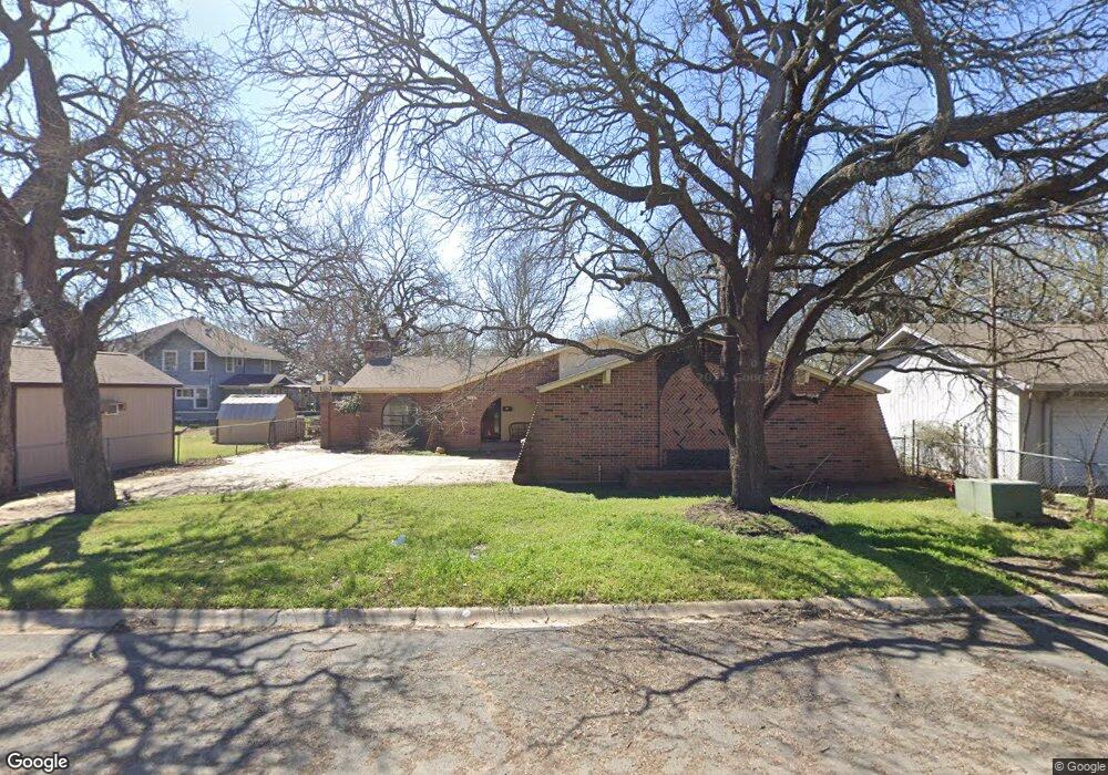
103 Corson St Cleburne, TX 76033
Osage-North Fisk NeighborhoodEstimated Value: $230,465 - $256,000
3
Beds
2
Baths
1,572
Sq Ft
$153/Sq Ft
Est. Value
About This Home
This home is located at 103 Corson St, Cleburne, TX 76033 and is currently estimated at $240,616, approximately $153 per square foot. 103 Corson St is a home located in Johnson County with nearby schools including Gerard Elementary School, Lowell Smith Jr. Middle School, and Cleburne High School.
Ownership History
Date
Name
Owned For
Owner Type
Purchase Details
Closed on
Feb 3, 2017
Sold by
Smith Gary Michael and William H Smith Trust
Bought by
Mccoy Marcus J and Mccoy Ruhama T
Current Estimated Value
Home Financials for this Owner
Home Financials are based on the most recent Mortgage that was taken out on this home.
Original Mortgage
$123,675
Outstanding Balance
$61,299
Interest Rate
4.3%
Mortgage Type
New Conventional
Estimated Equity
$179,317
Create a Home Valuation Report for This Property
The Home Valuation Report is an in-depth analysis detailing your home's value as well as a comparison with similar homes in the area
Home Values in the Area
Average Home Value in this Area
Purchase History
| Date | Buyer | Sale Price | Title Company |
|---|---|---|---|
| Mccoy Marcus J | -- | Stewart Title |
Source: Public Records
Mortgage History
| Date | Status | Borrower | Loan Amount |
|---|---|---|---|
| Open | Mccoy Marcus J | $123,675 |
Source: Public Records
Tax History Compared to Growth
Tax History
| Year | Tax Paid | Tax Assessment Tax Assessment Total Assessment is a certain percentage of the fair market value that is determined by local assessors to be the total taxable value of land and additions on the property. | Land | Improvement |
|---|---|---|---|---|
| 2025 | $2,792 | $186,250 | $55,800 | $130,450 |
| 2024 | $2,792 | $186,250 | $55,800 | $130,450 |
| 2023 | $2,799 | $186,250 | $55,800 | $130,450 |
| 2022 | $4,661 | $186,250 | $55,800 | $130,450 |
| 2021 | $4,424 | $212,835 | $62,000 | $150,835 |
| 2020 | $4,271 | $154,145 | $30,000 | $124,145 |
| 2019 | $4,312 | $154,145 | $30,000 | $124,145 |
| 2018 | $3,921 | $132,661 | $15,000 | $117,661 |
| 2017 | $3,107 | $132,661 | $15,000 | $117,661 |
| 2016 | $2,825 | $95,954 | $8,500 | $87,454 |
| 2015 | $928 | $95,954 | $8,500 | $87,454 |
| 2014 | $928 | $91,024 | $8,500 | $82,524 |
Source: Public Records
Map
Nearby Homes
- 1503 Stanwood Ave
- 1107 Stanwood Ave
- 616 Bellevue Dr
- 714 Forrest Ave
- 1027 Spring Azure Dr
- 1104 Cherrywood Dr
- 611 Forrest Ave
- 1102 Hillsboro St
- 0000 State Highway 171
- 909 Highland Dr
- 311 Sunset Dr
- 603 S Walnut St
- 4112 Highland Dr
- 4101 Highland Dr
- 1104 Lynnwood Dr
- 215 Sunset Dr
- TBD E Hwy 4 Hwy
- 505 W Earl St
- 404 Forrest Ave
- 1411 Clearfield Dr
- 1203 Gleason Ave
- 1201 Gleason Ave
- 1204 Prairie Ave
- 1202 Prairie Ave
- 1205 Gleason Ave
- 1126 Prairie Ave
- 1207 Gleason Ave
- 1117 Gleason Ave
- 1206 Prairie Ave
- 102 Scudder St
- 1209 Gleason Ave
- 1122 Prairie Ave
- 1111 Gleason Ave
- 1208 Prairie Ave
- 1204 Gleason Ave
- 1211 Gleason Ave
- 1202 Gleason Ave
- 1208 Gleason Ave
- 1120 Prairie Ave
- 1201 Prairie Ave