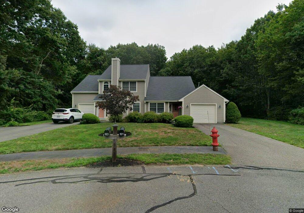
103 E Glen Dr Taunton, MA 02780
Weir Village NeighborhoodEstimated Value: $408,000 - $438,000
3
Beds
2
Baths
1,272
Sq Ft
$335/Sq Ft
Est. Value
About This Home
This home is located at 103 E Glen Dr, Taunton, MA 02780 and is currently estimated at $425,698, approximately $334 per square foot. 103 E Glen Dr is a home located in Bristol County with nearby schools including Elizabeth Pole School, Taunton High School, and John F. Parker Middle School.
Ownership History
Date
Name
Owned For
Owner Type
Purchase Details
Closed on
Aug 11, 2017
Sold by
Backner Irwin S and Backner Mura L
Bought by
Faria Keith M and Faria Michelle M
Current Estimated Value
Home Financials for this Owner
Home Financials are based on the most recent Mortgage that was taken out on this home.
Original Mortgage
$181,600
Outstanding Balance
$96,855
Interest Rate
3.88%
Mortgage Type
New Conventional
Estimated Equity
$328,843
Purchase Details
Closed on
Aug 29, 2001
Sold by
Kilroy Rt and Leahy E
Bought by
Backner Irwin S and Backner Myra L
Home Financials for this Owner
Home Financials are based on the most recent Mortgage that was taken out on this home.
Original Mortgage
$74,000
Interest Rate
7.06%
Mortgage Type
Purchase Money Mortgage
Purchase Details
Closed on
Aug 30, 1996
Sold by
Francioso Anthony L and Francioso Lorraine M
Bought by
Kilroy Rt and Leahy E
Home Financials for this Owner
Home Financials are based on the most recent Mortgage that was taken out on this home.
Original Mortgage
$81,000
Interest Rate
8.18%
Mortgage Type
Purchase Money Mortgage
Purchase Details
Closed on
Oct 2, 1995
Sold by
Melo Carlos R
Bought by
Francioso Anthony L and Francioso Lorraine M
Home Financials for this Owner
Home Financials are based on the most recent Mortgage that was taken out on this home.
Original Mortgage
$78,650
Interest Rate
7.89%
Mortgage Type
Purchase Money Mortgage
Create a Home Valuation Report for This Property
The Home Valuation Report is an in-depth analysis detailing your home's value as well as a comparison with similar homes in the area
Home Values in the Area
Average Home Value in this Area
Purchase History
| Date | Buyer | Sale Price | Title Company |
|---|---|---|---|
| Faria Keith M | $227,000 | -- | |
| Backner Irwin S | $183,000 | -- | |
| Kilroy Rt | $110,000 | -- | |
| Francioso Anthony L | $104,900 | -- |
Source: Public Records
Mortgage History
| Date | Status | Borrower | Loan Amount |
|---|---|---|---|
| Open | Faria Keith M | $181,600 | |
| Previous Owner | Francioso Anthony L | $74,000 | |
| Previous Owner | Francioso Anthony L | $81,000 | |
| Previous Owner | Francioso Anthony L | $78,650 |
Source: Public Records
Tax History Compared to Growth
Tax History
| Year | Tax Paid | Tax Assessment Tax Assessment Total Assessment is a certain percentage of the fair market value that is determined by local assessors to be the total taxable value of land and additions on the property. | Land | Improvement |
|---|---|---|---|---|
| 2025 | $4,063 | $371,400 | $0 | $371,400 |
| 2024 | $3,642 | $325,500 | $0 | $325,500 |
| 2023 | $3,468 | $287,800 | $0 | $287,800 |
| 2022 | $3,008 | $228,200 | $0 | $228,200 |
| 2021 | $2,884 | $203,100 | $0 | $203,100 |
| 2020 | $2,982 | $200,700 | $0 | $200,700 |
| 2019 | $3,095 | $196,400 | $0 | $196,400 |
| 2018 | $3,048 | $193,900 | $0 | $193,900 |
| 2017 | $2,883 | $183,500 | $0 | $183,500 |
| 2016 | $2,742 | $174,900 | $0 | $174,900 |
| 2015 | $2,738 | $182,400 | $0 | $182,400 |
| 2014 | $2,684 | $183,700 | $0 | $183,700 |
Source: Public Records
Map
Nearby Homes
- 23 Johnson St Unit A
- 23 Johnson St Unit C
- 55 Donna Terrace
- 11 Williams St
- 26 Maynard St Unit A
- 600 County St
- 600 County St Lot A
- 600
- 28 Barbara Rd
- 168 Hart St Unit 22
- 59 Linden St Unit 308
- 106 Alicia Dr
- 71 Linden St
- 165 King James Blvd
- 1301 Carriage Ln Unit 1301
- 170 Hart St Unit B
- 117 Hart St Unit 5
- 6 W Summer St
- 99 Summer St
- 1 Fayal Ave