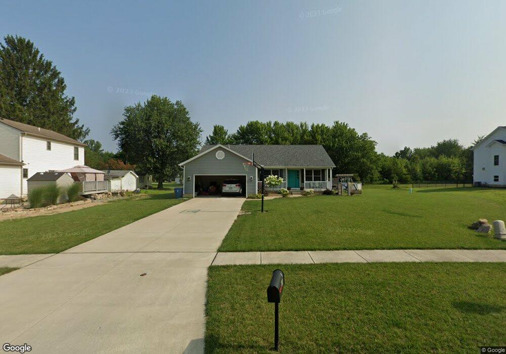
103 Factory Way Lagrange, OH 44050
Estimated Value: $297,000 - $356,000
3
Beds
2
Baths
1,448
Sq Ft
$223/Sq Ft
Est. Value
About This Home
This home is located at 103 Factory Way, Lagrange, OH 44050 and is currently estimated at $322,295, approximately $222 per square foot. 103 Factory Way is a home with nearby schools including Keystone Elementary School, Keystone Middle School, and Keystone High School.
Ownership History
Date
Name
Owned For
Owner Type
Purchase Details
Closed on
Jul 11, 2016
Sold by
Christensen Walter J
Bought by
Dean Chelsa M
Current Estimated Value
Home Financials for this Owner
Home Financials are based on the most recent Mortgage that was taken out on this home.
Original Mortgage
$163,593
Outstanding Balance
$130,932
Interest Rate
3.66%
Mortgage Type
New Conventional
Estimated Equity
$191,363
Create a Home Valuation Report for This Property
The Home Valuation Report is an in-depth analysis detailing your home's value as well as a comparison with similar homes in the area
Home Values in the Area
Average Home Value in this Area
Purchase History
| Date | Buyer | Sale Price | Title Company |
|---|---|---|---|
| Dean Chelsa M | $22,000 | Fidelity National Title |
Source: Public Records
Mortgage History
| Date | Status | Borrower | Loan Amount |
|---|---|---|---|
| Open | Dean Chelsa M | $163,593 |
Source: Public Records
Tax History Compared to Growth
Tax History
| Year | Tax Paid | Tax Assessment Tax Assessment Total Assessment is a certain percentage of the fair market value that is determined by local assessors to be the total taxable value of land and additions on the property. | Land | Improvement |
|---|---|---|---|---|
| 2024 | $3,775 | $89,068 | $16,625 | $72,443 |
| 2023 | $4,764 | $93,867 | $16,086 | $77,781 |
| 2022 | $4,732 | $93,867 | $16,086 | $77,781 |
| 2021 | $4,734 | $93,867 | $16,086 | $77,781 |
| 2020 | $4,623 | $81,690 | $14,000 | $67,690 |
| 2019 | $4,363 | $77,250 | $14,000 | $63,250 |
| 2018 | $4,165 | $77,250 | $14,000 | $63,250 |
| 2017 | $4,119 | $71,010 | $14,000 | $57,010 |
| 2016 | $578 | $9,800 | $9,800 | $0 |
| 2015 | $577 | $9,800 | $9,800 | $0 |
| 2014 | $511 | $9,800 | $9,800 | $0 |
| 2013 | $496 | $9,800 | $9,800 | $0 |
Source: Public Records
Map
Nearby Homes
- 302 N Center St
- 433 N Center St
- 171 Keywood Blvd
- 110 Railroad St
- 194 Railroad St
- 128 Harvest Ct
- 516 Appomattox Ct
- 0 Dill Ct Unit 5072837
- 548 William St
- 607 Rundle St
- 614 Rundle St
- 630 Rundle St
- 756 N Center St
- 40725 Biggs Rd
- 808 Buckingham Dr
- 822 Robinson Dr
- 800 Buckingham Dr
- 829 Robinson Dr
- 831 Robinson Dr
- 19045 Whitehead Rd
- 210 Factory St
- 202 Factory St
- 0 Factory Way Unit 3980406
- 4 SL Factory Way
- 300 Factory St
- 300 Prospect St
- 4 Factory Way
- 107 Factory Way
- 306 Factory St
- 159 Factory St
- 150 Factory St
- 157 Factory St
- 155 Factory St
- 314 Factory St
- 309 Prospect St
- 151 Factory St
- 309 Factory St
- 108 Factory Way
- 328 Factory St
- 147 Factory St