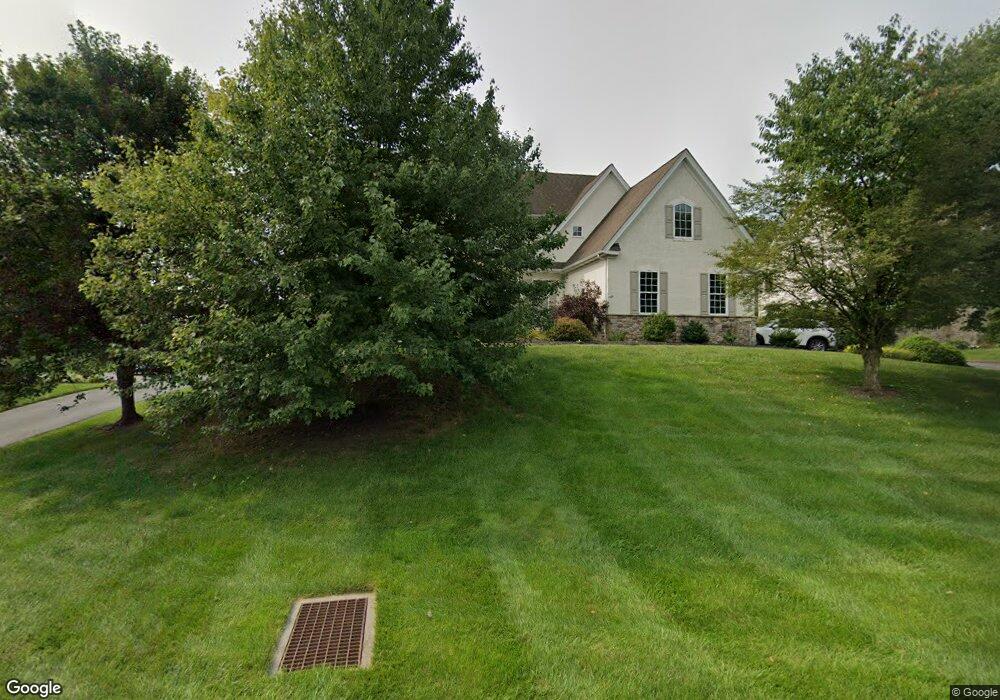
103 Forest Dr Kennett Square, PA 19348
Estimated Value: $936,799 - $1,097,000
4
Beds
5
Baths
3,726
Sq Ft
$275/Sq Ft
Est. Value
About This Home
This home is located at 103 Forest Dr, Kennett Square, PA 19348 and is currently estimated at $1,024,450, approximately $274 per square foot. 103 Forest Dr is a home located in Chester County with nearby schools including Kennett Middle School, Kennett High School, and St. Patrick School.
Ownership History
Date
Name
Owned For
Owner Type
Purchase Details
Closed on
May 6, 2005
Sold by
Wilkinson Heritage Llc
Bought by
Taylor Kevin J and Taylor Courtney M
Current Estimated Value
Home Financials for this Owner
Home Financials are based on the most recent Mortgage that was taken out on this home.
Original Mortgage
$359,650
Outstanding Balance
$190,047
Interest Rate
6.05%
Mortgage Type
Fannie Mae Freddie Mac
Estimated Equity
$834,403
Create a Home Valuation Report for This Property
The Home Valuation Report is an in-depth analysis detailing your home's value as well as a comparison with similar homes in the area
Home Values in the Area
Average Home Value in this Area
Purchase History
| Date | Buyer | Sale Price | Title Company |
|---|---|---|---|
| Taylor Kevin J | $613,132 | -- |
Source: Public Records
Mortgage History
| Date | Status | Borrower | Loan Amount |
|---|---|---|---|
| Open | Taylor Kevin J | $359,650 |
Source: Public Records
Tax History
| Year | Tax Paid | Tax Assessment Tax Assessment Total Assessment is a certain percentage of the fair market value that is determined by local assessors to be the total taxable value of land and additions on the property. | Land | Improvement |
|---|---|---|---|---|
| 2025 | $14,755 | $361,830 | $86,660 | $275,170 |
| 2024 | $14,755 | $361,830 | $86,660 | $275,170 |
| 2023 | $14,468 | $361,830 | $86,660 | $275,170 |
| 2022 | $14,083 | $361,830 | $86,660 | $275,170 |
| 2021 | $13,871 | $361,830 | $86,660 | $275,170 |
| 2020 | $13,612 | $361,830 | $86,660 | $275,170 |
| 2019 | $13,430 | $361,830 | $86,660 | $275,170 |
| 2018 | $13,152 | $361,830 | $86,660 | $275,170 |
| 2017 | $12,233 | $361,830 | $86,660 | $275,170 |
| 2016 | $1,332 | $361,830 | $86,660 | $275,170 |
| 2015 | $1,332 | $361,830 | $86,660 | $275,170 |
| 2014 | $1,332 | $361,830 | $86,660 | $275,170 |
Source: Public Records
Map
Nearby Homes
- 403 Winterberry Dr Unit 42
- 105 Waywood Dr
- 400 Lantern Ln
- 115 Waywood Dr Unit 31
- 113 Waywood Dr Unit 32
- 111 Waywood Dr Unit 33
- 103 Waywood Dr Unit 36
- 103 Waywood Dr
- 535 Kenview Ave
- 989 Sills Mill Rd
- 323 Cherry Ln
- 39 E Jonathan Ct
- 10104 Beacon St
- 10103 Beacon St
- 123 Federal Walk
- 530 Richards Rd
- 10101 Beacon St
- 10101 Austin Dr
- 10102 Beacon St
- 10102 Bramble St
- 105 Forest Dr
- 101 Forest Dr
- 107 Forest Dr
- 104 Forest Dr
- 100 Forest Dr
- 102 Forest Dr
- 106 Forest Dr
- 665 Rosedale Rd
- 109 Forest Dr
- 108 Forest Dr
- 663 Rosedale Rd
- 661 Rosedale Rd
- 106 Blue Spruce Dr
- 108 Blue Spruce Dr
- 104 Blue Spruce Dr
- 106 Woodview Dr
- 675 Rosedale Rd
- 102 Blue Spruce Dr
- 109 Blue Spruce Dr
- 104 Woodview Dr
Your Personal Tour Guide
Ask me questions while you tour the home.