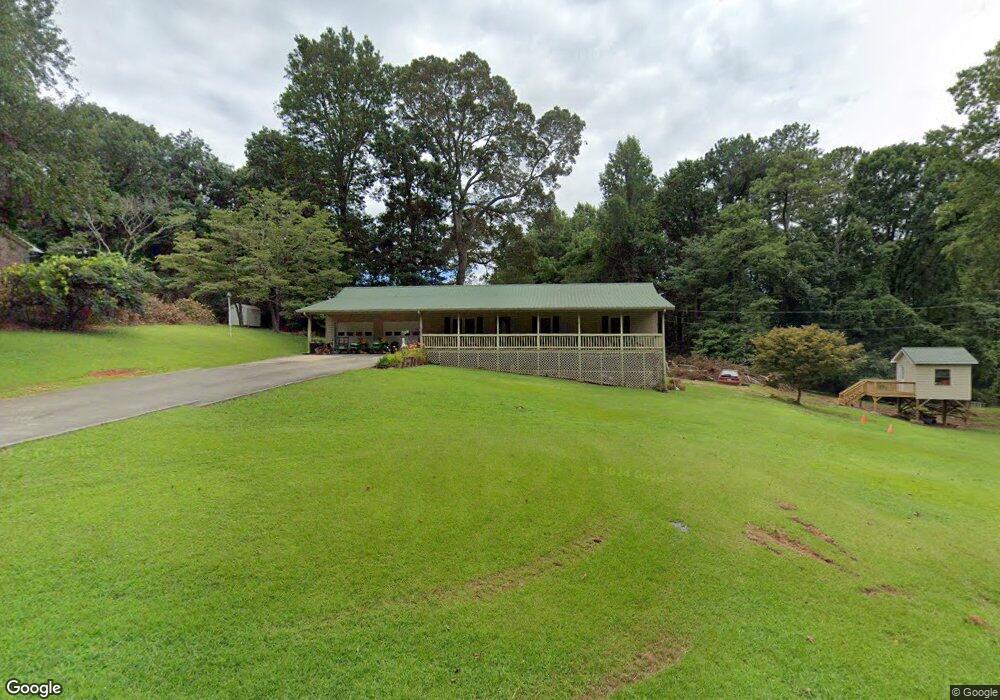
103 Glyness St Jasper, GA 30143
Estimated Value: $264,000 - $310,000
Studio
1
Bath
1,344
Sq Ft
$213/Sq Ft
Est. Value
About This Home
This home is located at 103 Glyness St, Jasper, GA 30143 and is currently estimated at $285,812, approximately $212 per square foot. 103 Glyness St is a home located in Pickens County with nearby schools including Harmony Elementary School, Pickens County Middle School, and Pickens County High School.
Ownership History
Date
Name
Owned For
Owner Type
Purchase Details
Closed on
Mar 18, 2008
Sold by
Stone Stanley
Bought by
Stone Stanley and Stone Lisa
Current Estimated Value
Home Financials for this Owner
Home Financials are based on the most recent Mortgage that was taken out on this home.
Original Mortgage
$164,000
Outstanding Balance
$102,020
Interest Rate
5.97%
Mortgage Type
New Conventional
Estimated Equity
$183,792
Purchase Details
Closed on
Jul 20, 1981
Sold by
Barnes Barnes E and Barnes C
Bought by
Stone Stanley
Create a Home Valuation Report for This Property
The Home Valuation Report is an in-depth analysis detailing your home's value as well as a comparison with similar homes in the area
Home Values in the Area
Average Home Value in this Area
Purchase History
We collect this data history from publicly available records. To have your information removed, we recommend requesting removal directly through your county’s website.
| Date | Buyer | Sale Price | Title Company |
|---|---|---|---|
| Stone Stanley | -- | -- | |
| Stone Stanley | $5,000 | -- |
Source: Public Records
Mortgage History
We collect this data history from publicly available records. To have your information removed, we recommend requesting removal directly through your county’s website.
| Date | Status | Borrower | Loan Amount |
|---|---|---|---|
| Open | Stone Stanley | $164,000 |
Source: Public Records
Tax History
| Year | Tax Paid | Tax Assessment Tax Assessment Total Assessment is a certain percentage of the fair market value that is determined by local assessors to be the total taxable value of land and additions on the property. | Land | Improvement |
|---|---|---|---|---|
| 2025 | $1,877 | $108,648 | $30,000 | $78,648 |
| 2024 | $2,051 | $108,648 | $30,000 | $78,648 |
| 2023 | $2,108 | $108,648 | $30,000 | $78,648 |
| 2022 | $1,679 | $87,558 | $30,000 | $57,558 |
| 2021 | $977 | $49,826 | $10,768 | $39,058 |
| 2020 | $1,006 | $49,826 | $10,768 | $39,058 |
| 2019 | $1,029 | $49,826 | $10,768 | $39,058 |
| 2018 | $1,039 | $49,826 | $10,768 | $39,058 |
| 2017 | $1,056 | $49,826 | $10,768 | $39,058 |
| 2016 | $1,073 | $49,826 | $10,768 | $39,058 |
| 2015 | $1,048 | $49,826 | $10,768 | $39,058 |
| 2014 | $1,050 | $49,826 | $10,768 | $39,058 |
| 2013 | -- | $49,825 | $10,768 | $39,057 |
Source: Public Records
Map
Nearby Homes
- 174 Golden Springs Dr
- 12 Sammy McGhee Blvd Unit 203
- 7 Noah Dr
- 80 Mountain Mint Dr
- 5566 Red Fox Ln
- 0 Hunters Ridge Rd Unit 7714906
- 2668 Highland Trail
- 5574 Red Fox Ln
- 0 Mulberry Cir Unit 7740480
- 0 Lower Sassafras Pkwy Unit 10772964
- 0 Mulberry Cir Unit 10756000
- LOT 26 Falcons Nest Unit 26
- 0 Lower Sassafras Pkwy Unit 7777751
- 0 Hunters Ridge Rd Unit 10685847
- 3513 Bear Creek Point
- 280 Vistaview Pkwy
- LOT 26 Falcons Nest
- 0 Mulberry Cir Unit 409241
- 0 Hunters Ridge Rd Unit 10685863
- 0 Hunters Ridge Rd Unit 7714898
- 16 Arminda St
- 75 Glyness St
- 165 Glyness St
- 42 Arminda St Unit A
- 42 Arminda St
- 42 Arminda St Unit A
- 42 Arminda St Unit A & B
- 30 W Gordon Rd
- 56 W Gordon Rd
- 25 Arminda St
- 401 Gordon Rd
- 401 Gordon Rd Unit 45
- 203 Glyness St
- 28 Myrtle St
- 190 Glyness St
- 65 Myrtle St
- 59 Arminda St
- 60 Myrtle St
- 345 Gordon Rd
- 70 Arminda St
Your Personal Tour Guide
Ask me questions while you tour the home.