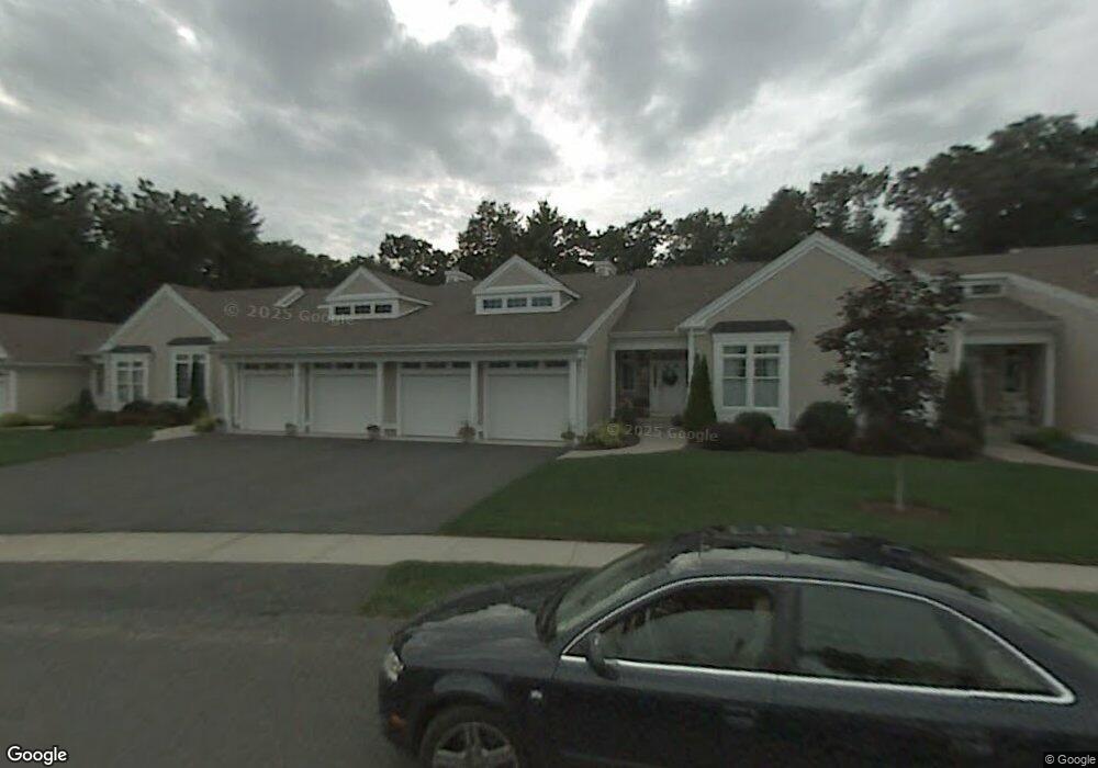
103 High Pine Cir Wilbraham, MA 01095
Estimated Value: $519,000 - $637,000
3
Beds
3
Baths
2,436
Sq Ft
$235/Sq Ft
Est. Value
About This Home
This home is located at 103 High Pine Cir, Wilbraham, MA 01095 and is currently estimated at $572,079, approximately $234 per square foot. 103 High Pine Cir is a home located in Hampden County with nearby schools including Minnechaug Regional High School and Wilbraham & Monson Academy.
Ownership History
Date
Name
Owned For
Owner Type
Purchase Details
Closed on
Apr 11, 2022
Sold by
Dalto Elizabeth A
Bought by
Elizabeth Dalto Nt
Current Estimated Value
Purchase Details
Closed on
Oct 1, 2021
Sold by
Pallotta George A and Pallotta Barbara S
Bought by
Dalto Elizabeth A
Purchase Details
Closed on
May 4, 2017
Sold by
Bogdan Candace J and Camblos Christine S
Bought by
Pallotta George A and Pallotta Barbara S
Purchase Details
Closed on
Aug 27, 2009
Sold by
Couture Shirley W
Bought by
Bogdan Candace Jc and Camblos Christine S C
Purchase Details
Closed on
Jul 20, 2000
Sold by
Woods At Wilbraham Llc
Bought by
Lj & Sw Couture Ret and Couture Leonard J
Create a Home Valuation Report for This Property
The Home Valuation Report is an in-depth analysis detailing your home's value as well as a comparison with similar homes in the area
Home Values in the Area
Average Home Value in this Area
Purchase History
| Date | Buyer | Sale Price | Title Company |
|---|---|---|---|
| Elizabeth Dalto Nt | -- | None Available | |
| Dalto Elizabeth A | $477,000 | None Available | |
| Pallotta George A | $344,900 | -- | |
| Bogdan Candace Jc | -- | -- | |
| Couture Shirley W | -- | -- | |
| Lj & Sw Couture Ret | $298,800 | -- |
Source: Public Records
Tax History
| Year | Tax Paid | Tax Assessment Tax Assessment Total Assessment is a certain percentage of the fair market value that is determined by local assessors to be the total taxable value of land and additions on the property. | Land | Improvement |
|---|---|---|---|---|
| 2025 | $9,993 | $558,900 | $0 | $558,900 |
| 2024 | $9,087 | $491,200 | $0 | $491,200 |
| 2023 | $8,747 | $481,400 | $0 | $481,400 |
| 2022 | $8,747 | $426,900 | $0 | $426,900 |
| 2021 | $7,914 | $344,700 | $0 | $344,700 |
| 2020 | $7,714 | $344,700 | $0 | $344,700 |
| 2019 | $7,517 | $344,800 | $0 | $344,800 |
| 2018 | $7,707 | $340,400 | $0 | $340,400 |
| 2017 | $7,489 | $340,400 | $0 | $340,400 |
| 2016 | $7,333 | $339,500 | $0 | $339,500 |
| 2015 | $7,089 | $339,500 | $0 | $339,500 |
Source: Public Records
Map
Nearby Homes
- 104 High Pine Cir
- 1 Aspen Dr
- 35 Lake Dr
- 4 Hillcrest Dr
- 46 Washington Rd
- 20 Old Orchard Rd
- 16 Maple St
- 8 Patriot Ridge Ln
- 36 Maple St
- 3 Mohawk St
- 6 Teak Terrace Unit 24
- 474 Mountain Rd
- 103 Sandalwood Dr Unit site 00
- 57 Sandalwood Dr Unit site 61
- 111 Sandalwood Dr Unit site 00
- 474-480 Mountain Rd
- 22 Brainard Rd
- 84 Sandalwood Dr Unit site 00
- 26 Sandalwood Dr
- 24 Lodge Ln Unit 24
- 109 High Pine Cir
- 107 High Pine Cir
- 103 High Pine Cir Unit 103
- 115 High Pine Cir
- 111 High Pine Cir
- 99 High Pine Cir
- 108 High Pine Cir
- 106 High Pine Cir
- 98 High Pine Cir
- 96 High Pine Cir
- 102 High Pine Cir
- 100 High Pine Cir
- 4 Balsam Dr
- 2 Balsam Dr
- 10 Marilyn Dr
- 8 Balsam Dr
- 6 Balsam Dr
- 12 Balsam Dr
- 10 Balsam Dr
- 5 Balsam Dr
Your Personal Tour Guide
Ask me questions while you tour the home.