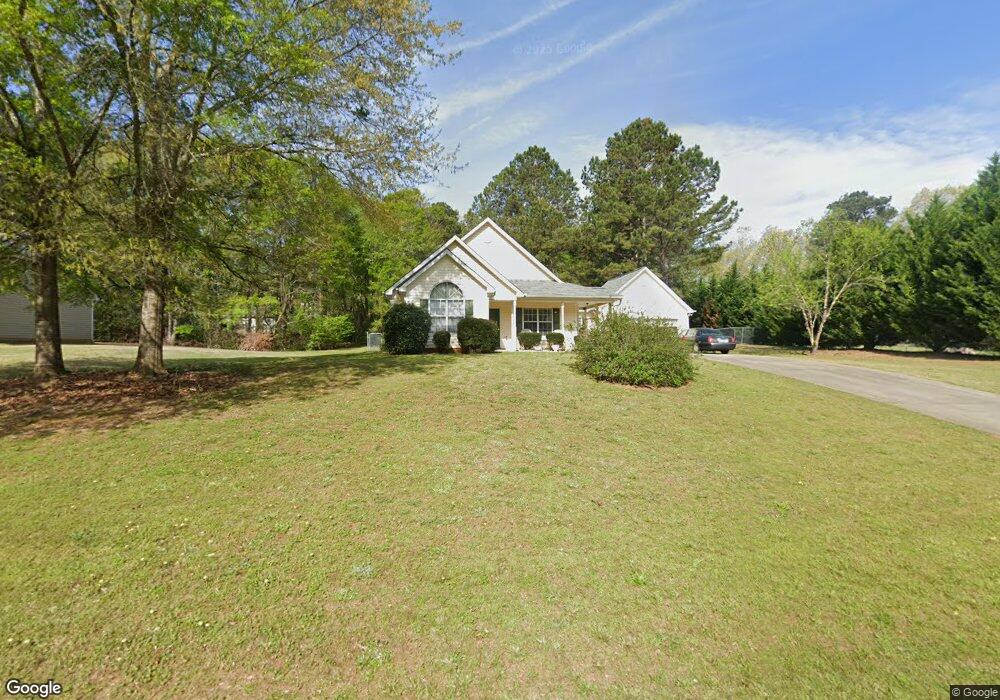
103 Kimbell Farm Dr Unit 2 Locust Grove, GA 30248
Estimated Value: $274,516 - $286,000
3
Beds
2
Baths
1,521
Sq Ft
$183/Sq Ft
Est. Value
About This Home
This home is located at 103 Kimbell Farm Dr Unit 2, Locust Grove, GA 30248 and is currently estimated at $278,129, approximately $182 per square foot. 103 Kimbell Farm Dr Unit 2 is a home located in Henry County with nearby schools including Unity Grove Elementary School, Locust Grove Middle School, and Locust Grove High School.
Ownership History
Date
Name
Owned For
Owner Type
Purchase Details
Closed on
May 19, 2005
Sold by
Crosby Norman L
Bought by
Buice Allen
Current Estimated Value
Home Financials for this Owner
Home Financials are based on the most recent Mortgage that was taken out on this home.
Original Mortgage
$119,160
Outstanding Balance
$71,397
Interest Rate
8.25%
Mortgage Type
New Conventional
Estimated Equity
$206,732
Purchase Details
Closed on
Apr 25, 2003
Sold by
Bussey Sharen L
Bought by
Crosby Norman L
Home Financials for this Owner
Home Financials are based on the most recent Mortgage that was taken out on this home.
Original Mortgage
$24,350
Interest Rate
5.05%
Mortgage Type
Unknown
Purchase Details
Closed on
Jul 11, 2001
Sold by
Jackson Christopher A and Jackson Cathy D
Bought by
Bussey Sharen L
Home Financials for this Owner
Home Financials are based on the most recent Mortgage that was taken out on this home.
Original Mortgage
$91,920
Interest Rate
7.16%
Mortgage Type
New Conventional
Create a Home Valuation Report for This Property
The Home Valuation Report is an in-depth analysis detailing your home's value as well as a comparison with similar homes in the area
Home Values in the Area
Average Home Value in this Area
Purchase History
| Date | Buyer | Sale Price | Title Company |
|---|---|---|---|
| Buice Allen | $132,400 | -- | |
| Crosby Norman L | $121,900 | -- | |
| Bussey Sharen L | $114,900 | -- | |
| Jackson Christopher A | $114,900 | -- |
Source: Public Records
Mortgage History
| Date | Status | Borrower | Loan Amount |
|---|---|---|---|
| Open | Buice Allen | $119,160 | |
| Previous Owner | Crosby Norman L | $24,350 | |
| Previous Owner | Crosby Norman L | $97,500 | |
| Previous Owner | Jackson Christopher A | $91,920 | |
| Previous Owner | Jackson Christopher A | $95,900 |
Source: Public Records
Tax History Compared to Growth
Tax History
| Year | Tax Paid | Tax Assessment Tax Assessment Total Assessment is a certain percentage of the fair market value that is determined by local assessors to be the total taxable value of land and additions on the property. | Land | Improvement |
|---|---|---|---|---|
| 2025 | $702 | $114,560 | $14,000 | $100,560 |
| 2024 | $702 | $108,400 | $14,000 | $94,400 |
| 2023 | $445 | $108,520 | $14,000 | $94,520 |
| 2022 | $590 | $85,280 | $14,000 | $71,280 |
| 2021 | $590 | $71,360 | $14,000 | $57,360 |
| 2020 | $590 | $60,760 | $12,000 | $48,760 |
| 2019 | $590 | $59,200 | $12,000 | $47,200 |
| 2018 | $590 | $53,760 | $10,800 | $42,960 |
| 2016 | $572 | $51,120 | $10,000 | $41,120 |
| 2015 | $541 | $46,600 | $10,000 | $36,600 |
| 2014 | $507 | $43,680 | $10,000 | $33,680 |
Source: Public Records
Map
Nearby Homes
- 601 Amerigo Ct
- 521 Deadwood Trail
- 218 Baxter Ln
- 604 Onieda Dr
- 143 Kimbell Farm Dr
- 1000 Coan Dr
- 705 Seabolt Rd
- 678 Seabolt Rd
- 165 Caraway Rd
- 305 Annie Ln Unit 2
- 100 Harbin Trail
- 1126 Old Jackson Rd
- 1850 Old Jackson Rd
- 121, 125, 129 Case Dr
- 1627 Leguin Mill Rd
- 108 Caraway Rd
- 281 Laney Dr
- 995 Old Jackson Rd
- 230 Leguin Mill Rd
- 201 Nina Cir
- 105 Kimbell Farm Dr
- 101 Kimbell Farm Dr Unit I
- 1211 Coan Dr
- 104 Kimbell Farm Dr
- 1219 Coan Dr
- 1219 Coan Dr Unit I
- 107 Kimbell Farm Dr Unit 2
- 106 Kimbell Farm Dr Unit 53
- 1199 Coan Dr
- 605 Amerigo Ct
- 605 Amerigo Ct Unit 601
- 505 Deadwood Trail
- 505 Deadwood Trail Unit 600
- 1223 Coan Dr
- 108 Kimbell Farm Dr
- 609 Amerigo Ct
- 609 Amerigo Ct Unit 602
- 99 Kimbell Farm Dr
- 1231 Coan Dr Unit 1
- 102 Kimbell Farm Dr