Estimated Value: $98,000 - $135,000
2
Beds
--
Bath
1,754
Sq Ft
$64/Sq Ft
Est. Value
About This Home
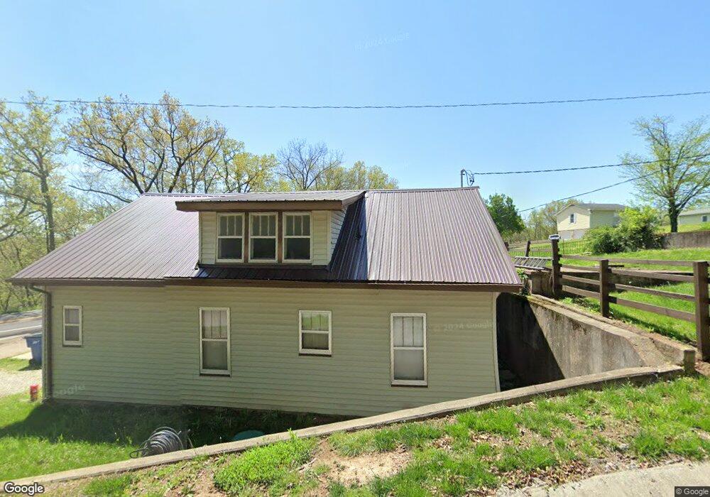
This home is located at 103 Locust St, Meta, MO 65058 and is currently estimated at $112,406, approximately $64 per square foot. 103 Locust St is a home with nearby schools including Fatima Elementary School and Fatima High School.
Ownership History
Date
Name
Owned For
Owner Type
Purchase Details
Closed on
Jul 11, 2025
Sold by
Jacobs Christopher and Jacobs Christal J
Bought by
Anton Thea Marie
Current Estimated Value
Purchase Details
Closed on
Nov 28, 2007
Sold by
Thomas Marilyn D and Bock Michael J
Bought by
Thomas Marilyn
Home Financials for this Owner
Home Financials are based on the most recent Mortgage that was taken out on this home.
Original Mortgage
$25,336
Interest Rate
6.26%
Create a Home Valuation Report for This Property
The Home Valuation Report is an in-depth analysis detailing your home's value as well as a comparison with similar homes in the area
Purchase History
| Date | Buyer | Sale Price | Title Company |
|---|---|---|---|
| Anton Thea Marie | -- | None Listed On Document | |
| Anton Thea Marie | -- | None Listed On Document | |
| Thomas Marilyn | -- | -- |
Source: Public Records
Mortgage History
| Date | Status | Borrower | Loan Amount |
|---|---|---|---|
| Previous Owner | Thomas Marilyn | $25,336 |
Source: Public Records
Tax History
| Year | Tax Paid | Tax Assessment Tax Assessment Total Assessment is a certain percentage of the fair market value that is determined by local assessors to be the total taxable value of land and additions on the property. | Land | Improvement |
|---|---|---|---|---|
| 2025 | $814 | $14,919 | $0 | $0 |
| 2024 | $751 | $14,292 | $0 | $0 |
| 2023 | $719 | $13,532 | $0 | $0 |
| 2022 | $582 | $11,700 | $0 | $0 |
| 2020 | $524 | $10,670 | $0 | $0 |
| 2019 | $524 | $10,830 | $0 | $0 |
| 2018 | $459 | $9,390 | $0 | $0 |
| 2017 | $456 | $9,390 | $0 | $0 |
| 2014 | -- | $9,390 | $0 | $0 |
| 2013 | -- | $9,390 | $0 | $0 |
Source: Public Records
Map
Nearby Homes
- 300 N Linn St
- 36798 Highway 133
- 5667 Missouri 133
- 16100 Channel Ln
- 210 Plum St
- 90 Sheltie Ln
- 656 S Walnut St
- 14616 Deer Run Rd
- 466 Old 10 Mile Rd
- 1673 Highway T
- 11218 Maries 225 Rd
- 11218 Maries Road 225
- 88 Highway 42
- LOT 5 Rylan Rd
- 000 Swift Rd
- 9412 Pleasant Hill Rd
- 9112 Bode Ferry Rd
- 105 Sudhammer Rd
- 12907 Penny Hollow Rd
- 5620 Buffalo Rd
Your Personal Tour Guide
Ask me questions while you tour the home.