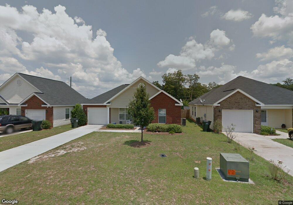
103 Maryjay Dr Warner Robins, GA 31088
Estimated Value: $178,000 - $199,000
3
Beds
2
Baths
1,314
Sq Ft
$142/Sq Ft
Est. Value
About This Home
This home is located at 103 Maryjay Dr, Warner Robins, GA 31088 and is currently estimated at $186,030, approximately $141 per square foot. 103 Maryjay Dr is a home located in Houston County with nearby schools including Miller Elementary School, Warner Robins Middle School, and Warner Robins High School.
Ownership History
Date
Name
Owned For
Owner Type
Purchase Details
Closed on
Apr 6, 2006
Sold by
Ter Car Llc
Bought by
Cook & Cook Properties Llc
Current Estimated Value
Home Financials for this Owner
Home Financials are based on the most recent Mortgage that was taken out on this home.
Original Mortgage
$103,968
Outstanding Balance
$59,193
Interest Rate
6.2%
Mortgage Type
Purchase Money Mortgage
Estimated Equity
$126,837
Purchase Details
Closed on
Aug 31, 2005
Sold by
Boone John
Bought by
Carter Roy O'Neil and Dixon James Jack
Create a Home Valuation Report for This Property
The Home Valuation Report is an in-depth analysis detailing your home's value as well as a comparison with similar homes in the area
Home Values in the Area
Average Home Value in this Area
Purchase History
| Date | Buyer | Sale Price | Title Company |
|---|---|---|---|
| Cook & Cook Properties Llc | $103,500 | None Available | |
| Carter Roy O'Neil | -- | -- |
Source: Public Records
Mortgage History
| Date | Status | Borrower | Loan Amount |
|---|---|---|---|
| Open | Cook & Cook Properties Llc | $103,968 |
Source: Public Records
Tax History Compared to Growth
Tax History
| Year | Tax Paid | Tax Assessment Tax Assessment Total Assessment is a certain percentage of the fair market value that is determined by local assessors to be the total taxable value of land and additions on the property. | Land | Improvement |
|---|---|---|---|---|
| 2024 | $1,836 | $56,120 | $6,400 | $49,720 |
| 2023 | $1,723 | $52,240 | $6,400 | $45,840 |
| 2022 | $1,099 | $47,800 | $6,400 | $41,400 |
| 2021 | $1,004 | $43,440 | $6,400 | $37,040 |
| 2020 | $954 | $41,080 | $6,400 | $34,680 |
| 2019 | $954 | $41,080 | $6,400 | $34,680 |
| 2018 | $954 | $41,080 | $6,400 | $34,680 |
| 2017 | $955 | $41,080 | $6,400 | $34,680 |
| 2016 | $957 | $41,080 | $6,400 | $34,680 |
| 2015 | -- | $41,080 | $6,400 | $34,680 |
| 2014 | -- | $41,080 | $6,400 | $34,680 |
| 2013 | -- | $41,080 | $6,400 | $34,680 |
Source: Public Records
Map
Nearby Homes
- 129 Maryjay Dr
- 209 Knodishall Dr
- 301 Millside Dr
- 112 Peacock Dr
- 318 Somerset Dr
- 127 N Amanda Place
- 321 Somerset Dr
- 707 Wilmington Dr
- 106 Westcliff Cir
- 141 Peacock Dr
- 110 Westcliff Cir Unit C
- 111 Hawthorne Rd
- 501 Pinecrest Dr
- 705 Corder Rd
- 103 Westcliff Cir Unit A
- 103 Westcliff Cir Unit A
- 115 Pershing Place Ct
- 135 Carterwoods Dr
- 86 Westcliff Cir
- 102 Westcliff Center St Unit D
- 105 Maryjay Dr
- 101 Maryjay Dr
- 107 Maryjay Dr
- 0 Maryjay Dr Unit 8682034
- 0 Maryjay Dr Unit 8381748
- 0 Maryjay Dr Unit 8627938
- 0 Maryjay Dr Unit 3239819
- 0 Maryjay Dr
- 109 Maryjay Dr
- 102 Maryjay Dr
- 102 Maryjay Dr Unit 140
- 104 Maryjay Dr
- 100 Maryjay Dr
- 111 Maryjay Dr
- 106 Maryjay Dr
- 103 Holt Ave
- 108 Maryjay Dr
- 111 Holt Ave
- 113 Maryjay Dr
- 110 Maryjay Dr