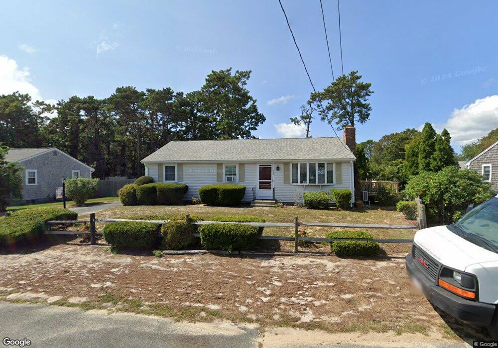
103 Michaels Ave Dennis Port, MA 02639
Dennis Port NeighborhoodEstimated Value: $580,000 - $730,000
3
Beds
2
Baths
1,312
Sq Ft
$501/Sq Ft
Est. Value
About This Home
This home is located at 103 Michaels Ave, Dennis Port, MA 02639 and is currently estimated at $656,661, approximately $500 per square foot. 103 Michaels Ave is a home located in Barnstable County with nearby schools including Dennis-Yarmouth Regional High School and St. Pius X. School.
Ownership History
Date
Name
Owned For
Owner Type
Purchase Details
Closed on
Nov 30, 2018
Sold by
Martell Kristin F and Martell Jonathan J
Bought by
Martell 2018 Funding T
Current Estimated Value
Purchase Details
Closed on
Sep 1, 2015
Sold by
Furey John J Est
Bought by
Martell Kristin F and Martell Jonathan J
Home Financials for this Owner
Home Financials are based on the most recent Mortgage that was taken out on this home.
Original Mortgage
$224,000
Interest Rate
4.09%
Mortgage Type
New Conventional
Purchase Details
Closed on
Nov 12, 2010
Sold by
Furey John J and Furey Katherine R
Bought by
Furey John J and Furey Katherine R
Create a Home Valuation Report for This Property
The Home Valuation Report is an in-depth analysis detailing your home's value as well as a comparison with similar homes in the area
Home Values in the Area
Average Home Value in this Area
Purchase History
| Date | Buyer | Sale Price | Title Company |
|---|---|---|---|
| Martell 2018 Funding T | -- | -- | |
| Martell Kristin F | $280,000 | -- | |
| Furey John J | -- | -- |
Source: Public Records
Mortgage History
| Date | Status | Borrower | Loan Amount |
|---|---|---|---|
| Previous Owner | Martell Kristin F | $224,000 |
Source: Public Records
Tax History Compared to Growth
Tax History
| Year | Tax Paid | Tax Assessment Tax Assessment Total Assessment is a certain percentage of the fair market value that is determined by local assessors to be the total taxable value of land and additions on the property. | Land | Improvement |
|---|---|---|---|---|
| 2025 | $2,745 | $634,000 | $202,200 | $431,800 |
| 2024 | $2,626 | $598,200 | $194,500 | $403,700 |
| 2023 | $2,540 | $543,800 | $176,800 | $367,000 |
| 2022 | $2,354 | $420,300 | $159,300 | $261,000 |
| 2021 | $2,395 | $397,200 | $178,400 | $218,800 |
| 2020 | $2,163 | $354,600 | $156,100 | $198,500 |
| 2019 | $2,034 | $329,700 | $153,100 | $176,600 |
| 2018 | $1,928 | $304,100 | $145,700 | $158,400 |
| 2017 | $1,776 | $288,700 | $135,300 | $153,400 |
| 2016 | $1,798 | $275,300 | $145,700 | $129,600 |
| 2015 | $1,762 | $275,300 | $145,700 | $129,600 |
| 2014 | $1,616 | $254,500 | $124,900 | $129,600 |
Source: Public Records
Map
Nearby Homes
- 80 Michaels Ave
- 19 Standish Way
- 37 Ocean Dr Unit 2
- 31 Easy St
- 12 Spoonbill Rd
- 64 Beaten Rd
- 22 Wixon Rd
- 71 Main St
- 61 Trotters Ln
- 4 Coffey Ln
- 15 Woodside Park Rd
- 125 Main St Unit 3
- 112 Old Wharf Rd Unit E4
- 112 Old Wharf Rd Unit E1
- 154 Old Wharf Rd Unit 26
- 154 Old Wharf Rd Unit 14
- 120 Old Wharf Rd Unit 11
- 72 Bassett Ln
- 268 Main St
- 6 Baker Way
- 99 Michaels Ave
- 107 Michaels Ave
- 80 Northern Ave
- 102 Michaels Ave
- 84 Northern Ave
- 98 Michaels Ave
- 95 Michaels Ave
- 76 Northern Ave
- 111 Michaels Ave
- 106 Michaels Ave
- 94 Michaels Ave
- 72 Northern Ave
- 91 Michaels Ave
- 69 Lawrence Rd
- 67 Lawrence Rd
- 110 Michaels Ave
- 73 Lawrence Rd
- 63 Lawrence Rd
- 90 Michaels Ave
- 115 Michaels Ave