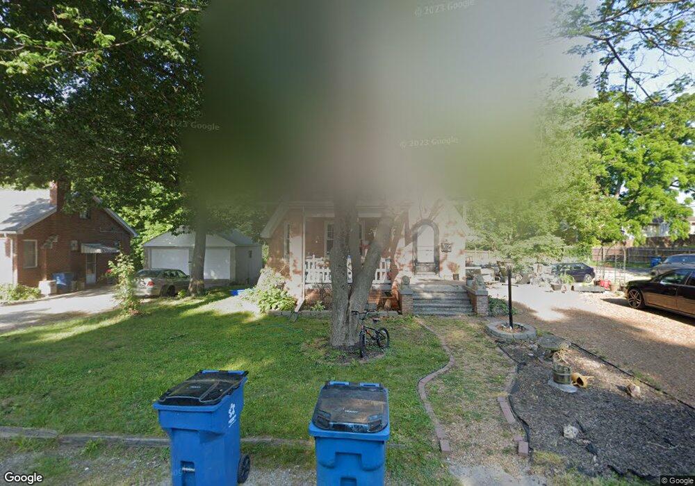
103 Moffett Ave Collinsville, IL 62234
Estimated Value: $173,294 - $198,000
5
Beds
2
Baths
1,100
Sq Ft
$171/Sq Ft
Est. Value
About This Home
This home is located at 103 Moffett Ave, Collinsville, IL 62234 and is currently estimated at $187,824, approximately $170 per square foot. 103 Moffett Ave is a home located in Madison County with nearby schools including Jefferson Elementary School, Dorris Intermediate School, and Collinsville Middle School.
Ownership History
Date
Name
Owned For
Owner Type
Purchase Details
Closed on
Feb 9, 2024
Sold by
Delisio Patrick and Delisio Ashli
Bought by
Delisio Patrick
Current Estimated Value
Purchase Details
Closed on
Feb 7, 2013
Sold by
Delisio-Long Linny F
Bought by
Delisio-Long Linny F and Delisio Patrick
Home Financials for this Owner
Home Financials are based on the most recent Mortgage that was taken out on this home.
Original Mortgage
$152,000
Interest Rate
3.38%
Mortgage Type
New Conventional
Create a Home Valuation Report for This Property
The Home Valuation Report is an in-depth analysis detailing your home's value as well as a comparison with similar homes in the area
Home Values in the Area
Average Home Value in this Area
Purchase History
| Date | Buyer | Sale Price | Title Company |
|---|---|---|---|
| Delisio Patrick | -- | None Available | |
| Delisio-Long Linny F | -- | None Available | |
| Dilislo Lonng Linny F | -- | Chesterfield Title |
Source: Public Records
Mortgage History
| Date | Status | Borrower | Loan Amount |
|---|---|---|---|
| Previous Owner | Dilislo Lonng Linny F | $152,000 |
Source: Public Records
Tax History Compared to Growth
Tax History
| Year | Tax Paid | Tax Assessment Tax Assessment Total Assessment is a certain percentage of the fair market value that is determined by local assessors to be the total taxable value of land and additions on the property. | Land | Improvement |
|---|---|---|---|---|
| 2024 | $3,499 | $60,730 | $7,090 | $53,640 |
| 2023 | $3,499 | $55,300 | $6,450 | $48,850 |
| 2022 | $3,245 | $51,130 | $5,960 | $45,170 |
| 2021 | $2,559 | $48,040 | $5,600 | $42,440 |
| 2020 | $2,431 | $45,830 | $5,340 | $40,490 |
| 2019 | $2,911 | $52,380 | $5,140 | $47,240 |
| 2018 | $2,822 | $49,620 | $4,870 | $44,750 |
| 2017 | $2,808 | $48,630 | $4,770 | $43,860 |
| 2016 | $3,331 | $48,630 | $4,770 | $43,860 |
| 2015 | $3,544 | $47,370 | $4,650 | $42,720 |
| 2014 | $3,544 | $53,340 | $7,410 | $45,930 |
| 2013 | $3,544 | $53,340 | $7,410 | $45,930 |
Source: Public Records
Map
Nearby Homes
- 710 Saint Louis Rd
- 114 Moffett Ave Unit 116
- 128 Courtland Place
- 116 Moffett Ave
- Lot 38 Jefferson Ave
- Lot 36 Jefferson Ave
- Lot 37 Jefferson Ave
- Lot 20 Jefferson Ave
- Lot 32 Jefferson Ave
- 820 Bond Ave
- 151 Helen Place
- 11 Davis Place
- 202 Keeneland Ct
- 746 Maple St
- 1109 Saint Clair Ave
- 126 Collinsville Ave
- 208 Coral Dr
- 714 Lillian St
- 205 Audrey Ave
- 108 Westridge Dr
- 600 St Louis Rd
- 620 Saint Louis Rd
- 105 Moffett Ave
- 100 Moffett Ave
- 600 Saint Louis Rd
- 624 Saint Louis Rd
- 107 Moffett Ave
- 628 Saint Louis Rd
- 538 St Louis Rd
- 538 Saint Louis Rd
- 700 Saint Louis Rd
- 109 Moffett Ave
- 121 Courtland Place
- 123 Courtland Place
- 536 Saint Louis Rd
- 119 Courtland Place
- 125 Courtland Place
- 504 Western Ave
- 117 Courtland Place
- 111 Moffett Ave