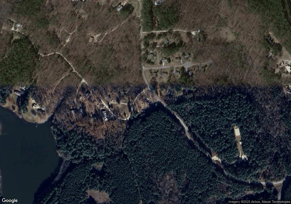
103 Poor Farm Rd Walhalla, SC 29691
Estimated Value: $213,000 - $270,000
3
Beds
2
Baths
1,440
Sq Ft
$170/Sq Ft
Est. Value
About This Home
This home is located at 103 Poor Farm Rd, Walhalla, SC 29691 and is currently estimated at $245,149, approximately $170 per square foot. 103 Poor Farm Rd is a home located in Oconee County with nearby schools including James M. Brown Elementary School, Walhalla Middle School, and Walhalla High School.
Ownership History
Date
Name
Owned For
Owner Type
Purchase Details
Closed on
Oct 21, 2025
Sold by
Braswell Tommy Earl and Braswell Karen Sue
Bought by
Tommy E Braswell And Karen S Braswell Revocab and Braswell
Current Estimated Value
Purchase Details
Closed on
Sep 19, 2018
Sold by
Braswell Tommy Earl
Bought by
Bradwell Tommy Earl and Bradwell Karen S
Home Financials for this Owner
Home Financials are based on the most recent Mortgage that was taken out on this home.
Original Mortgage
$77,886
Interest Rate
4.5%
Mortgage Type
New Conventional
Create a Home Valuation Report for This Property
The Home Valuation Report is an in-depth analysis detailing your home's value as well as a comparison with similar homes in the area
Home Values in the Area
Average Home Value in this Area
Purchase History
| Date | Buyer | Sale Price | Title Company |
|---|---|---|---|
| Tommy E Braswell And Karen S Braswell Revocab | -- | None Listed On Document | |
| Bradwell Tommy Earl | -- | None Available |
Source: Public Records
Mortgage History
| Date | Status | Borrower | Loan Amount |
|---|---|---|---|
| Previous Owner | Bradwell Tommy Earl | $77,886 |
Source: Public Records
Tax History Compared to Growth
Tax History
| Year | Tax Paid | Tax Assessment Tax Assessment Total Assessment is a certain percentage of the fair market value that is determined by local assessors to be the total taxable value of land and additions on the property. | Land | Improvement |
|---|---|---|---|---|
| 2025 | $1,661 | $5,154 | $452 | $4,702 |
| 2024 | $1,661 | $5,154 | $452 | $4,702 |
| 2023 | $1,661 | $5,154 | $452 | $4,702 |
| 2022 | $1,596 | $5,154 | $452 | $4,702 |
| 2021 | $538 | $4,828 | $362 | $4,466 |
| 2020 | $538 | $4,828 | $362 | $4,466 |
| 2019 | $538 | $0 | $0 | $0 |
| 2018 | $1,072 | $0 | $0 | $0 |
| 2017 | $448 | $0 | $0 | $0 |
| 2016 | $448 | $0 | $0 | $0 |
| 2015 | -- | $0 | $0 | $0 |
| 2014 | -- | $4,267 | $402 | $3,866 |
| 2013 | -- | $0 | $0 | $0 |
Source: Public Records
Map
Nearby Homes
- 155 Whitman Hollow Rd
- 000 Hunters Trail
- 430 Rock Crusher Rd
- 222 T U 2
- 253 Pitts Rd
- 000 Oak Grove Rd
- 249 & 253 Pitts Rd
- 34.23 Acres Charles Dr
- 2054 Westminster Hwy
- 1624 Westminster Hwy
- 621 Pine View Dr
- 316 Briar Creek Rd
- 711 Campbell Town Rd
- 1703 Coffee Rd
- 2423 Westminster Hwy
- 000 Stephens Dr
- 117 Edney Dr
- 606 W South Broad St
- 1050 Highlands Hwy
- 213 Castlebrook Dr
- 100 Ledbetter Ln
- 102 Ledbetter Ln
- 305 Nectarine Cir
- 104 Ledbetter Ln
- 125 Whitman Hollow Rd
- Lot 9,11,12,13 Ledbetter Ln
- Lot 13 Ledbetter Ln
- Lot 12 Ledbetter Ln
- Lot 9 Ledbetter Ln
- Lot 11 Ledbetter Ln
- 103 Ledbetter Ln
- 263 Nectarine Cir
- 106 Ledbetter Ln
- 105 Ledbetter Ln
- 109 Ledbetter Ln
- 112 Ledbetter Ln
- 111 Ledbetter Ln
- 259 Nectarine Cir
- 107 Ledbetter Ln
- 108 Ledbetter Ln
