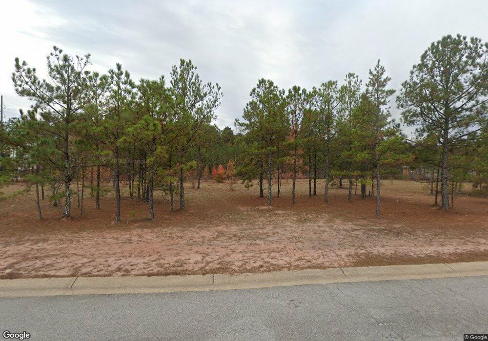
103 Redding Dr Bremen, GA 30110
Estimated Value: $330,698
--
Bed
--
Bath
--
Sq Ft
3.68
Acres
About This Home
This home is located at 103 Redding Dr, Bremen, GA 30110 and is currently estimated at $330,698. 103 Redding Dr is a home located in Haralson County with nearby schools including Jones Elementary School, Bremen 4th & 5th Grade Academy, and Bremen Middle School.
Ownership History
Date
Name
Owned For
Owner Type
Purchase Details
Closed on
Dec 31, 2020
Sold by
Licklog Properties Inc
Bought by
Dr Sanders Corp
Current Estimated Value
Home Financials for this Owner
Home Financials are based on the most recent Mortgage that was taken out on this home.
Original Mortgage
$202,500
Interest Rate
2.71%
Mortgage Type
New Conventional
Purchase Details
Closed on
Jul 6, 2012
Sold by
Wilson Robert L
Bought by
Licklog Properties Inc
Purchase Details
Closed on
Jun 22, 2012
Sold by
Wilson Robert Lynn
Bought by
Licklog Properties Inc
Purchase Details
Closed on
Apr 12, 2001
Sold by
Tendall Properties Llc
Bought by
Wilson Robert L
Create a Home Valuation Report for This Property
The Home Valuation Report is an in-depth analysis detailing your home's value as well as a comparison with similar homes in the area
Home Values in the Area
Average Home Value in this Area
Purchase History
| Date | Buyer | Sale Price | Title Company |
|---|---|---|---|
| Dr Sanders Corp | $225,000 | -- | |
| Licklog Properties Inc | -- | -- | |
| Licklog Properties Inc | -- | -- | |
| Wilson Robert L | $184,500 | -- | |
| Tendall Properties Llc | -- | -- |
Source: Public Records
Mortgage History
| Date | Status | Borrower | Loan Amount |
|---|---|---|---|
| Closed | Dr Sanders Corp | $202,500 |
Source: Public Records
Tax History Compared to Growth
Tax History
| Year | Tax Paid | Tax Assessment Tax Assessment Total Assessment is a certain percentage of the fair market value that is determined by local assessors to be the total taxable value of land and additions on the property. | Land | Improvement |
|---|---|---|---|---|
| 2024 | $2,247 | $80,000 | $80,000 | $0 |
| 2023 | $1,329 | $44,200 | $44,200 | $0 |
| 2022 | $426 | $44,200 | $44,200 | $0 |
| 2021 | $446 | $44,200 | $44,200 | $0 |
| 2020 | $449 | $44,200 | $44,200 | $0 |
| 2019 | $464 | $44,200 | $44,200 | $0 |
| 2018 | $470 | $44,200 | $44,200 | $0 |
| 2017 | $1,517 | $44,200 | $44,200 | $0 |
| 2016 | $549 | $44,200 | $44,200 | $0 |
| 2015 | $566 | $45,386 | $45,386 | $0 |
| 2014 | -- | $45,386 | $45,386 | $0 |
Source: Public Records
Map
Nearby Homes
- 0 Redding Dr Unit LOT 6 2596250
- 0 Redding Dr Unit LOT 6 3184638
- 0 Redding Dr Unit LOT 6 7053009
- 0 Redding Dr Unit LOT 6 7218719
- 0 Redding Dr Unit LOT 6 7401431
- 0 Redding Dr Unit 5395310
- 0 Redding Dr Unit 7294934
- 0 Reid Rd
- 0 Reid Rd Unit 8273736
- 0 Reid Rd Unit 8367519
- 0 Reid Rd Unit 8447498
- 0 Reid Rd Unit 8447423
- 0 Reid Rd Unit 8580984
- 0 Reid Rd Unit 8580955
- 0 Reid Rd Unit 8909228
- 0 Reid Rd Unit 7552198
- 0 Reid Rd Unit 6550973
- 0 Mangham Dr Unit 145312
- 0 Mangham Dr Unit 20175573
- 109 Redding Dr
