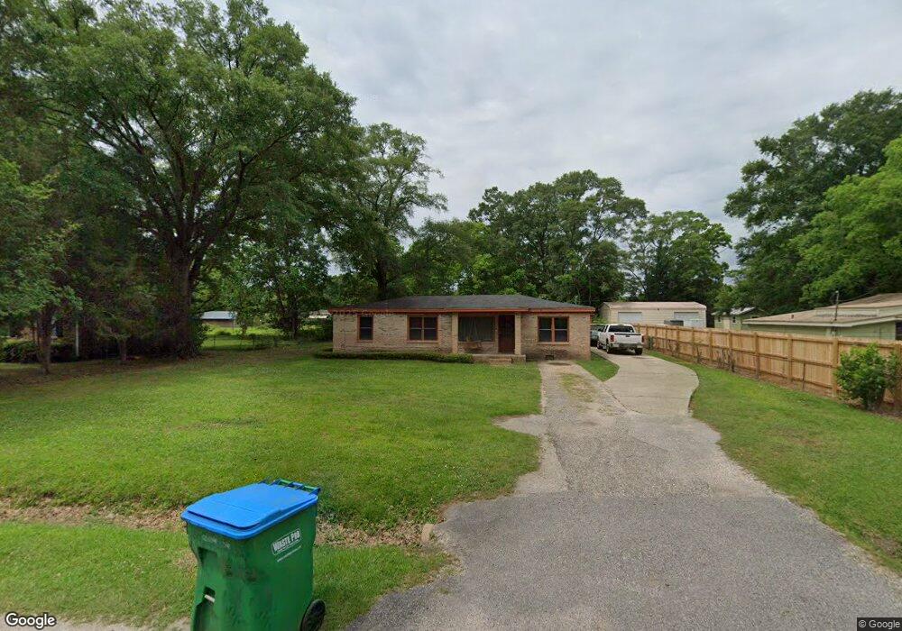
103 Robbie Ln Saraland, AL 36571
Estimated Value: $165,000 - $207,000
--
Bed
1
Bath
1,225
Sq Ft
$152/Sq Ft
Est. Value
About This Home
This home is located at 103 Robbie Ln, Saraland, AL 36571 and is currently estimated at $186,258, approximately $152 per square foot. 103 Robbie Ln is a home located in Mobile County with nearby schools including Saraland Elementary School, Nelson Leon Adams Middle School/Saraland Middle School, and Saraland High School.
Ownership History
Date
Name
Owned For
Owner Type
Purchase Details
Closed on
Apr 17, 2001
Sold by
Hud
Bought by
Whittaker Montae and Whittaker Dana
Current Estimated Value
Home Financials for this Owner
Home Financials are based on the most recent Mortgage that was taken out on this home.
Original Mortgage
$57,596
Outstanding Balance
$21,185
Interest Rate
6.99%
Mortgage Type
FHA
Estimated Equity
$165,073
Purchase Details
Closed on
Nov 2, 2000
Sold by
Wells Fargo Home Mtg Inc
Bought by
Hud
Purchase Details
Closed on
Oct 13, 2000
Sold by
Vete Richard S and Vete Mary Kathleen
Bought by
Wells Fargo Home Mtg Inc
Create a Home Valuation Report for This Property
The Home Valuation Report is an in-depth analysis detailing your home's value as well as a comparison with similar homes in the area
Home Values in the Area
Average Home Value in this Area
Purchase History
| Date | Buyer | Sale Price | Title Company |
|---|---|---|---|
| Whittaker Montae | $58,500 | -- | |
| Hud | -- | -- | |
| Wells Fargo Home Mtg Inc | $57,233 | -- |
Source: Public Records
Mortgage History
| Date | Status | Borrower | Loan Amount |
|---|---|---|---|
| Open | Whittaker Montae | $57,596 |
Source: Public Records
Tax History Compared to Growth
Tax History
| Year | Tax Paid | Tax Assessment Tax Assessment Total Assessment is a certain percentage of the fair market value that is determined by local assessors to be the total taxable value of land and additions on the property. | Land | Improvement |
|---|---|---|---|---|
| 2024 | $1,185 | $9,520 | $2,400 | $7,120 |
| 2023 | $1,133 | $8,260 | $2,520 | $5,740 |
| 2022 | $921 | $15,480 | $4,500 | $10,980 |
| 2021 | $838 | $14,080 | $3,600 | $10,480 |
| 2020 | $840 | $14,120 | $2,940 | $11,180 |
| 2019 | $823 | $13,840 | $2,940 | $10,900 |
| 2018 | $823 | $13,840 | $0 | $0 |
| 2017 | $823 | $13,840 | $0 | $0 |
| 2016 | $826 | $13,880 | $0 | $0 |
| 2013 | $649 | $12,220 | $0 | $0 |
Source: Public Records
Map
Nearby Homes
- 30 Melinda Dr
- 20 Robbie Ln
- 14 Sara Forest Dr
- 505 Norton Ave
- 410 Allen Cir
- 131 Ideal Dr
- 0 Shelton Beach Rd Unit 7618795
- 503 Shelton Beach Rd
- 234 Autumn Dr
- 205 Stauffer Ave
- 228 Shelton Beach Rd
- 21 Frances St
- 129 Lafayette Dr
- 131 Everett Ave W
- 159 Courtaulds Ave
- 136 Mathieson Ave
- 208 Strange Ave
- 228 Lucille St
- 114 Bethel Forest Dr S
- 308 E Ponce de Leon Dr