Estimated Value: $603,672 - $669,000
1
Bed
3
Baths
480
Sq Ft
$1,346/Sq Ft
Est. Value
About This Home
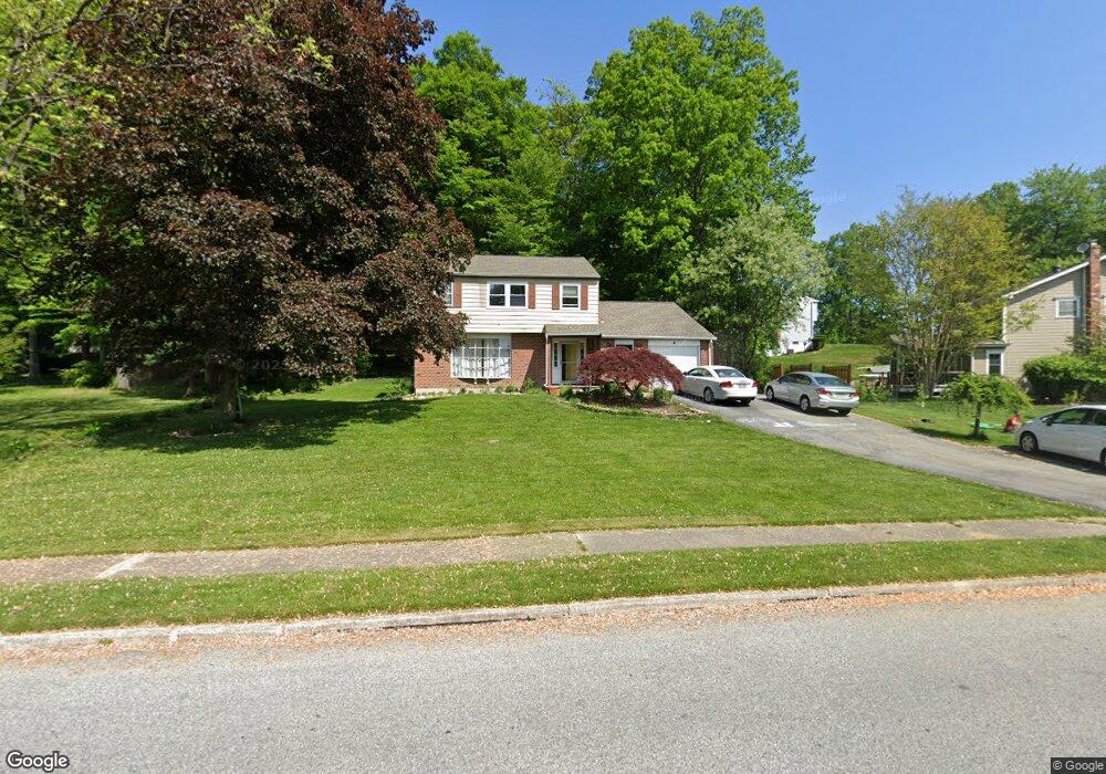
This home is located at 103 Robin Rd, Exton, PA 19341 and is currently estimated at $646,168, approximately $1,346 per square foot. 103 Robin Rd is a home located in Chester County with nearby schools including Lionville Elementary School, Lionville Middle School, and Downingtown High School East.
Ownership History
Date
Name
Owned For
Owner Type
Purchase Details
Closed on
Dec 30, 2008
Sold by
Landis William N and Landis Denise J
Bought by
Landis Denise J
Current Estimated Value
Purchase Details
Closed on
Sep 5, 1997
Sold by
Padmanabhan Sreenivasan and Padmanabhan Manorama
Bought by
Landis William N and Landis Denise J
Home Financials for this Owner
Home Financials are based on the most recent Mortgage that was taken out on this home.
Original Mortgage
$131,200
Outstanding Balance
$19,266
Interest Rate
6.87%
Estimated Equity
$626,902
Create a Home Valuation Report for This Property
The Home Valuation Report is an in-depth analysis detailing your home's value as well as a comparison with similar homes in the area
Home Values in the Area
Average Home Value in this Area
Purchase History
| Date | Buyer | Sale Price | Title Company |
|---|---|---|---|
| Landis Denise J | $102,300 | None Available | |
| Landis William N | $164,000 | -- |
Source: Public Records
Mortgage History
| Date | Status | Borrower | Loan Amount |
|---|---|---|---|
| Open | Landis William N | $131,200 |
Source: Public Records
Tax History
| Year | Tax Paid | Tax Assessment Tax Assessment Total Assessment is a certain percentage of the fair market value that is determined by local assessors to be the total taxable value of land and additions on the property. | Land | Improvement |
|---|---|---|---|---|
| 2025 | $5,226 | $152,670 | $42,550 | $110,120 |
| 2024 | $5,226 | $152,670 | $42,550 | $110,120 |
| 2023 | $5,073 | $152,670 | $42,550 | $110,120 |
| 2022 | $4,946 | $152,670 | $42,550 | $110,120 |
| 2021 | $4,863 | $152,670 | $42,550 | $110,120 |
| 2020 | $4,835 | $152,670 | $42,550 | $110,120 |
| 2019 | $4,835 | $152,670 | $42,550 | $110,120 |
| 2018 | $4,835 | $152,670 | $42,550 | $110,120 |
| 2017 | $4,835 | $152,670 | $42,550 | $110,120 |
| 2016 | $4,482 | $152,670 | $42,550 | $110,120 |
| 2015 | $4,482 | $152,670 | $42,550 | $110,120 |
| 2014 | $4,482 | $152,670 | $42,550 | $110,120 |
Source: Public Records
Map
Nearby Homes
- 305 Concord Ave
- 532 Westfield Dr
- 51 Oakland Dr
- 411 Forge Ln
- 9 Whitely Rd
- 111 Village Walk Unit 111
- 301 Jennifer Ln
- 212 Cambridge Chase Unit 13
- 524 E Saxony Dr Unit 524
- 48 Buttonwood Dr
- 119 Conway Ct
- 430 Carmarthen Ct
- 300 Bell Ct
- 207 Lucy Cir
- 26 Mcilvain Dr
- 233 Lucy Cir
- 447 Wharton Blvd Unit 34
- 2303 Bridgewater Ct
- 506 Langford Dr
- 720 Brainerd Rd
Your Personal Tour Guide
Ask me questions while you tour the home.