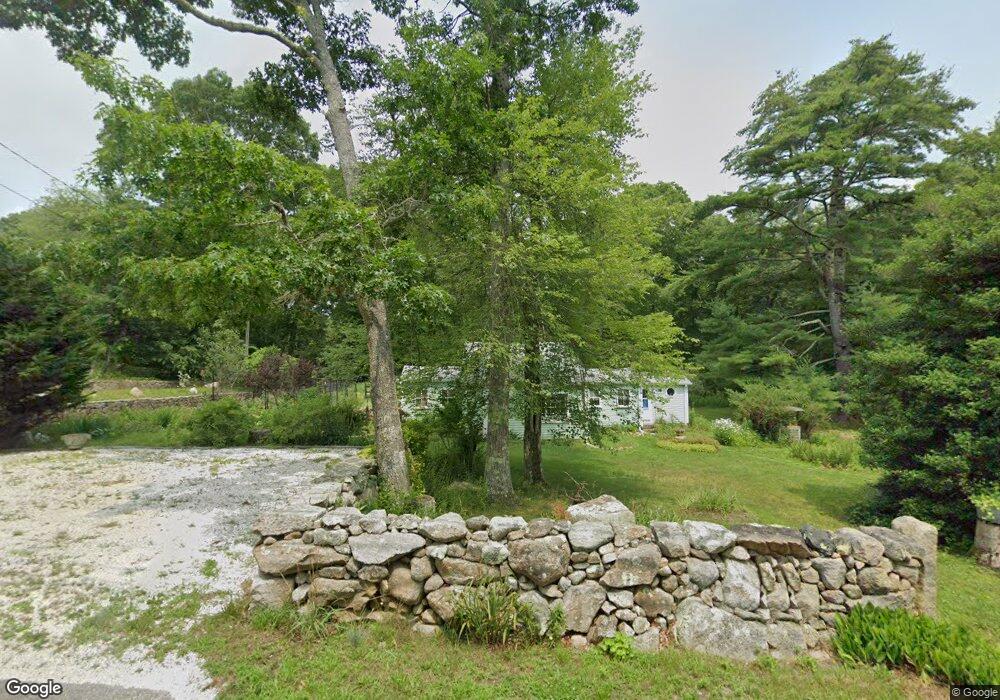
103 Rock Odundee Rd South Dartmouth, MA 02748
Cow Yard/Nonquitt NeighborhoodEstimated Value: $443,981 - $527,000
2
Beds
1
Bath
830
Sq Ft
$577/Sq Ft
Est. Value
About This Home
This home is located at 103 Rock Odundee Rd, South Dartmouth, MA 02748 and is currently estimated at $478,745, approximately $576 per square foot. 103 Rock Odundee Rd is a home located in Bristol County with nearby schools including Dartmouth High School.
Ownership History
Date
Name
Owned For
Owner Type
Purchase Details
Closed on
Jul 15, 2019
Sold by
Trahan Wayne F and Motha Joann T
Bought by
Motha Joann T
Current Estimated Value
Purchase Details
Closed on
Mar 14, 2006
Sold by
Motha Joann T
Bought by
Motha Joann T and Trahan Wayne F
Purchase Details
Closed on
Mar 9, 2000
Sold by
Sylvia Mary H and Robinson Mary A
Bought by
Motha Joann T
Home Financials for this Owner
Home Financials are based on the most recent Mortgage that was taken out on this home.
Original Mortgage
$121,500
Interest Rate
8.18%
Mortgage Type
Purchase Money Mortgage
Create a Home Valuation Report for This Property
The Home Valuation Report is an in-depth analysis detailing your home's value as well as a comparison with similar homes in the area
Home Values in the Area
Average Home Value in this Area
Purchase History
| Date | Buyer | Sale Price | Title Company |
|---|---|---|---|
| Motha Joann T | -- | -- | |
| Motha Joann T | -- | -- | |
| Motha Joann T | $135,000 | -- |
Source: Public Records
Mortgage History
| Date | Status | Borrower | Loan Amount |
|---|---|---|---|
| Previous Owner | Motha Joann T | $121,500 |
Source: Public Records
Tax History Compared to Growth
Tax History
| Year | Tax Paid | Tax Assessment Tax Assessment Total Assessment is a certain percentage of the fair market value that is determined by local assessors to be the total taxable value of land and additions on the property. | Land | Improvement |
|---|---|---|---|---|
| 2025 | $3,158 | $366,800 | $231,200 | $135,600 |
| 2024 | $3,069 | $353,200 | $228,700 | $124,500 |
| 2023 | $2,838 | $309,500 | $197,500 | $112,000 |
| 2022 | $2,897 | $292,600 | $197,500 | $95,100 |
| 2021 | $2,583 | $249,300 | $175,400 | $73,900 |
| 2020 | $4,228 | $252,800 | $183,600 | $69,200 |
| 2019 | $2,504 | $240,800 | $170,500 | $70,300 |
| 2018 | $2,401 | $234,500 | $170,500 | $64,000 |
| 2017 | $2,305 | $230,000 | $166,800 | $63,200 |
| 2016 | $2,347 | $231,000 | $170,700 | $60,300 |
| 2015 | $2,157 | $212,700 | $151,500 | $61,200 |
| 2014 | $2,116 | $207,200 | $147,100 | $60,100 |
Source: Public Records
Map
Nearby Homes
- 105 Rock Odundee Rd
- 24 White Alder Way
- 482 Smith Neck Rd
- 738 Smith Neck Rd
- Lot 1 Rafael Rd
- 61 Pardon Hill Rd
- 248 Bakerville Rd
- 24 Eagle Dr
- 48 N Shore Dr Unit 3&7
- 48 N Shore Dr Unit 8
- 158 Little River Rd
- 12 Meadow Shores Rd
- 62 Hetty Green St Unit 62
- 23 High St
- 40 School St
- 1150 Russells Mills Rd
- 34 Country Way
- 75 Country Way Unit 75
- 76 Shipyard Ln
- 48 Wilson St
- 109 Rock Odundee Rd
- 104 Rock Odundee Rd
- 108 Rock Odundee Rd
- 113 Rock Odundee Rd
- 89 Rock Odundee Rd
- 114 Rock Odundee Rd
- 117 Rock Odundee Rd
- 83 Rock Odundee Rd
- 80 Rock Odundee Rd
- 100 Rock O'Dundee Rd
- 100 Rock Odundee Rd
- 79 Rock O'Dundee Rd
- 74 Rock Odundee Rd
- 79 Rock Odundee Rd
- 125 Rock Odundee Rd
- 148 Rock Odundee Rd
- 142 Rock Odundee Rd
- 149 Rock Odundee Rd
- 136 Rock Odundee Rd
- 132 Rock Odundee Rd