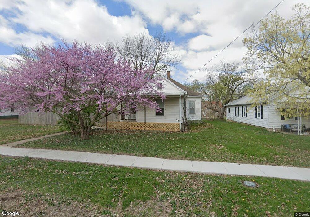
103 S Anson St Middletown, IL 62666
Estimated Value: $61,049 - $120,000
--
Bed
--
Bath
1,574
Sq Ft
$58/Sq Ft
Est. Value
About This Home
This home is located at 103 S Anson St, Middletown, IL 62666 and is currently estimated at $91,012, approximately $57 per square foot. 103 S Anson St is a home located in Logan County with nearby schools including New Holland-Middletown Elementary School and Lincoln Community High School.
Ownership History
Date
Name
Owned For
Owner Type
Purchase Details
Closed on
Oct 19, 2021
Sold by
Boward David G
Bought by
Burge Kara E
Current Estimated Value
Purchase Details
Closed on
Dec 29, 2016
Sold by
Boward David G and Boward Glenn D
Bought by
Boward David G
Purchase Details
Closed on
May 2, 1981
Sold by
Boward Kenneth
Bought by
Boward Henrietta
Create a Home Valuation Report for This Property
The Home Valuation Report is an in-depth analysis detailing your home's value as well as a comparison with similar homes in the area
Home Values in the Area
Average Home Value in this Area
Purchase History
| Date | Buyer | Sale Price | Title Company |
|---|---|---|---|
| Burge Kara E | -- | None Available | |
| Boward David G | -- | -- | |
| Boward Henrietta | $7,500 | -- |
Source: Public Records
Tax History Compared to Growth
Tax History
| Year | Tax Paid | Tax Assessment Tax Assessment Total Assessment is a certain percentage of the fair market value that is determined by local assessors to be the total taxable value of land and additions on the property. | Land | Improvement |
|---|---|---|---|---|
| 2024 | $1,434 | $17,270 | $2,640 | $14,630 |
| 2023 | $1,333 | $15,910 | $2,430 | $13,480 |
| 2022 | $1,273 | $14,840 | $2,270 | $12,570 |
| 2021 | $1,214 | $14,270 | $2,180 | $12,090 |
| 2020 | $1,174 | $14,060 | $2,150 | $11,910 |
| 2019 | $1,157 | $13,850 | $2,120 | $11,730 |
| 2018 | $1,172 | $13,850 | $2,120 | $11,730 |
| 2017 | $1,414 | $16,600 | $2,120 | $14,480 |
| 2016 | $1,624 | $19,140 | $2,120 | $17,020 |
| 2015 | $1,468 | $17,220 | $1,870 | $15,350 |
| 2014 | $1,468 | $17,220 | $1,870 | $15,350 |
| 2013 | $1,468 | $16,240 | $1,760 | $14,480 |
| 2012 | $1,468 | $16,180 | $1,750 | $14,430 |
Source: Public Records
Map
Nearby Homes
- 200 N Anson St
- 104 N Logan St
- 204 Logan St
- 16969 Peoria St
- 207 E Douglas St
- 14 Chicory Dr
- 13 Chicory Dr
- 11-12 Chicory Dr
- 137 E Adams St
- 0 Blue Stem Dr
- 305 Kennedy Rd
- 235 W Van Buren St
- 104 E Stahl
- 314 S Enterprise St
- 101 S Bogardus St
- 555 W Douglas St
- 1598 700th Ave
- 3 Governor's Dr
- 1535 E Pine St
- 819 E Chestnut St
- 101 S Anson St
- 107 S Anson St
- 807 W 6th St
- 102 S Anson St
- 100 S Anson St
- 101 N Anson St
- 108 S Anson St
- 708 6th St
- 808 W 6th St
- 107 N Anson St
- 107 N Anson St Unit 201 N Anson Street
- 701 W 6th St
- 105 S Grove St
- 107 S Grove St
- 108 N Anson St
- 201 S Grove St
- 107 N Grove St
- 203 S Grove St
- 102 S Grove St
- 106 S Grove St