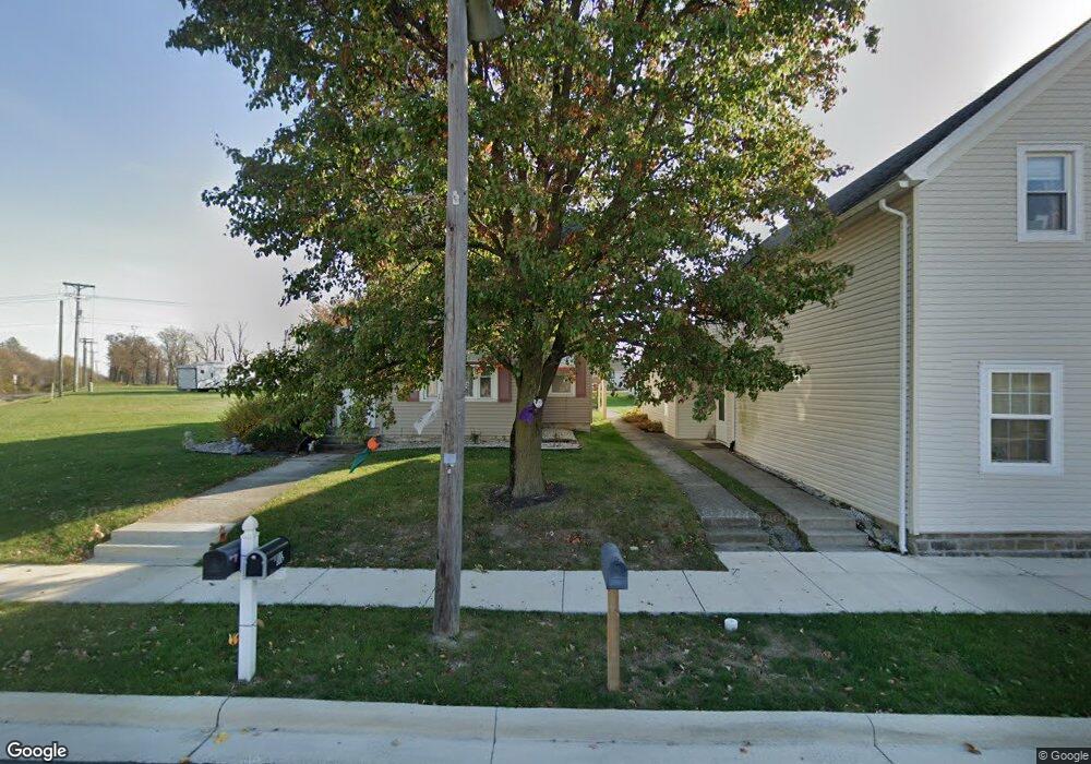
103 S Main St Buckland, OH 45819
Estimated Value: $114,061 - $185,000
4
Beds
2
Baths
2,038
Sq Ft
$78/Sq Ft
Est. Value
About This Home
This home is located at 103 S Main St, Buckland, OH 45819 and is currently estimated at $158,765, approximately $77 per square foot. 103 S Main St is a home located in Auglaize County with nearby schools including Wapakoneta Elementary School, Wapakoneta High School, and Wapakoneta Middle School.
Ownership History
Date
Name
Owned For
Owner Type
Purchase Details
Closed on
Oct 12, 2005
Sold by
Gibson Mace D
Bought by
Place Douglas G and Place Jayne E
Current Estimated Value
Home Financials for this Owner
Home Financials are based on the most recent Mortgage that was taken out on this home.
Original Mortgage
$51,000
Outstanding Balance
$27,418
Interest Rate
5.83%
Mortgage Type
Future Advance Clause Open End Mortgage
Estimated Equity
$131,347
Purchase Details
Closed on
Sep 19, 2003
Sold by
Kohlreiser Dustin
Bought by
Place Douglas G
Home Financials for this Owner
Home Financials are based on the most recent Mortgage that was taken out on this home.
Original Mortgage
$39,500
Interest Rate
6.4%
Mortgage Type
Future Advance Clause Open End Mortgage
Purchase Details
Closed on
Oct 25, 1999
Sold by
Detty Timothy F
Bought by
Kohlreiser Dustin
Purchase Details
Closed on
Sep 28, 1992
Sold by
Detty Timothy F
Bought by
Detty Timothy F
Create a Home Valuation Report for This Property
The Home Valuation Report is an in-depth analysis detailing your home's value as well as a comparison with similar homes in the area
Home Values in the Area
Average Home Value in this Area
Purchase History
| Date | Buyer | Sale Price | Title Company |
|---|---|---|---|
| Place Douglas G | $12,750 | None Available | |
| Place Douglas G | $39,500 | -- | |
| Kohlreiser Dustin | $25,000 | -- | |
| Detty Timothy F | -- | -- |
Source: Public Records
Mortgage History
| Date | Status | Borrower | Loan Amount |
|---|---|---|---|
| Open | Place Douglas G | $51,000 | |
| Previous Owner | Place Douglas G | $39,500 |
Source: Public Records
Tax History Compared to Growth
Tax History
| Year | Tax Paid | Tax Assessment Tax Assessment Total Assessment is a certain percentage of the fair market value that is determined by local assessors to be the total taxable value of land and additions on the property. | Land | Improvement |
|---|---|---|---|---|
| 2024 | $1,354 | $26,680 | $2,500 | $24,180 |
| 2023 | $941 | $26,680 | $2,500 | $24,180 |
| 2022 | $776 | $19,750 | $2,300 | $17,450 |
| 2021 | $757 | $19,750 | $2,300 | $17,450 |
| 2020 | $389 | $19,744 | $2,296 | $17,448 |
| 2019 | $701 | $17,490 | $2,034 | $15,456 |
| 2018 | $703 | $17,490 | $2,034 | $15,456 |
| 2017 | $700 | $17,490 | $2,034 | $15,456 |
| 2016 | $540 | $13,444 | $1,936 | $11,508 |
| 2015 | $540 | $13,444 | $1,936 | $11,508 |
| 2014 | $504 | $13,444 | $1,936 | $11,508 |
| 2013 | $513 | $13,444 | $1,936 | $11,508 |
Source: Public Records
Map
Nearby Homes
- 17054 State Route 198
- 15644 Bay Rd
- 22284 Ohio 198
- 1020 Timber Trail
- 1028 Stonegate Ct
- 920 Primrose Dr
- 924 Poppy Dr
- 601 Warren St
- 906 Aster Dr
- 808 Aster Dr
- 8304 Kruse Rd
- 322 Cole Dr
- 106 Valleyview Dr
- 420 Hoopengarner St
- 7470 Fort Amanda Rd
- 1100 W Auglaize St
- 814 W Benton St
- 0 Wapakoneta Cridersville Rd
- 414 W Auglaize St
- 307 W Auglaize St