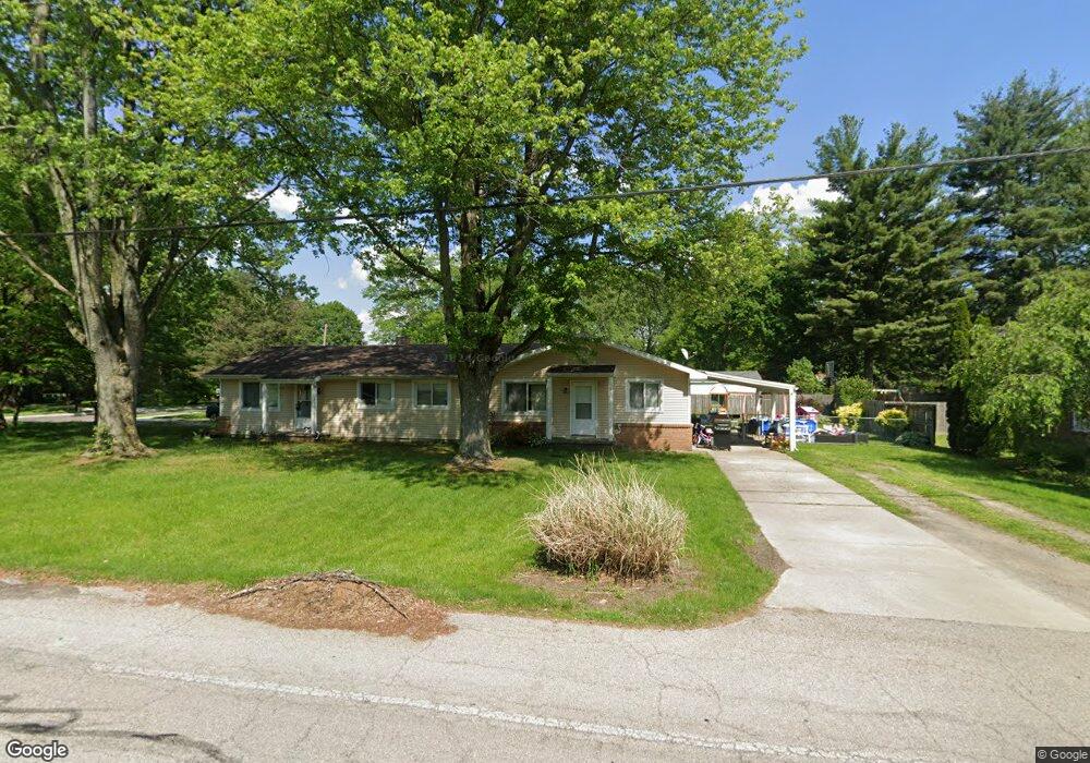
103 S Munson Rd Swanton, OH 43558
Estimated Value: $156,000 - $245,440
6
Beds
2
Baths
2,132
Sq Ft
$86/Sq Ft
Est. Value
About This Home
This home is located at 103 S Munson Rd, Swanton, OH 43558 and is currently estimated at $184,110, approximately $86 per square foot. 103 S Munson Rd is a home located in Fulton County with nearby schools including Swanton High School, Swanton Middle School, and St. Richard School.
Ownership History
Date
Name
Owned For
Owner Type
Purchase Details
Closed on
Aug 10, 2022
Sold by
Obenauf Gary L and Obenauf Deborah A
Bought by
Duck Elissa Dawn
Current Estimated Value
Purchase Details
Closed on
Feb 29, 2008
Sold by
Obenauf Gary and Obenauf Deborah A
Bought by
Cpd Properties Ltd
Purchase Details
Closed on
Jan 1, 1990
Bought by
Obenauf Gary L and Obenauf Deborah
Create a Home Valuation Report for This Property
The Home Valuation Report is an in-depth analysis detailing your home's value as well as a comparison with similar homes in the area
Home Values in the Area
Average Home Value in this Area
Purchase History
| Date | Buyer | Sale Price | Title Company |
|---|---|---|---|
| Duck Elissa Dawn | -- | Chamberlain David G | |
| Duck Elissa Dawn | -- | Chamberlain David G | |
| Obenauf Gary L | -- | Chamberlain David G | |
| Obenauf Gary L | -- | Chamberlain David G | |
| Cpd Properties Ltd | $140,000 | Attorney | |
| Obenauf Gary L | -- | -- |
Source: Public Records
Mortgage History
| Date | Status | Borrower | Loan Amount |
|---|---|---|---|
| Closed | Cpd Properties Ltd | $0 |
Source: Public Records
Tax History Compared to Growth
Tax History
| Year | Tax Paid | Tax Assessment Tax Assessment Total Assessment is a certain percentage of the fair market value that is determined by local assessors to be the total taxable value of land and additions on the property. | Land | Improvement |
|---|---|---|---|---|
| 2024 | $2,847 | $68,850 | $10,920 | $57,930 |
| 2023 | $2,870 | $68,850 | $10,920 | $57,930 |
| 2022 | $2,391 | $52,010 | $9,100 | $42,910 |
| 2021 | $2,536 | $52,010 | $9,100 | $42,910 |
| 2020 | $2,574 | $52,010 | $9,100 | $42,910 |
| 2019 | $2,183 | $42,810 | $9,100 | $33,710 |
| 2018 | $2,036 | $42,810 | $9,100 | $33,710 |
| 2017 | $2,022 | $42,810 | $9,100 | $33,710 |
| 2016 | $1,999 | $37,310 | $9,100 | $28,210 |
| 2015 | $1,901 | $37,310 | $9,100 | $28,210 |
| 2014 | $1,942 | $37,310 | $9,100 | $28,210 |
| 2013 | $2,121 | $40,220 | $7,040 | $33,180 |
Source: Public Records
Map
Nearby Homes
- 7893 County Road 2
- 227 Kierra Ln
- 103 Cherry St
- 214 Franklin Ave
- 510 S Main St
- 404 E Garfield Ave
- 407 E Garfield Ave
- 0 Waterwood Dr
- 502 Brookside Dr
- 433 Church St
- 215 Hickory St
- 225 Kierra Ln
- 6854 County Road 3
- 4303 S Berkey Southern Rd
- 6042 County Road 1-1
- 1200 County Road F
- 13645 Shaffer Rd
- 4555 S Fulton Lucas Rd
- 12922 Airport Hwy
- 3121 County Road Ef
- 13 County Road 2
- 13 County Rd 2
- 107 S Munson Rd
- 521 W Garfield Ave
- 109 S Munson Rd
- 524 Mettabrook Dr
- 524 W Garfield Ave
- 99 S Munson Rd
- 519 W Garfield Ave
- 522 Mettabrook Dr
- 7743 County Road 2
- 97 S Munson Rd
- 520 Mettabrook Dr
- 525 Mettabrook Dr
- 517 W Garfield Ave
- 518 W Garfield Ave
- 7711 County Road 2
- 518 Mettabrook Dr
- 523 Mettabrook Dr
- 201 S Munson Rd