Estimated Value: $305,765 - $338,000
2
Beds
2
Baths
1,065
Sq Ft
$297/Sq Ft
Est. Value
About This Home
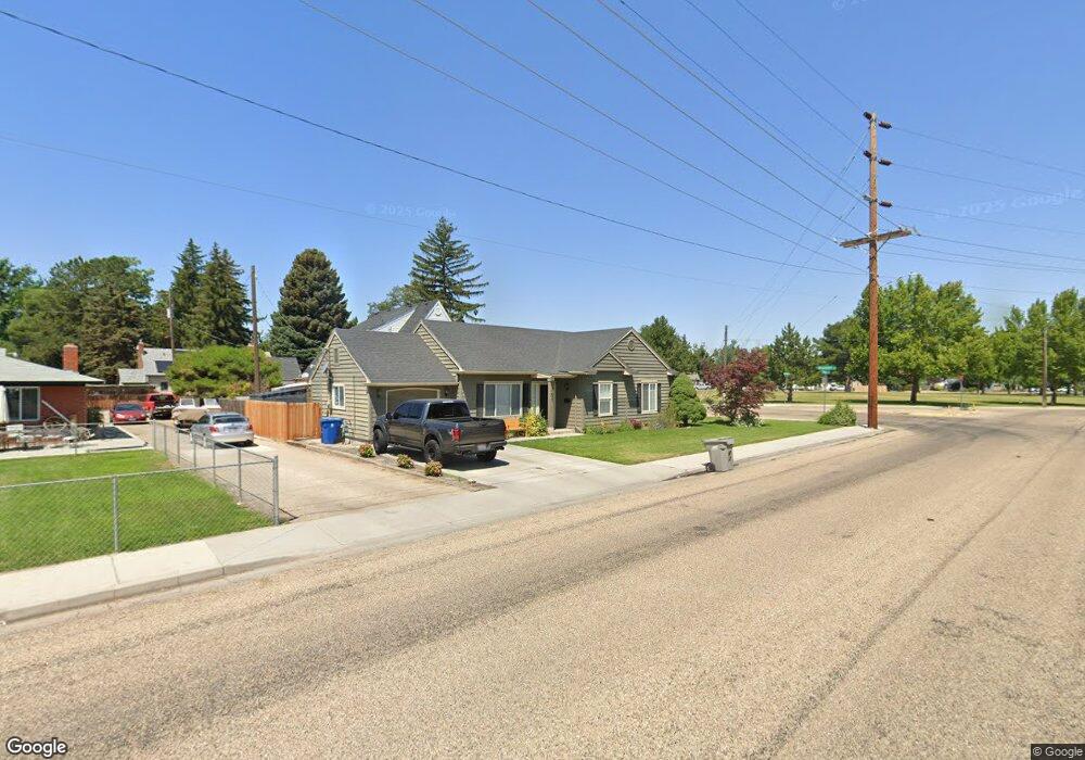
This home is located at 103 S Powerline Rd, Nampa, ID 83686 and is currently estimated at $316,441, approximately $297 per square foot. 103 S Powerline Rd is a home located in Canyon County with nearby schools including Sherman Elementary School, West Middle School, and Skyview High School.
Ownership History
Date
Name
Owned For
Owner Type
Purchase Details
Closed on
Oct 7, 2019
Sold by
Davis James S
Bought by
Rienstra Drew and Davis Faith
Current Estimated Value
Home Financials for this Owner
Home Financials are based on the most recent Mortgage that was taken out on this home.
Original Mortgage
$182,183
Interest Rate
3.37%
Mortgage Type
FHA
Purchase Details
Closed on
Aug 7, 2012
Sold by
Davis Kristine M
Bought by
Davis James S
Create a Home Valuation Report for This Property
The Home Valuation Report is an in-depth analysis detailing your home's value as well as a comparison with similar homes in the area
Home Values in the Area
Average Home Value in this Area
Purchase History
| Date | Buyer | Sale Price | Title Company |
|---|---|---|---|
| Rienstra Drew | -- | Nextitle | |
| Davis James S | -- | Pioneer Title Canyon Ca |
Source: Public Records
Mortgage History
| Date | Status | Borrower | Loan Amount |
|---|---|---|---|
| Closed | Rienstra Drew | $182,183 |
Source: Public Records
Tax History Compared to Growth
Tax History
| Year | Tax Paid | Tax Assessment Tax Assessment Total Assessment is a certain percentage of the fair market value that is determined by local assessors to be the total taxable value of land and additions on the property. | Land | Improvement |
|---|---|---|---|---|
| 2025 | $1,017 | $307,100 | $100,700 | $206,400 |
| 2024 | $1,017 | $289,300 | $89,500 | $199,800 |
| 2023 | $957 | $286,000 | $89,500 | $196,500 |
| 2022 | $1,365 | $309,900 | $100,700 | $209,200 |
| 2021 | $1,290 | $219,000 | $52,500 | $166,500 |
| 2020 | $1,175 | $181,400 | $42,000 | $139,400 |
| 2019 | $2,479 | $154,500 | $36,400 | $118,100 |
| 2018 | $2,415 | $0 | $0 | $0 |
| 2017 | $2,207 | $0 | $0 | $0 |
| 2016 | $2,045 | $0 | $0 | $0 |
| 2015 | $1,794 | $0 | $0 | $0 |
| 2014 | $1,651 | $84,700 | $15,500 | $69,200 |
Source: Public Records
Map
Nearby Homes
- 216 S Powerline Rd
- 516 20th Ave S
- 511 20th Ave S
- 11420 W Taviton St
- 1716 Nixon Ave
- 416 S Powerline Rd
- 11480 W Sammi St
- 15634 N Shadow Cove Ave
- 2024 2nd St S
- 520 S Powerline Rd
- 1207 E Sheridan Ave
- 615 18th Ave S
- 223 S Elder St
- 618 Dufur St
- 1711 1st St S
- 1711 1st St S Unit 2, Ground Floor SW s
- 304 16th Ave S
- 703 S Chestnut St
- 123 17th Ave S
- 1708 1st St S
- 1415 E Roosevelt Ave
- 107 S Powerline Rd
- 119 S Powerline Rd
- 1411 E Roosevelt Ave
- 500 22nd Ave S
- 108 S Powerline Rd
- 116 Almond St
- 1406 E Washington Ave
- 404 22nd Ave S
- 116 S Powerline Rd
- 2215 4th St S
- 2221 4th St S
- 1520 E Washington Ave
- 207 S Powerline Rd
- 204 S Powerline Rd
- 115 S Florence St
- 1323 E Roosevelt Ave
- 121 S Florence St
- 1411 E Washington Ave
- 111 Almond St