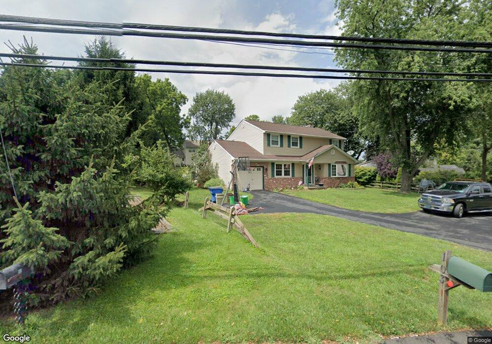
103 Silver Lake Rd Newtown, PA 18940
Estimated Value: $664,864 - $934,000
3
Beds
3
Baths
2,329
Sq Ft
$327/Sq Ft
Est. Value
About This Home
This home is located at 103 Silver Lake Rd, Newtown, PA 18940 and is currently estimated at $760,966, approximately $326 per square foot. 103 Silver Lake Rd is a home located in Bucks County with nearby schools including Goodnoe Elementary School, Newtown Middle School, and Council Rock High School North.
Ownership History
Date
Name
Owned For
Owner Type
Purchase Details
Closed on
May 14, 2002
Sold by
Wittman Sharon B and Wittmann Sharon B
Bought by
Deppi Paul J and Marchionni Bethany
Current Estimated Value
Home Financials for this Owner
Home Financials are based on the most recent Mortgage that was taken out on this home.
Original Mortgage
$185,000
Outstanding Balance
$78,558
Interest Rate
7.01%
Estimated Equity
$682,408
Purchase Details
Closed on
Dec 11, 1998
Sold by
Bullis Daniel R and Rogers Bullis Dorothy
Bought by
Wittmann Sharon B
Home Financials for this Owner
Home Financials are based on the most recent Mortgage that was taken out on this home.
Original Mortgage
$70,000
Interest Rate
6.78%
Purchase Details
Closed on
Sep 25, 1998
Sold by
Amelung James C and Amelung Linda S
Bought by
Bullis Daniel R and Rogers Bullis Dorothy
Home Financials for this Owner
Home Financials are based on the most recent Mortgage that was taken out on this home.
Original Mortgage
$132,000
Interest Rate
6.89%
Create a Home Valuation Report for This Property
The Home Valuation Report is an in-depth analysis detailing your home's value as well as a comparison with similar homes in the area
Home Values in the Area
Average Home Value in this Area
Purchase History
| Date | Buyer | Sale Price | Title Company |
|---|---|---|---|
| Deppi Paul J | $245,000 | -- | |
| Wittmann Sharon B | $185,000 | -- | |
| Bullis Daniel R | $153,000 | -- |
Source: Public Records
Mortgage History
| Date | Status | Borrower | Loan Amount |
|---|---|---|---|
| Open | Deppi Paul J | $185,000 | |
| Previous Owner | Wittmann Sharon B | $70,000 | |
| Previous Owner | Bullis Daniel R | $132,000 |
Source: Public Records
Tax History Compared to Growth
Tax History
| Year | Tax Paid | Tax Assessment Tax Assessment Total Assessment is a certain percentage of the fair market value that is determined by local assessors to be the total taxable value of land and additions on the property. | Land | Improvement |
|---|---|---|---|---|
| 2025 | $5,719 | $32,180 | $2,680 | $29,500 |
| 2024 | $5,719 | $32,180 | $2,680 | $29,500 |
| 2023 | $5,472 | $32,180 | $2,680 | $29,500 |
| 2022 | $5,366 | $32,180 | $2,680 | $29,500 |
| 2021 | $5,283 | $32,180 | $2,680 | $29,500 |
| 2020 | $5,028 | $32,180 | $2,680 | $29,500 |
| 2019 | $4,909 | $32,180 | $2,680 | $29,500 |
| 2018 | $4,816 | $32,180 | $2,680 | $29,500 |
| 2017 | $4,649 | $32,180 | $2,680 | $29,500 |
| 2016 | $4,617 | $32,180 | $2,680 | $29,500 |
| 2015 | -- | $32,180 | $2,680 | $29,500 |
| 2014 | -- | $32,180 | $2,680 | $29,500 |
Source: Public Records
Map
Nearby Homes
- 128 Thornhill Ln
- 277 Willow Dr
- 21 Violet Ln Unit 161A
- 25 Wellington Rd
- 8 Bennington Place
- 0 Route 413 Bypass Unit PABU2010042
- 35 Essex Place
- 2 Farmington Place
- 52 Yorkshire Dr
- 2017 Quarry Rd
- 215 Rumford Ct
- 206 Paxon Alley Unit 51
- 106 Hicks Alley
- 210 Shady Brook Dr
- 54 Kanon Ct
- 101 N Norwood Ave
- 532 Penn St
- 41 Nathan Ct
- 1819 Windflower Ln
- 1839 Windflower Ln