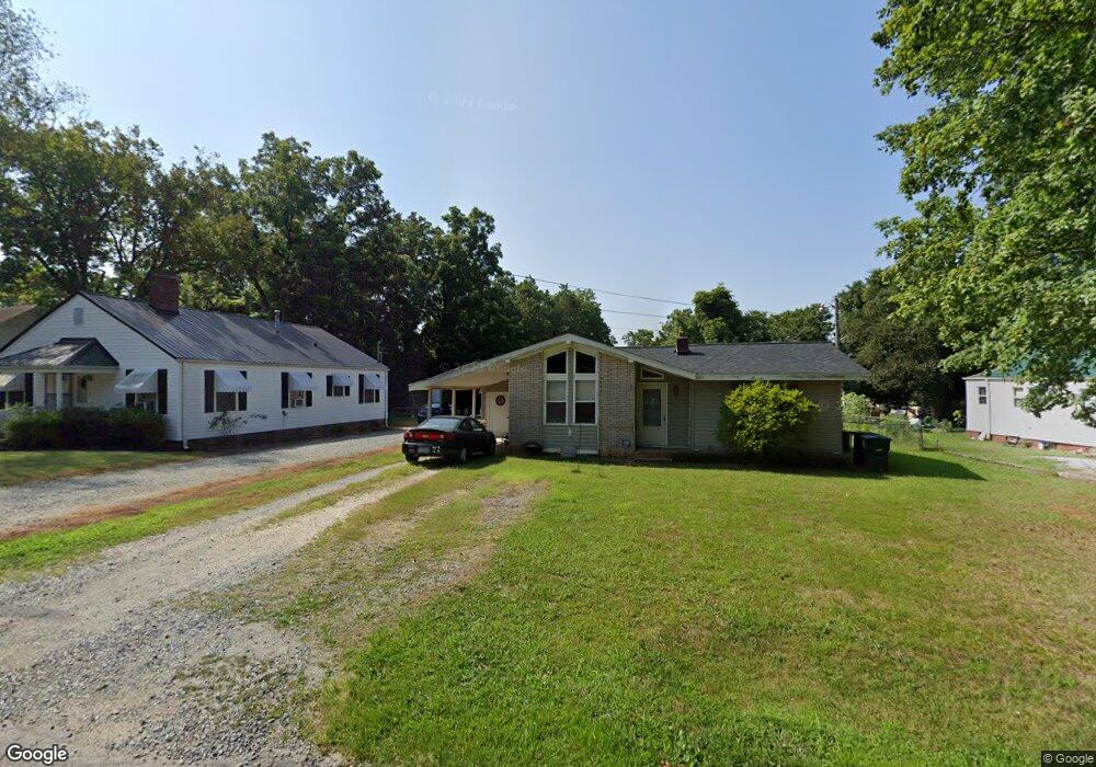
103 Sink Cir Lexington, NC 27292
Estimated Value: $103,000 - $140,000
2
Beds
1
Bath
832
Sq Ft
$146/Sq Ft
Est. Value
About This Home
This home is located at 103 Sink Cir, Lexington, NC 27292 and is currently estimated at $121,621, approximately $146 per square foot. 103 Sink Cir is a home located in Davidson County with nearby schools including South Lexington School, Lexington Middle School, and Lexington Senior High School.
Ownership History
Date
Name
Owned For
Owner Type
Purchase Details
Closed on
Jan 10, 2011
Sold by
Eh Pooled 810 Lp
Bought by
Ferguson Robert R and Ferguson Linda G
Current Estimated Value
Purchase Details
Closed on
Sep 29, 2010
Sold by
Deutsche Bank National Trust Company
Bought by
Eh Pooled 810 Lp
Purchase Details
Closed on
Mar 16, 2010
Sold by
Gaddy Jamon and Gaddy Lisa
Bought by
Deutsche Bank National Trust Company
Purchase Details
Closed on
Apr 11, 2006
Sold by
Gaddy Lisa
Bought by
Gaddy Jamon and Gaddy Lisa
Home Financials for this Owner
Home Financials are based on the most recent Mortgage that was taken out on this home.
Original Mortgage
$61,650
Interest Rate
9.35%
Mortgage Type
New Conventional
Purchase Details
Closed on
May 1, 1995
Create a Home Valuation Report for This Property
The Home Valuation Report is an in-depth analysis detailing your home's value as well as a comparison with similar homes in the area
Home Values in the Area
Average Home Value in this Area
Purchase History
| Date | Buyer | Sale Price | Title Company |
|---|---|---|---|
| Ferguson Robert R | $23,000 | None Available | |
| Eh Pooled 810 Lp | $16,451 | None Available | |
| Deutsche Bank National Trust Company | $21,300 | None Available | |
| Gaddy Jamon | -- | Chicago Title Insurance Co | |
| -- | $6,000 | -- |
Source: Public Records
Mortgage History
| Date | Status | Borrower | Loan Amount |
|---|---|---|---|
| Previous Owner | Gaddy Jamon | $61,650 |
Source: Public Records
Tax History Compared to Growth
Tax History
| Year | Tax Paid | Tax Assessment Tax Assessment Total Assessment is a certain percentage of the fair market value that is determined by local assessors to be the total taxable value of land and additions on the property. | Land | Improvement |
|---|---|---|---|---|
| 2025 | $633 | $48,690 | $0 | $0 |
| 2024 | $633 | $48,690 | $0 | $0 |
| 2023 | $633 | $48,690 | $0 | $0 |
| 2022 | $633 | $48,690 | $0 | $0 |
| 2021 | $633 | $48,690 | $0 | $0 |
| 2020 | $593 | $45,960 | $0 | $0 |
| 2019 | $602 | $45,960 | $0 | $0 |
| 2018 | $602 | $45,960 | $0 | $0 |
| 2017 | $602 | $45,960 | $0 | $0 |
| 2016 | $602 | $45,960 | $0 | $0 |
| 2015 | $579 | $45,960 | $0 | $0 |
| 2014 | $727 | $57,680 | $0 | $0 |
Source: Public Records
Map
Nearby Homes
- 386 Harper Mill Cir
- 337 Owens Ridge Way
- 330 Owens Ridge Way
- 326 Owens Ridge Way
- 333 Owens Ridge Way
- 329 Owens Ridge Way
- 325 Owens Ridge Way
- 341 Owens Ridge Way
- 401 Owens Ridge Way
- 405 Owens Ridge Way
- 409 Owens Ridge Way
- TAYLOR Plan at Owens Ridge
- HAYDEN Plan at Owens Ridge
- ROBIE Plan at Owens Ridge
- PENWELL Plan at Owens Ridge
- CALI Plan at Owens Ridge
- BELHAVEN Plan at Owens Ridge
- 306 Pope St
- 26 Harrington Ave
- 503 Quail Ln