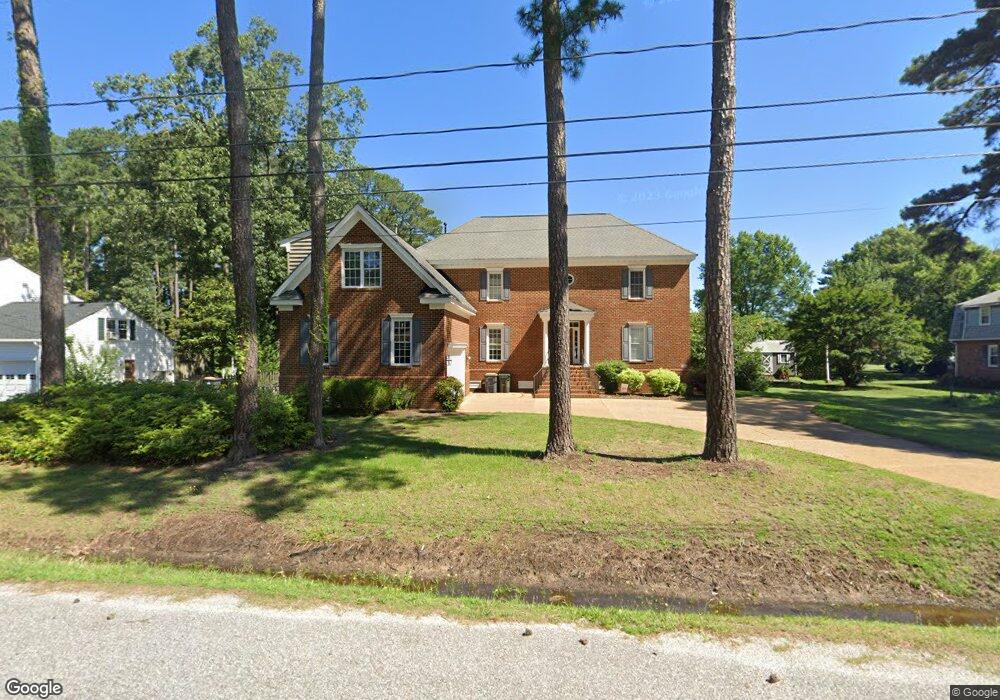
103 Sir Ralph Ln Poquoson, VA 23662
Poquoson City Center NeighborhoodEstimated Value: $697,000 - $736,000
4
Beds
3
Baths
4,351
Sq Ft
$164/Sq Ft
Est. Value
About This Home
This home is located at 103 Sir Ralph Ln, Poquoson, VA 23662 and is currently estimated at $715,563, approximately $164 per square foot. 103 Sir Ralph Ln is a home located in Poquoson City with nearby schools including Emmanuel Lutheran School and Summit Christian Academy - Upper School.
Ownership History
Date
Name
Owned For
Owner Type
Purchase Details
Closed on
Dec 28, 2020
Sold by
Creasy Dana M
Bought by
Epler Jonathan David and Marshall Autumn R
Current Estimated Value
Home Financials for this Owner
Home Financials are based on the most recent Mortgage that was taken out on this home.
Original Mortgage
$511,500
Outstanding Balance
$456,435
Interest Rate
2.7%
Mortgage Type
VA
Estimated Equity
$259,128
Purchase Details
Closed on
Mar 6, 2015
Sold by
Bowen William B and Bowen Dana M
Bought by
Bowen Dana M
Create a Home Valuation Report for This Property
The Home Valuation Report is an in-depth analysis detailing your home's value as well as a comparison with similar homes in the area
Home Values in the Area
Average Home Value in this Area
Purchase History
| Date | Buyer | Sale Price | Title Company |
|---|---|---|---|
| Epler Jonathan David | $500,000 | Eastern Va Title Co Inc | |
| Bowen Dana M | -- | -- |
Source: Public Records
Mortgage History
| Date | Status | Borrower | Loan Amount |
|---|---|---|---|
| Open | Epler Jonathan David | $511,500 |
Source: Public Records
Tax History Compared to Growth
Tax History
| Year | Tax Paid | Tax Assessment Tax Assessment Total Assessment is a certain percentage of the fair market value that is determined by local assessors to be the total taxable value of land and additions on the property. | Land | Improvement |
|---|---|---|---|---|
| 2024 | $6,548 | $574,400 | $88,800 | $485,600 |
| 2023 | $6,376 | $574,400 | $88,800 | $485,600 |
| 2022 | $6,076 | $537,700 | $88,800 | $448,900 |
| 2021 | $6,076 | $537,700 | $88,800 | $448,900 |
| 2020 | $0 | $479,300 | $88,800 | $390,500 |
| 2019 | -- | $479,300 | $88,800 | $390,500 |
| 2018 | -- | $447,900 | $88,800 | $359,100 |
| 2017 | -- | $425,500 | $88,800 | $336,700 |
| 2016 | -- | $425,500 | $88,800 | $336,700 |
| 2015 | -- | $419,900 | $88,800 | $331,100 |
| 2013 | -- | $419,900 | $88,800 | $331,100 |
Source: Public Records
Map
Nearby Homes
- 1020 Poquoson Ave
- 1020 Poquoson Ave Unit C
- 8.5AC Poquoson Ave
- 10 Kathy Dr
- 208 Little Florida Rd
- 7 Quail Cove
- 15 Robert Bruce Rd
- 119 Robert Bruce Rd
- 128 Robert Bruce Rd
- 117 Robert Bruce Rd
- 129 Robert Bruce Rd
- 101 Oystermans Way
- 103 Oystermans Way
- 122 Robert Bruce Rd
- 120 Robert Bruce Rd
- 111 Robert Bruce Rd
- 1.55ac Holloway Rd
- 109 Robert Bruce Rd
- 104 Robert Bruce Rd
- 108 Robert Bruce Rd
- 101 Sir Ralph Ln
- 24 Laydon Way
- 102 Sir Ralph Ln
- 104 Sir Ralph Ln
- 101 Ct Deayllon
- 20 Laydon Way
- 5 Sir Ralph Ln
- 25 Laydon Way
- 102 Laydon Way
- 103 Ct Deayllon
- 103 Court Deayllon
- 101 Laydon Way
- 23 Laydon Way
- 102 Court Deayllon
- 102 Ct Deayllon
- 21 Laydon Way
- 18 Laydon Way
- 3 Sir Ralph Ln
- 203 Sir Ralph Ln
- 105 Ct Deayllon