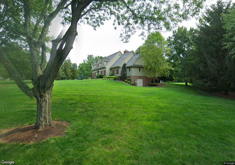
103 Stonepine Dr Kennett Square, PA 19348
Estimated Value: $946,223 - $1,197,000
4
Beds
3
Baths
3,798
Sq Ft
$276/Sq Ft
Est. Value
About This Home
This home is located at 103 Stonepine Dr, Kennett Square, PA 19348 and is currently estimated at $1,049,056, approximately $276 per square foot. 103 Stonepine Dr is a home located in Chester County with nearby schools including Kennett Middle School, Kennett High School, and St. Patrick School.
Ownership History
Date
Name
Owned For
Owner Type
Purchase Details
Closed on
Dec 24, 2003
Sold by
Yoder Eugene C and Yoder Nancy J
Bought by
Marson Lois M and Marson Karen
Current Estimated Value
Home Financials for this Owner
Home Financials are based on the most recent Mortgage that was taken out on this home.
Original Mortgage
$400,000
Outstanding Balance
$175,467
Interest Rate
5.12%
Mortgage Type
Purchase Money Mortgage
Estimated Equity
$873,589
Create a Home Valuation Report for This Property
The Home Valuation Report is an in-depth analysis detailing your home's value as well as a comparison with similar homes in the area
Home Values in the Area
Average Home Value in this Area
Purchase History
| Date | Buyer | Sale Price | Title Company |
|---|---|---|---|
| Marson Lois M | $580,000 | -- |
Source: Public Records
Mortgage History
| Date | Status | Borrower | Loan Amount |
|---|---|---|---|
| Open | Marson Lois M | $400,000 |
Source: Public Records
Tax History
| Year | Tax Paid | Tax Assessment Tax Assessment Total Assessment is a certain percentage of the fair market value that is determined by local assessors to be the total taxable value of land and additions on the property. | Land | Improvement |
|---|---|---|---|---|
| 2025 | $15,475 | $379,490 | $108,030 | $271,460 |
| 2024 | $15,475 | $379,490 | $108,030 | $271,460 |
| 2023 | $15,175 | $379,490 | $108,030 | $271,460 |
| 2022 | $14,770 | $379,490 | $108,030 | $271,460 |
| 2021 | $14,548 | $379,490 | $108,030 | $271,460 |
| 2020 | $14,276 | $379,490 | $108,030 | $271,460 |
| 2019 | $14,085 | $379,490 | $108,030 | $271,460 |
| 2018 | $13,794 | $379,490 | $108,030 | $271,460 |
| 2017 | $12,830 | $379,490 | $108,030 | $271,460 |
| 2016 | $1,308 | $379,490 | $108,030 | $271,460 |
| 2015 | $1,308 | $417,720 | $108,030 | $309,690 |
| 2014 | $1,308 | $417,720 | $108,030 | $309,690 |
Source: Public Records
Map
Nearby Homes
- 989 Sills Mill Rd
- 178 S Orchard Ave
- 818 Burrows Run Rd
- 110 Hannah Ln
- 821 Burrows Run Rd
- 39 E Jonathan Ct
- 200 Fulling Dr
- 103 Pierce Ln
- 403 Winterberry Dr Unit 42
- 400 Lantern Ln
- 123 Federal Walk
- 962 E Baltimore Pike
- 316 Maple Dr
- 106 Orchard Terrace
- 105 Waywood Dr
- 113 Waywood Dr Unit 32
- 115 Waywood Dr Unit 31
- 111 Waywood Dr Unit 33
- 103 Waywood Dr Unit 36
- 103 Waywood Dr
- 105 Stonepine Dr
- 101 Stonepine Dr
- 102 Stonepine Dr
- 108 Stonepine Dr
- 106 Stonepine Dr
- 405 Hannum Rd
- 107 Stonepine Dr
- 104 Stonepine Dr
- 721 Rosedale Rd
- 984 Deerfield Ln
- 110 Stonepine Dr
- 401 Hannum Rd
- 109 Stonepine Dr
- 114 Stonepine Dr
- 118 Stonepine Dr
- 407 Hannum Rd
- 989 Deerfield Ln
- 990 Deerfield Ln
- 726 Rosedale Rd
- 709 Rosedale Rd
Your Personal Tour Guide
Ask me questions while you tour the home.