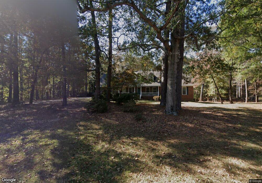
103 Sturbridge Dr Lagrange, GA 30240
Estimated Value: $371,665 - $473,000
4
Beds
3
Baths
2,329
Sq Ft
$184/Sq Ft
Est. Value
About This Home
This home is located at 103 Sturbridge Dr, Lagrange, GA 30240 and is currently estimated at $429,166, approximately $184 per square foot. 103 Sturbridge Dr is a home located in Troup County with nearby schools including Hillcrest Elementary School, Franklin Forest Elementary School, and Hollis Hand Elementary School.
Ownership History
Date
Name
Owned For
Owner Type
Purchase Details
Closed on
Jul 23, 2004
Sold by
Kight Keith V and Kight Cathy B
Bought by
Nevil Earl and Nevil Karrie
Current Estimated Value
Purchase Details
Closed on
May 17, 1999
Sold by
Bennett Terry L and Bennett Teri J
Bought by
Kight Keith V and Kight Cathy B
Purchase Details
Closed on
Jul 23, 1998
Sold by
Purvis Barney and Purvis Sandra S
Bought by
Bennett Terry L and Bennett Teri J
Purchase Details
Closed on
Feb 1, 1988
Bought by
Purvis Barney and Purvis Sandra S
Purchase Details
Closed on
Aug 1, 1986
Purchase Details
Closed on
Jan 1, 1986
Create a Home Valuation Report for This Property
The Home Valuation Report is an in-depth analysis detailing your home's value as well as a comparison with similar homes in the area
Purchase History
| Date | Buyer | Sale Price | Title Company |
|---|---|---|---|
| Nevil Earl | $235,000 | -- | |
| Kight Keith V | $180,000 | -- | |
| Bennett Terry L | $173,000 | -- | |
| Purvis Barney | -- | -- | |
| -- | -- | -- | |
| -- | -- | -- |
Source: Public Records
Tax History
| Year | Tax Paid | Tax Assessment Tax Assessment Total Assessment is a certain percentage of the fair market value that is determined by local assessors to be the total taxable value of land and additions on the property. | Land | Improvement |
|---|---|---|---|---|
| 2025 | $3,978 | $151,840 | $12,000 | $139,840 |
| 2024 | $3,779 | $140,560 | $12,000 | $128,560 |
| 2023 | $3,224 | $138,120 | $12,000 | $126,120 |
| 2022 | $3,673 | $133,600 | $12,000 | $121,600 |
| 2021 | $2,917 | $98,720 | $12,000 | $86,720 |
| 2020 | $2,917 | $98,720 | $12,000 | $86,720 |
| 2019 | $2,825 | $95,640 | $12,000 | $83,640 |
| 2018 | $2,747 | $91,080 | $12,000 | $79,080 |
| 2017 | $2,687 | $91,080 | $12,000 | $79,080 |
Source: Public Records
Map
Nearby Homes
- 206 Sturbridge Dr
- 219 E Yorktown Dr
- 107 Cameron Pointe Dr
- 102 Cameron Pointe Dr
- 111 Copper Creek Dr
- 135 Copper Creek Dr
- 64 Waterview Ct
- 120 Copper Creek Dr
- 0 Waterview Dr Unit 10558462
- 110 Pond View Point
- 130 Sunny Point Cir
- 103 Woodchase
- 300 Willow Pointe Dr
- 302 Willow Pointe Dr
- 348 Willow Pointe Dr
- 178 Waterview Dr
- 24 N Brooks Rd
- 109 Windridge
- 107 Windridge
- 106 Highland Park
- 105 Sturbridge Dr
- 101 Sturbridge Dr
- 102 Sturbridge Dr
- 100 Sturbridge Dr
- 104 Sturbridge Dr
- 107 Sturbridge Dr
- 106 Sturbridge Dr
- 160 Sanders Rd
- 1408 Antioch Rd
- 109 Sturbridge Dr
- 108 Sturbridge Dr
- 153 Sanders Rd
- 95 Sanders Rd
- 178 Sanders Rd
- 111 Sturbridge Dr
- 83 Sanders Rd
- 110 Sturbridge Dr
- 178186 Sanders Rd
- 65 Sanders Rd
- 203 Sanders Rd
Your Personal Tour Guide
Ask me questions while you tour the home.