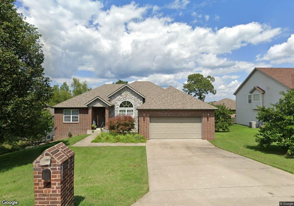
103 Tannin Trace Rd Branson, MO 65616
North Branson NeighborhoodEstimated Value: $423,000 - $461,000
--
Bed
--
Bath
1,944
Sq Ft
$225/Sq Ft
Est. Value
About This Home
This home is located at 103 Tannin Trace Rd, Branson, MO 65616 and is currently estimated at $438,256, approximately $225 per square foot. 103 Tannin Trace Rd is a home with nearby schools including Cedar Ridge Primary, Cedar Ridge Intermediate School, and Cedar Ridge Elementary School.
Ownership History
Date
Name
Owned For
Owner Type
Purchase Details
Closed on
Nov 18, 2021
Sold by
Hollyhock Rentals Llc
Bought by
Wherry Holly
Current Estimated Value
Purchase Details
Closed on
Jul 2, 2007
Sold by
Duncan Monte S and Duncan Jennifer K
Bought by
Wherry Holly L
Home Financials for this Owner
Home Financials are based on the most recent Mortgage that was taken out on this home.
Original Mortgage
$259,900
Interest Rate
6.62%
Mortgage Type
Adjustable Rate Mortgage/ARM
Create a Home Valuation Report for This Property
The Home Valuation Report is an in-depth analysis detailing your home's value as well as a comparison with similar homes in the area
Home Values in the Area
Average Home Value in this Area
Purchase History
| Date | Buyer | Sale Price | Title Company |
|---|---|---|---|
| Wherry Holly | -- | None Listed On Document | |
| Wherry Holly L | -- | -- |
Source: Public Records
Mortgage History
| Date | Status | Borrower | Loan Amount |
|---|---|---|---|
| Previous Owner | Wherry Holly L | $259,900 |
Source: Public Records
Tax History Compared to Growth
Tax History
| Year | Tax Paid | Tax Assessment Tax Assessment Total Assessment is a certain percentage of the fair market value that is determined by local assessors to be the total taxable value of land and additions on the property. | Land | Improvement |
|---|---|---|---|---|
| 2025 | $2,503 | $39,840 | -- | -- |
| 2023 | $2,503 | $46,820 | $0 | $0 |
| 2022 | $2,434 | $46,820 | $0 | $0 |
| 2021 | $2,419 | $46,820 | $0 | $0 |
| 2019 | $2,240 | $41,560 | $0 | $0 |
| 2018 | $2,242 | $41,560 | $0 | $0 |
| 2017 | $1,827 | $34,190 | $0 | $0 |
| 2016 | $1,822 | $34,190 | $0 | $0 |
| 2015 | $1,805 | $34,190 | $0 | $0 |
| 2014 | $1,762 | $34,990 | $0 | $0 |
Source: Public Records
Map
Nearby Homes
- 128 Sapling Dr
- 229 Stillwood Dr Unit 6a
- 180 Stillwood Dr Unit 10a
- 311 Stillwood Dr
- 290 Stillwood Dr
- 168 Rockridge Rd
- 149 Rue de Villas Cir
- 160 Rue de Villas Cir
- 159 Vixen Cir Unit H
- Lot 96 Stone Valley Estates
- 000 Hummingbird Ln
- 143 Vixen Cir Unit B
- 160 Brookside Ct
- 118 Vixen Cir Unit D
- 528 Darla Dr
- 111 Vixen Cir Unit C
- 000 Branson Hills Pkwy
- Tract 2 Branson Hills Pkwy
- Tract 1 Branson Hills Pkwy
- 464 State Highway 248
- 105 Tannin Trace Rd
- 101 Tannin Trace Rd
- 117 Sapling Dr
- 102 Tannin Trace Rd
- 109 Tannin Trace Rd
- 104 Tannin Trace Rd
- 100 Tannin Trace Rd
- 106 Tannin Trace Rd
- 139 Sapling Dr
- 137 Sapling Dr
- 135 Sapling Dr
- 112 Sapling Dr
- 133 Sapling Dr
- 143 Sapling Dr
- 107 Sapling Dr
- 110 Sapling Dr
- 116 Sapling Dr
- 114 Sapling Dr
- 151 Sapling Dr
- 103 Acorn Ln