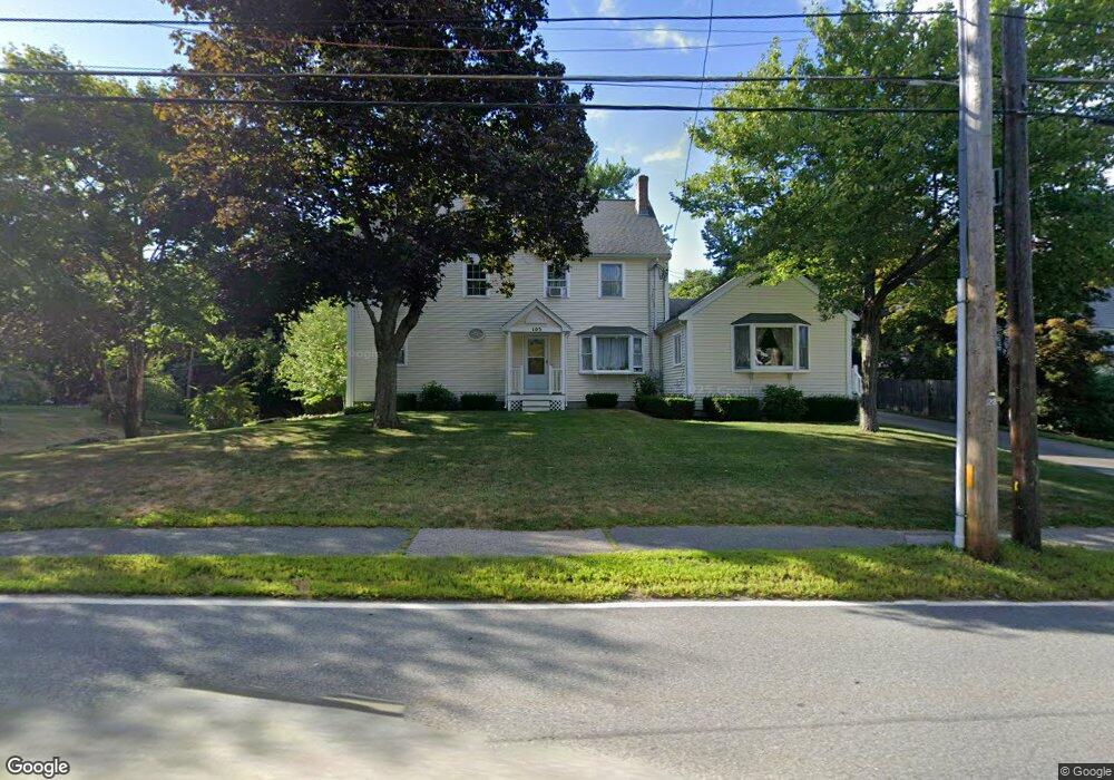
103 W Bacon St Plainville, MA 02762
Estimated Value: $663,000 - $831,000
4
Beds
3
Baths
2,992
Sq Ft
$255/Sq Ft
Est. Value
About This Home
This home is located at 103 W Bacon St, Plainville, MA 02762 and is currently estimated at $761,620, approximately $254 per square foot. 103 W Bacon St is a home located in Norfolk County with nearby schools including Anna Ware Jackson School, Beatrice H. Wood Elementary School, and Cadence Academy Preschool - North Attleborough.
Ownership History
Date
Name
Owned For
Owner Type
Purchase Details
Closed on
Feb 10, 1995
Sold by
Est Cobb Beryl A and Cobb Donald A
Bought by
Cobb Scott M and Cobb Lisa M
Current Estimated Value
Home Financials for this Owner
Home Financials are based on the most recent Mortgage that was taken out on this home.
Original Mortgage
$85,500
Interest Rate
9.18%
Mortgage Type
Purchase Money Mortgage
Create a Home Valuation Report for This Property
The Home Valuation Report is an in-depth analysis detailing your home's value as well as a comparison with similar homes in the area
Home Values in the Area
Average Home Value in this Area
Purchase History
| Date | Buyer | Sale Price | Title Company |
|---|---|---|---|
| Cobb Scott M | $90,000 | -- | |
| Cobb Scott M | $90,000 | -- |
Source: Public Records
Mortgage History
| Date | Status | Borrower | Loan Amount |
|---|---|---|---|
| Open | Cobb Scott M | $97,500 | |
| Closed | Cobb Scott M | $85,500 | |
| Previous Owner | Cobb Scott M | $45,500 |
Source: Public Records
Tax History Compared to Growth
Tax History
| Year | Tax Paid | Tax Assessment Tax Assessment Total Assessment is a certain percentage of the fair market value that is determined by local assessors to be the total taxable value of land and additions on the property. | Land | Improvement |
|---|---|---|---|---|
| 2025 | $83 | $714,100 | $215,200 | $498,900 |
| 2024 | $7,837 | $653,100 | $195,900 | $457,200 |
| 2023 | $7,644 | $612,500 | $195,900 | $416,600 |
| 2022 | $7,073 | $504,100 | $187,600 | $316,500 |
| 2021 | $6,849 | $465,900 | $187,600 | $278,300 |
| 2020 | $6,661 | $453,100 | $187,600 | $265,500 |
| 2019 | $6,778 | $452,800 | $187,600 | $265,200 |
| 2018 | $6,542 | $434,400 | $169,200 | $265,200 |
| 2017 | $6,281 | $418,700 | $169,200 | $249,500 |
| 2016 | $6,024 | $406,200 | $169,200 | $237,000 |
| 2015 | $6,133 | $397,700 | $144,500 | $253,200 |
| 2014 | $6,000 | $401,100 | $144,500 | $256,600 |
Source: Public Records
Map
Nearby Homes
- 105 W Bacon St
- 145 W Bacon St
- 16 Elizabeth St
- 10 Cliff Dr
- 5 Farm Hill Ln
- 3 Field Dr
- 45 Moran St
- 35-R Whiting St
- 20 South St
- 10 Legion Dr
- 230 South St
- 12 Morgan Way Unit 1
- 133 Pleasant St Unit 2
- 64 Smith St
- 6 Hilltop Rd Unit 122
- 99 Arnold Rd
- 1066 Mount Hope St
- 68 Fisher St
- 12 Roosevelt Ave
- 19 Church St Unit A5
- 99 W Bacon St
- 98 W Bacon St
- 106 W Bacon St
- 109 W Bacon St
- 94 W Bacon St
- 111 W Bacon St
- 91 W Bacon St
- 110 W Bacon St
- 112 W Bacon St
- 1 Fletcher St Unit B
- 1 Fletcher St Unit A
- 1 Fletcher St Unit 1B
- 1 Fletcher St Unit 1A
- 117 W Bacon St
- 88 W Bacon St
- 5 Valerie Dr
- 3 Fletcher St
- 120 W Bacon St
- 7 Valerie Dr
- 2 Mathurin Rd