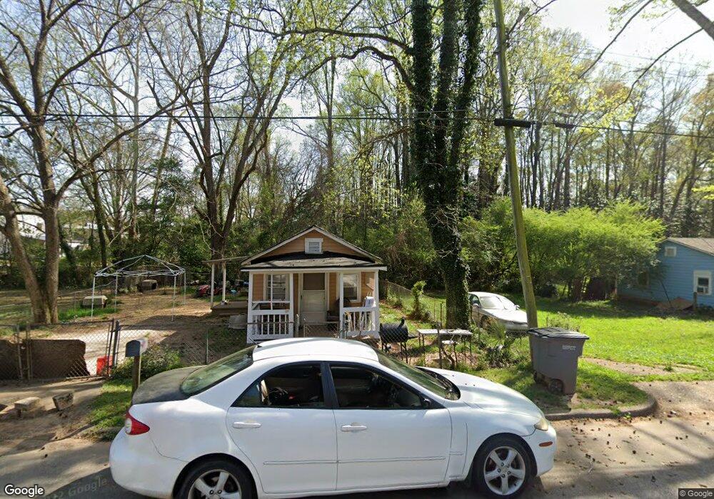
103 W Crovat St Lagrange, GA 30240
Estimated Value: $52,000 - $72,000
2
Beds
1
Bath
579
Sq Ft
$106/Sq Ft
Est. Value
About This Home
This home is located at 103 W Crovat St, Lagrange, GA 30240 and is currently estimated at $61,368, approximately $105 per square foot. 103 W Crovat St is a home located in Troup County with nearby schools including Ethel W. Kight Elementary School, Hollis Hand Elementary School, and Franklin Forest Elementary School.
Ownership History
Date
Name
Owned For
Owner Type
Purchase Details
Closed on
Nov 23, 1999
Sold by
Henry Ii G Word
Bought by
Word Ii Henry G
Current Estimated Value
Purchase Details
Closed on
Nov 22, 1999
Sold by
Guy M Word
Bought by
Henry Ii G Word
Purchase Details
Closed on
Mar 6, 1992
Sold by
Ruth High
Bought by
Guy M Word
Purchase Details
Closed on
Jul 28, 1977
Sold by
Word Guy
Bought by
Ruth High
Purchase Details
Closed on
Jan 1, 1974
Sold by
Cosper Onice Woodson
Bought by
Word Guy
Purchase Details
Closed on
Jan 1, 1972
Sold by
Cosper Claude
Bought by
Coper Onice Woodson
Create a Home Valuation Report for This Property
The Home Valuation Report is an in-depth analysis detailing your home's value as well as a comparison with similar homes in the area
Purchase History
| Date | Buyer | Sale Price | Title Company |
|---|---|---|---|
| Word Ii Henry G | -- | -- | |
| Henry Ii G Word | -- | -- | |
| Guy M Word | -- | -- | |
| Ruth High | -- | -- | |
| Word Guy | -- | -- | |
| Cosper Onice Woodson | -- | -- | |
| Coper Onice Woodson | -- | -- |
Source: Public Records
Tax History
| Year | Tax Paid | Tax Assessment Tax Assessment Total Assessment is a certain percentage of the fair market value that is determined by local assessors to be the total taxable value of land and additions on the property. | Land | Improvement |
|---|---|---|---|---|
| 2025 | $291 | $10,664 | $1,640 | $9,024 |
| 2024 | $270 | $9,904 | $1,640 | $8,264 |
| 2023 | $261 | $9,584 | $1,640 | $7,944 |
| 2022 | $255 | $9,144 | $1,640 | $7,504 |
| 2021 | $150 | $4,972 | $1,400 | $3,572 |
| 2020 | $150 | $4,972 | $1,400 | $3,572 |
| 2019 | $59 | $1,952 | $1,120 | $832 |
| 2018 | $86 | $2,836 | $1,964 | $872 |
| 2017 | $86 | $2,836 | $1,964 | $872 |
| 2016 | $84 | $2,799 | $1,964 | $835 |
| 2015 | $57 | $1,896 | $1,060 | $835 |
| 2014 | $114 | $3,781 | $1,414 | $2,367 |
| 2013 | -- | $3,946 | $1,414 | $2,532 |
Source: Public Records
Map
Nearby Homes
- 501 Milam St
- 103 Cedar St
- 109 Bell St
- 112 Cedar St
- 303 E Mulberry St
- 0 Bagley St
- 0 Boggs St Unit 10550243
- 0 Boggs St Unit 10550231
- 0 Boggs St Unit 10550239
- 0 Boggs St Unit 10550250
- 304 Butler St
- 1191 Whitesville St
- 1186 Lindsey St
- 203 Fannin St
- 901 Whiteline St
- 914 Todd St
- 1201 Whitesville St
- 0 E Fendig St
- 113 E Fendig St
- 509 S Lewis St
- 105 W Crovat St
- 107 W Crovat St
- 115 W Crovat St
- 610 Whitesville St
- 104 W Crovat St
- 700 Whitesville Rd
- 604 Whitesville St
- 700 Whitesville St
- 119 W Crovat St
- 602 Whitesville St
- 513 Milam St
- 602 Whitesville Rd
- 0 W Crovat St
- 120 W Crovat St
- 600 Whitesville St
- 121 W Crovat St
- 511 Milam St
- 701 Whitesville Rd
- 508 Whitesville St
- 796 Whitesville St
Your Personal Tour Guide
Ask me questions while you tour the home.