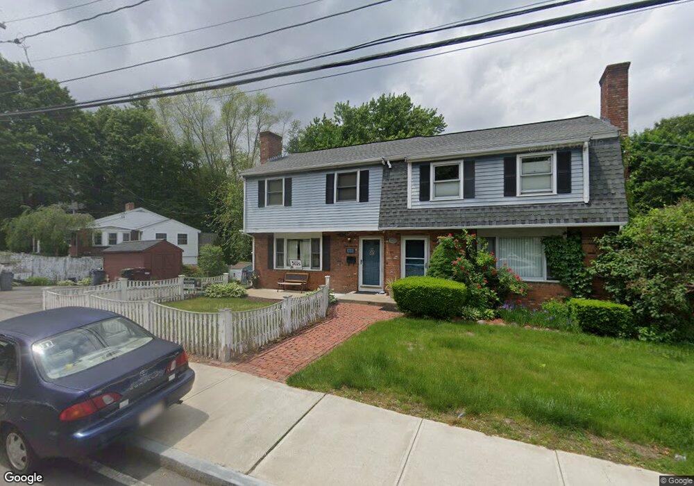
103 Walnut St Dedham, MA 02026
Oakdale NeighborhoodEstimated Value: $452,000 - $533,000
3
Beds
2
Baths
1,056
Sq Ft
$466/Sq Ft
Est. Value
About This Home
This home is located at 103 Walnut St, Dedham, MA 02026 and is currently estimated at $492,524, approximately $466 per square foot. 103 Walnut St is a home located in Norfolk County with nearby schools including Avery, Dedham Middle School, and Dedham High School.
Ownership History
Date
Name
Owned For
Owner Type
Purchase Details
Closed on
Jul 13, 2021
Sold by
Harris George A and Bushee June M
Bought by
Harris George A and Bushee June M
Current Estimated Value
Purchase Details
Closed on
Mar 3, 2004
Sold by
Harris George A
Bought by
Harris George A and Bushnee June M
Purchase Details
Closed on
Jul 29, 1994
Sold by
Levine John B and Levine Karen R
Bought by
Harris George A
Home Financials for this Owner
Home Financials are based on the most recent Mortgage that was taken out on this home.
Original Mortgage
$100,800
Interest Rate
8.25%
Mortgage Type
Purchase Money Mortgage
Create a Home Valuation Report for This Property
The Home Valuation Report is an in-depth analysis detailing your home's value as well as a comparison with similar homes in the area
Home Values in the Area
Average Home Value in this Area
Purchase History
| Date | Buyer | Sale Price | Title Company |
|---|---|---|---|
| Harris George A | -- | None Available | |
| Harris George A | -- | -- | |
| Harris George A | $126,000 | -- |
Source: Public Records
Mortgage History
| Date | Status | Borrower | Loan Amount |
|---|---|---|---|
| Previous Owner | Harris George A | $103,645 | |
| Previous Owner | Harris George A | $100,800 |
Source: Public Records
Tax History
| Year | Tax Paid | Tax Assessment Tax Assessment Total Assessment is a certain percentage of the fair market value that is determined by local assessors to be the total taxable value of land and additions on the property. | Land | Improvement |
|---|---|---|---|---|
| 2025 | $5,078 | $402,400 | $0 | $402,400 |
| 2024 | $4,840 | $387,200 | $0 | $387,200 |
| 2023 | $4,626 | $360,300 | $0 | $360,300 |
| 2022 | $4,543 | $340,300 | $0 | $340,300 |
| 2021 | $4,548 | $332,700 | $0 | $332,700 |
| 2020 | $4,062 | $296,100 | $0 | $296,100 |
| 2019 | $3,888 | $274,800 | $0 | $274,800 |
| 2018 | $3,851 | $264,700 | $0 | $264,700 |
| 2017 | $3,841 | $260,200 | $0 | $260,200 |
| 2016 | $3,840 | $247,900 | $0 | $247,900 |
| 2015 | $3,883 | $244,700 | $0 | $244,700 |
| 2014 | $3,935 | $244,700 | $0 | $244,700 |
Source: Public Records
Map
Nearby Homes
- 73 Walnut St
- 90 High St Unit 309
- 30 High St ( Cass St Entrance) Unit 209
- 108 High St
- 213 River St
- 105 Oakdale Ave
- 7 S Stone Mill Dr Unit 412
- 7 S Stone Mill Dr Unit 403
- 22 N Stone Mill Dr Unit 1111
- 147 Mount Vernon St
- 16 N Stone Mill Dr Unit 1014
- 56 Mount Vernon St
- 46 Park St
- 12 Blossom St
- 19 Lewis Ln
- 28 Linden Place
- 38 Fleming St
- 153 Colburn St
- 442 High St
- 49 Greenhood St
- 105 Walnut St
- 115 Walnut St
- 273 Whiting Ave
- 97 Walnut St
- 11 Oakdale Ave
- 90 Walnut St
- 90 Walnut St Unit 1
- 112 Walnut St
- 92 Walnut St Unit 2
- 261 Whiting Ave
- 125 Walnut St
- 125 Walnut St Unit 1
- 267 Whiting Ave
- 291 Whiting Ave
- 18 Fulton St
- 12 Oakdale Ave
- 21 Oakdale Ave
- 295 Whiting Ave
- 28 Fulton St
- 131 Walnut St
Your Personal Tour Guide
Ask me questions while you tour the home.