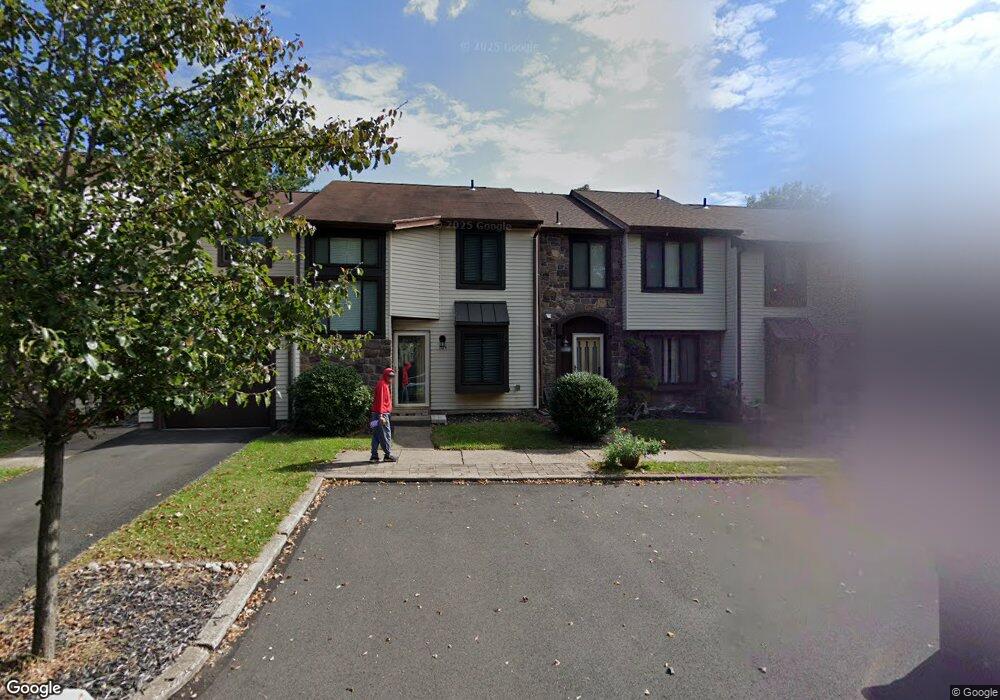
103 Windham Ct Newtown, PA 18940
Estimated Value: $372,000 - $462,000
3
Beds
2
Baths
1,371
Sq Ft
$307/Sq Ft
Est. Value
About This Home
This home is located at 103 Windham Ct, Newtown, PA 18940 and is currently estimated at $421,471, approximately $307 per square foot. 103 Windham Ct is a home located in Bucks County with nearby schools including Goodnoe Elementary School, Newtown Middle School, and Council Rock High School North.
Ownership History
Date
Name
Owned For
Owner Type
Purchase Details
Closed on
Aug 31, 2020
Sold by
Ritondo Robert
Bought by
Ritondo Christian P
Current Estimated Value
Purchase Details
Closed on
Jan 20, 2014
Sold by
Deo Darlene and Ritondo Robert
Bought by
Ritondo Robert
Purchase Details
Closed on
Oct 29, 2004
Sold by
Muzyk Marilyn and Muzyk Michael J
Bought by
Deo Darlene and Ritondo Robert
Purchase Details
Closed on
Oct 10, 1996
Sold by
Muzyk Marilyn and Monahan Marilyn
Bought by
Muzyk Michael J and Muzyk Marilyn
Home Financials for this Owner
Home Financials are based on the most recent Mortgage that was taken out on this home.
Original Mortgage
$94,900
Interest Rate
7.25%
Purchase Details
Closed on
Aug 23, 1996
Sold by
Mccarron Robert
Bought by
Monahan Marilyn and Muzyk Michael J
Home Financials for this Owner
Home Financials are based on the most recent Mortgage that was taken out on this home.
Original Mortgage
$94,900
Interest Rate
7.25%
Create a Home Valuation Report for This Property
The Home Valuation Report is an in-depth analysis detailing your home's value as well as a comparison with similar homes in the area
Home Values in the Area
Average Home Value in this Area
Purchase History
| Date | Buyer | Sale Price | Title Company |
|---|---|---|---|
| Ritondo Christian P | -- | None Available | |
| Ritondo Robert | -- | None Available | |
| Deo Darlene | $220,000 | -- | |
| Muzyk Michael J | -- | -- | |
| Monahan Marilyn | $99,900 | -- |
Source: Public Records
Mortgage History
| Date | Status | Borrower | Loan Amount |
|---|---|---|---|
| Previous Owner | Monahan Marilyn | $94,900 |
Source: Public Records
Tax History
| Year | Tax Paid | Tax Assessment Tax Assessment Total Assessment is a certain percentage of the fair market value that is determined by local assessors to be the total taxable value of land and additions on the property. | Land | Improvement |
|---|---|---|---|---|
| 2025 | $4,059 | $22,840 | $4,400 | $18,440 |
| 2024 | $4,059 | $22,840 | $4,400 | $18,440 |
| 2023 | $3,884 | $22,840 | $4,400 | $18,440 |
| 2022 | $3,809 | $22,840 | $4,400 | $18,440 |
| 2021 | $3,749 | $22,840 | $4,400 | $18,440 |
| 2020 | $3,569 | $22,840 | $4,400 | $18,440 |
| 2019 | $3,484 | $22,840 | $4,400 | $18,440 |
| 2018 | $3,418 | $22,840 | $4,400 | $18,440 |
| 2017 | $3,300 | $22,840 | $4,400 | $18,440 |
| 2016 | $3,277 | $22,840 | $4,400 | $18,440 |
| 2015 | -- | $22,840 | $4,400 | $18,440 |
| 2014 | -- | $22,840 | $4,400 | $18,440 |
Source: Public Records
Map
Nearby Homes
- 25 Independence Place
- 206 Paxon Aly Unit 51
- 4 Independence Place
- 17 Essex Place
- 25 Essex Place
- 35 David Dr
- 226 Andrew Dr
- 272 Stanford Place
- 32 Eaton Ct Unit B
- 1 Denton Cir
- 55 Violet Ln Unit 158E
- 21 S Lincoln Ave Unit 10
- 54 Kanon Ct
- 313 Washington Ave
- 0 Route 413 Bypass Unit PABU2115308
- 612 Double Woods Rd
- 348 Burgundy Ln
- 22 Penn St
- 113 Thorton Ln
- 113 Thornton
Your Personal Tour Guide
Ask me questions while you tour the home.