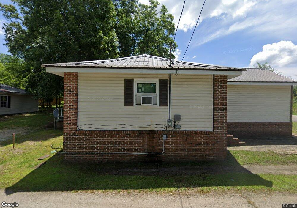
103 Witcher St Union Point, GA 30669
Estimated Value: $146,000 - $172,000
3
Beds
2
Baths
1,436
Sq Ft
$109/Sq Ft
Est. Value
About This Home
This home is located at 103 Witcher St, Union Point, GA 30669 and is currently estimated at $157,052, approximately $109 per square foot. 103 Witcher St is a home with nearby schools including Greene County High School.
Ownership History
Date
Name
Owned For
Owner Type
Purchase Details
Closed on
Nov 9, 2018
Sold by
Brown Sandra E
Bought by
Sandy Springs Greensboro Llc
Current Estimated Value
Purchase Details
Closed on
Dec 3, 2001
Sold by
Smith Michael A
Bought by
Brown Sandra E
Purchase Details
Closed on
Nov 21, 1997
Sold by
Carter Milton
Bought by
Smith Michael A
Purchase Details
Closed on
Jan 1, 1987
Sold by
Smith Leroy B
Bought by
Carter Milton
Purchase Details
Closed on
Jan 1, 1978
Sold by
Stewart John B
Bought by
Smith Leroy B
Purchase Details
Closed on
Jan 1, 1972
Sold by
Stewart Nancy H
Bought by
Stewart John B
Purchase Details
Closed on
Jan 1, 1961
Bought by
Harris R O Est
Create a Home Valuation Report for This Property
The Home Valuation Report is an in-depth analysis detailing your home's value as well as a comparison with similar homes in the area
Purchase History
| Date | Buyer | Sale Price | Title Company |
|---|---|---|---|
| Sandy Springs Greensboro Llc | -- | -- | |
| Brown Sandra E | $65,000 | -- | |
| Smith Michael A | $30,000 | -- | |
| Carter Milton | -- | -- | |
| Smith Leroy B | -- | -- | |
| Stewart John B | -- | -- | |
| Stewart Nancy H | -- | -- | |
| Harris R O Est | -- | -- |
Source: Public Records
Tax History
| Year | Tax Paid | Tax Assessment Tax Assessment Total Assessment is a certain percentage of the fair market value that is determined by local assessors to be the total taxable value of land and additions on the property. | Land | Improvement |
|---|---|---|---|---|
| 2025 | $1,533 | $48,120 | $760 | $47,360 |
| 2024 | $1,436 | $44,240 | $760 | $43,480 |
| 2023 | $878 | $42,560 | $760 | $41,800 |
| 2022 | $827 | $38,320 | $760 | $37,560 |
| 2021 | $786 | $34,000 | $760 | $33,240 |
| 2020 | $548 | $19,080 | $1,320 | $17,760 |
| 2019 | $566 | $19,080 | $1,320 | $17,760 |
| 2018 | $427 | $19,080 | $1,320 | $17,760 |
| 2017 | $510 | $19,138 | $1,350 | $17,788 |
| 2016 | $531 | $19,805 | $1,350 | $18,455 |
| 2015 | $498 | $19,804 | $1,350 | $18,455 |
| 2014 | $489 | $18,842 | $1,350 | $17,492 |
Source: Public Records
Map
Nearby Homes
- 509 Carlton Ave
- 202 Veazey St
- 405 Crawfordville Rd
- 1160 Moody St
- 324 N Rhodes St
- 0 Woodland Ct Unit 10543600
- 215 Hunter St
- 1241 Old Siloam Rd
- 1071 Alexander St
- 000 Washington Hwy
- 0 Washington Hwy Unit 10686255
- 1581 Highway 77 S Hwy
- 1581 Highway 77 S
- 5401 Union Point Hwy
- 1201 Buffalo Lick Rd
- 0 Buffalo Lick Rd Unit 10551234
- 0 Buffalo Lick Rd Unit 10551325
- 1251 Adams Rd
- 1251 Brick House Rd
- 1251 Brickhouse Rd
- 105 Witcher St
- 0 Carlton Ave Unit 10361072
- N Carlton Ave
- 403 Carlton Ave
- 107 Witcher St
- 401 Carlton Ave
- 0 Sibley Ave Unit .4 AC 9026524
- 507 Carlton Ave
- 109 Witcher St
- 101 Veazey St
- 111 Witcher St
- 110 Witcher St
- 108 Newsome St
- 305 Carlton Ave
- 103 Newsome St
- 103 Veazey St
- 110 Newsome St
- 107 Newsome St
- 404 Hart Ave
- 301 Carlton Ave
Your Personal Tour Guide
Ask me questions while you tour the home.