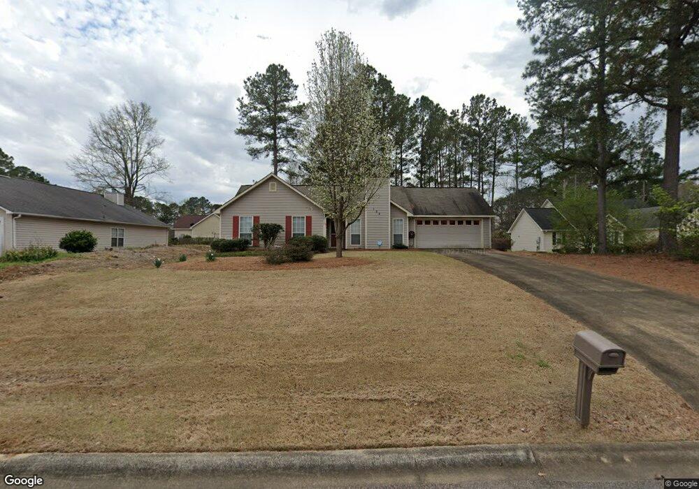
103 Woodridge Ct Lagrange, GA 30241
Estimated Value: $205,000 - $223,000
3
Beds
2
Baths
1,283
Sq Ft
$167/Sq Ft
Est. Value
About This Home
This home is located at 103 Woodridge Ct, Lagrange, GA 30241 and is currently estimated at $213,668, approximately $166 per square foot. 103 Woodridge Ct is a home located in Troup County with nearby schools including Callaway Elementary School, Hogansville Elementary School, and Callaway Middle School.
Ownership History
Date
Name
Owned For
Owner Type
Purchase Details
Closed on
Sep 18, 2001
Sold by
Billie Jean Rosen
Bought by
Bassett Linda C
Current Estimated Value
Purchase Details
Closed on
Aug 28, 2000
Sold by
Comm Bank & Trust/Troup Co
Bought by
Billie Jean Rosen
Purchase Details
Closed on
Nov 5, 1999
Sold by
Yates Unlimited Inc
Bought by
Comm Bank & Trust/Troup Co
Purchase Details
Closed on
Sep 9, 1999
Sold by
To Cb and To Spinks Brown
Bought by
Yates Unlimited Inc
Purchase Details
Closed on
Aug 17, 1999
Sold by
To Cb and To Spinks Brown Durand T
Bought by
To Cb and To Spinks Brown
Purchase Details
Closed on
Jun 7, 1999
Sold by
Spink Brown
Bought by
To Cb and To Spinks Brown Durand T
Purchase Details
Closed on
Aug 12, 1994
Bought by
Spink Brown
Create a Home Valuation Report for This Property
The Home Valuation Report is an in-depth analysis detailing your home's value as well as a comparison with similar homes in the area
Purchase History
| Date | Buyer | Sale Price | Title Company |
|---|---|---|---|
| Bassett Linda C | $102,000 | -- | |
| Billie Jean Rosen | -- | -- | |
| Comm Bank & Trust/Troup Co | $89,900 | -- | |
| Yates Unlimited Inc | -- | -- | |
| To Cb | -- | -- | |
| To Cb | $11,800 | -- | |
| Spink Brown | -- | -- |
Source: Public Records
Tax History
| Year | Tax Paid | Tax Assessment Tax Assessment Total Assessment is a certain percentage of the fair market value that is determined by local assessors to be the total taxable value of land and additions on the property. | Land | Improvement |
|---|---|---|---|---|
| 2025 | $1,157 | $78,160 | $14,000 | $64,160 |
| 2024 | $1,157 | $69,320 | $14,000 | $55,320 |
| 2023 | $669 | $69,320 | $14,000 | $55,320 |
| 2022 | $870 | $57,560 | $10,000 | $47,560 |
| 2021 | $756 | $51,560 | $8,000 | $43,560 |
| 2020 | $1,321 | $51,560 | $8,000 | $43,560 |
| 2019 | $1,162 | $46,280 | $8,000 | $38,280 |
| 2018 | $1,202 | $41,840 | $6,000 | $35,840 |
| 2017 | $1,202 | $41,840 | $6,000 | $35,840 |
| 2016 | $1,182 | $41,162 | $6,000 | $35,162 |
| 2015 | $1,184 | $41,162 | $6,000 | $35,162 |
| 2014 | $1,130 | $39,311 | $6,000 | $33,311 |
| 2013 | -- | $39,958 | $6,000 | $33,958 |
Source: Public Records
Map
Nearby Homes
- 124 Woodridge Cir
- 105 Ridgefield Dr
- 119 Sir Lancelot St
- 300 Old Pond Rd
- 304 Bridgette Blvd
- 101 Sarah Ln
- 227 River Meadow Dr Unit H14
- 227 River Meadow Dr
- 412 Sweetwood Ct Unit A36
- 509 Youngs Mill Rd
- 793 Celebration Blvd
- 112 Celebration Blvd
- 107 N Barnard Ave
- 0 N Barnard Ave
- 5 Gulfstream Dr
- 402 Sweetwood Ct Unit LOT 2
- 129 Celebration Blvd
- 110 Lenox Cir
- 3 Gulfstream Dr
- 200 Freshwater Ct Unit 37
- 101 Woodridge Ct
- 601 Brookstone Dr
- 105 Woodridge Ct
- 503 Brookstone Dr
- 102 Woodridge Ct
- 603 Brookstone Dr
- 107 Woodridge Ct
- 102 Woodridge Cir
- 100 Woodridge Cir
- 506 Brookstone Dr
- 504 Brookstone Dr
- 600 Brookstone Dr
- 104 Woodridge Ct
- 104 Woodridge Cir
- 109 Woodridge Ct
- 502 Brookstone Dr
- 602 Brookstone Dr Unit 18
- 602 Brookstone Dr
- 106 Woodridge Ct
- 106 Woodridge Cir
Your Personal Tour Guide
Ask me questions while you tour the home.