Estimated Value: $339,000 - $434,000
3
Beds
2
Baths
1,557
Sq Ft
$234/Sq Ft
Est. Value
About This Home
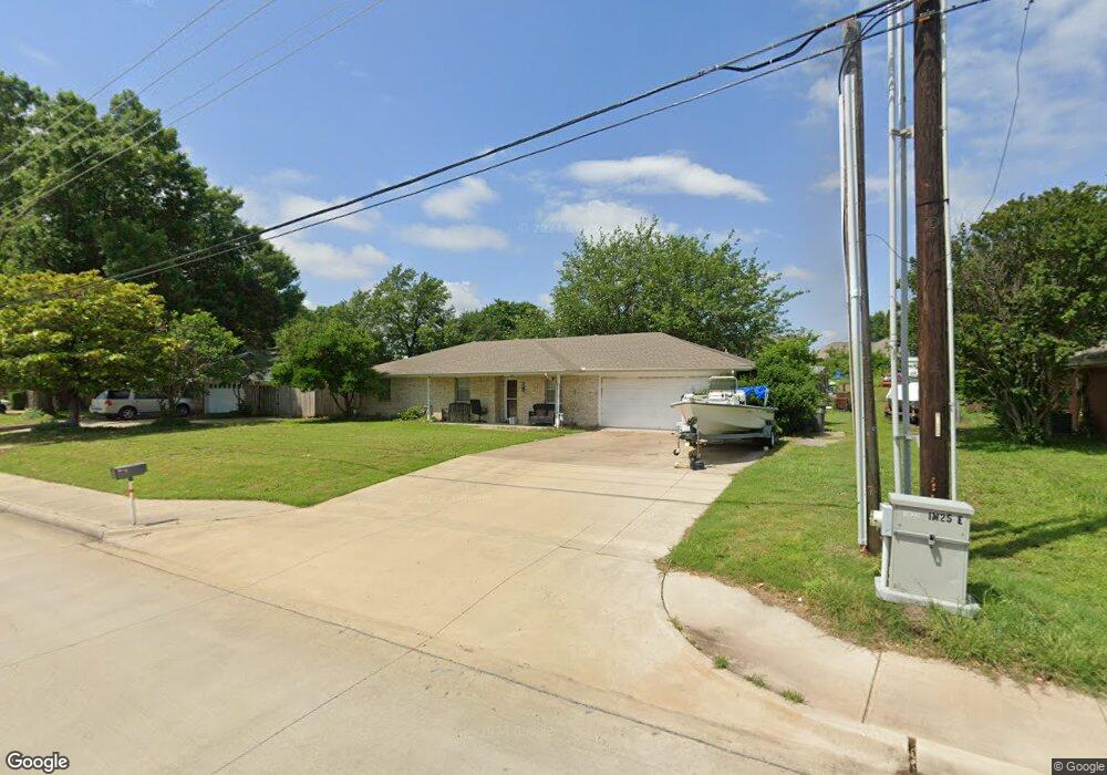
This home is located at 1030 E Fm 544, Wylie, TX 75098 and is currently estimated at $364,751, approximately $234 per square foot. 1030 E Fm 544 is a home located in Collin County with nearby schools including R F Hartman Elementary School, AB Harrison Intermediate School, and Grady Burnett J High School.
Ownership History
Date
Name
Owned For
Owner Type
Purchase Details
Closed on
Sep 17, 2012
Sold by
Morris Ii Douglas K and Morris Nikkii
Bought by
Ritter Brent E
Current Estimated Value
Home Financials for this Owner
Home Financials are based on the most recent Mortgage that was taken out on this home.
Original Mortgage
$144,897
Outstanding Balance
$98,737
Interest Rate
3.25%
Mortgage Type
FHA
Estimated Equity
$266,014
Purchase Details
Closed on
Nov 22, 2005
Sold by
Gould Ronald A and Gould Corrie Ty
Bought by
Morris Ii Douglas K
Home Financials for this Owner
Home Financials are based on the most recent Mortgage that was taken out on this home.
Original Mortgage
$112,800
Interest Rate
6.06%
Mortgage Type
Fannie Mae Freddie Mac
Create a Home Valuation Report for This Property
The Home Valuation Report is an in-depth analysis detailing your home's value as well as a comparison with similar homes in the area
Home Values in the Area
Average Home Value in this Area
Purchase History
| Date | Buyer | Sale Price | Title Company |
|---|---|---|---|
| Ritter Brent E | -- | Rtt | |
| Morris Ii Douglas K | -- | -- |
Source: Public Records
Mortgage History
| Date | Status | Borrower | Loan Amount |
|---|---|---|---|
| Open | Ritter Brent E | $144,897 | |
| Previous Owner | Morris Ii Douglas K | $112,800 |
Source: Public Records
Tax History Compared to Growth
Tax History
| Year | Tax Paid | Tax Assessment Tax Assessment Total Assessment is a certain percentage of the fair market value that is determined by local assessors to be the total taxable value of land and additions on the property. | Land | Improvement |
|---|---|---|---|---|
| 2025 | $3,270 | $227,355 | $90,250 | $137,105 |
| 2024 | $3,270 | $316,185 | $85,500 | $230,685 |
| 2023 | $3,270 | $291,181 | $85,500 | $208,846 |
| 2022 | $6,150 | $376,965 | $85,500 | $291,465 |
| 2021 | $4,113 | $240,645 | $47,500 | $193,145 |
| 2020 | $3,960 | $220,649 | $19,950 | $200,699 |
| 2019 | $3,918 | $205,974 | $19,950 | $186,024 |
| 2018 | $4,041 | $211,324 | $19,950 | $191,374 |
| 2017 | $3,154 | $164,964 | $19,950 | $145,014 |
| 2016 | $2,862 | $148,324 | $19,950 | $128,374 |
| 2015 | $2,639 | $143,026 | $19,950 | $123,076 |
Source: Public Records
Map
Nearby Homes
- 1210 Iron Horse St
- 1201 E Stone Rd
- 1318 Chestnut Hill Dr
- 1321 Iron Horse St
- 1320 Cedar Branch Dr
- 306 Foxwood Ct
- 1316 Taren Trail
- 1318 Taren Trail
- 825 Forest Edge Ln
- 1323 Canyon Creek Rd
- 312 Maltese Cir
- 407 Sparrow Dr
- 1330 Canyon Creek Rd
- 811 Forest Edge Ln
- 800 Twin Oaks Dr
- 1503 E Collins Blvd
- 820 Foxwood Ln
- 1209 Surrey Cir
- 825 Foxwood Ln
- 409 Cedar Ridge Dr
- 1040 E Fm 544
- 1020 E Fm 544
- 1050 E Fm 544
- 1040 Oakbrook Dr
- 1014 E Fm 544
- 1051 Oakbrook Dr
- 1201 Cedar Branch Dr
- 1070 E Fm 544
- 1203 Cedar Branch Dr
- 1010 E Fm 544
- 1205 Cedar Branch Dr
- 1041 Oakbrook Dr
- 1045 E Fm 544
- 1030 Oakbrook Dr
- 1207 Cedar Branch Dr
- 1090 E Fm 544
- 1020 Oakbrook Dr
- 1200 Cedar Branch Dr
- 1209 Cedar Branch Dr
- 1202 Cedar Branch Dr