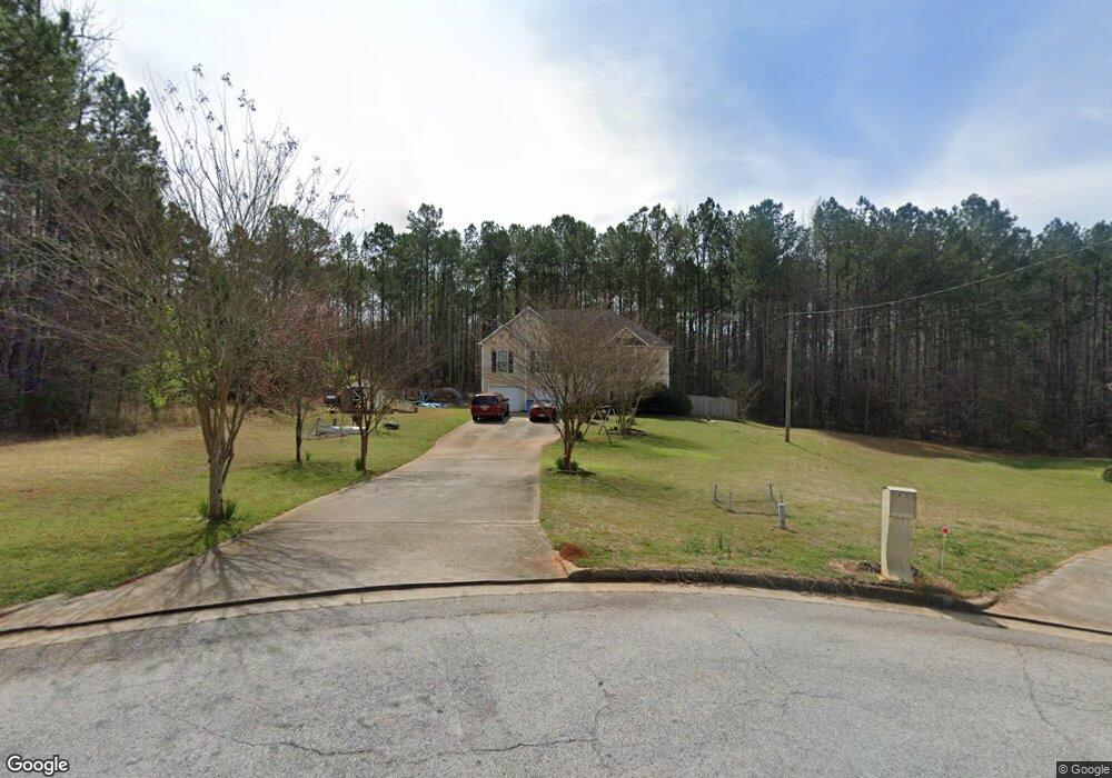
1030 Hamilton Dr Unit 36 Locust Grove, GA 30248
Estimated Value: $331,000 - $368,566
3
Beds
3
Baths
2,789
Sq Ft
$126/Sq Ft
Est. Value
About This Home
This home is located at 1030 Hamilton Dr Unit 36, Locust Grove, GA 30248 and is currently estimated at $350,392, approximately $125 per square foot. 1030 Hamilton Dr Unit 36 is a home located in Henry County with nearby schools including Luella Elementary School, Luella Middle School, and Luella High School.
Ownership History
Date
Name
Owned For
Owner Type
Purchase Details
Closed on
Aug 15, 2018
Sold by
Robinson Dustin
Bought by
Robinson Dustin and Robinson Amanda Denise
Current Estimated Value
Home Financials for this Owner
Home Financials are based on the most recent Mortgage that was taken out on this home.
Original Mortgage
$159,200
Outstanding Balance
$138,259
Interest Rate
4.5%
Mortgage Type
New Conventional
Estimated Equity
$212,133
Purchase Details
Closed on
Nov 9, 2012
Sold by
Federal Home Loan Mortgage Corporation
Bought by
Brown Julia M
Home Financials for this Owner
Home Financials are based on the most recent Mortgage that was taken out on this home.
Original Mortgage
$87,000
Interest Rate
3.43%
Mortgage Type
VA
Purchase Details
Closed on
Dec 6, 2011
Sold by
Bank Of America Na
Bought by
Federal Home Loan Mortgage Corporation
Create a Home Valuation Report for This Property
The Home Valuation Report is an in-depth analysis detailing your home's value as well as a comparison with similar homes in the area
Home Values in the Area
Average Home Value in this Area
Purchase History
| Date | Buyer | Sale Price | Title Company |
|---|---|---|---|
| Robinson Dustin | -- | -- | |
| Robinson Dusten | $199,000 | -- | |
| Brown Julia M | $87,000 | -- | |
| Federal Home Loan Mortgage Corporation | $169,446 | -- | |
| Bank Of America Na | $169,446 | -- |
Source: Public Records
Mortgage History
| Date | Status | Borrower | Loan Amount |
|---|---|---|---|
| Open | Robinson Dusten | $159,200 | |
| Closed | Robinson Dustin | $159,200 | |
| Previous Owner | Brown Julia M | $87,000 |
Source: Public Records
Tax History Compared to Growth
Tax History
| Year | Tax Paid | Tax Assessment Tax Assessment Total Assessment is a certain percentage of the fair market value that is determined by local assessors to be the total taxable value of land and additions on the property. | Land | Improvement |
|---|---|---|---|---|
| 2025 | $3,878 | $135,068 | $12,000 | $123,068 |
| 2024 | $3,878 | $130,000 | $12,000 | $118,000 |
| 2023 | $3,257 | $126,240 | $10,000 | $116,240 |
| 2022 | $3,361 | $109,280 | $10,000 | $99,280 |
| 2021 | $2,786 | $84,920 | $10,000 | $74,920 |
| 2020 | $2,661 | $79,640 | $8,000 | $71,640 |
| 2019 | $2,500 | $72,840 | $8,000 | $64,840 |
| 2018 | $2,614 | $66,200 | $8,000 | $58,200 |
| 2016 | $2,367 | $59,760 | $8,000 | $51,760 |
| 2015 | $2,377 | $58,200 | $8,000 | $50,200 |
| 2014 | $1,948 | $46,800 | $8,000 | $38,800 |
Source: Public Records
Map
Nearby Homes
- 231 Ashley Trace Dr
- 221 Ashley Trace Dr
- 179 Ashley Trace Dr
- 733 Derek Place Unit 2
- 170 Ashley Trace Dr
- 163 Ashley Trace Dr Unit 1
- 718 Derek Place
- 1871 Weems Rd
- 201 Vandalay Way
- 121 Bradesbury Ln
- 1007 S Hampton Rd
- 1090 S Hampton Rd
- 284 Valley Way
- 871 Rocky Creek Rd
- 876 Simpson Mill Rd
- 1999 Hampton Locust Grove Rd
- 161 Donovan Ave
- 11530 Kimberly Ct Unit 34
- 191 Kyndal Dr
- 1231 Hillview Rd
- 1030 Hamilton Dr
- 1032 Hamilton Dr
- 1026 Hamilton Dr
- 1033 Hamilton Dr
- 1031 Hamilton Dr
- 1027 Hamilton Dr
- 1020 Hamilton Dr
- 1025 Hamilton Dr
- 1021 Hamilton Dr Unit 8
- 1017 Hamilton Dr
- 1016 Hamilton Dr
- 1015 Hamilton Dr
- 1216 Butler Ct
- 1212 Butler Ct
- 1224 Butler Ct
- 1208 Butler Ct
- 1220 Butler Ct
- 1228 Butler Ct
- 1215 Butler Ct Unit 23
- 1215 Butler Ct Unit 7