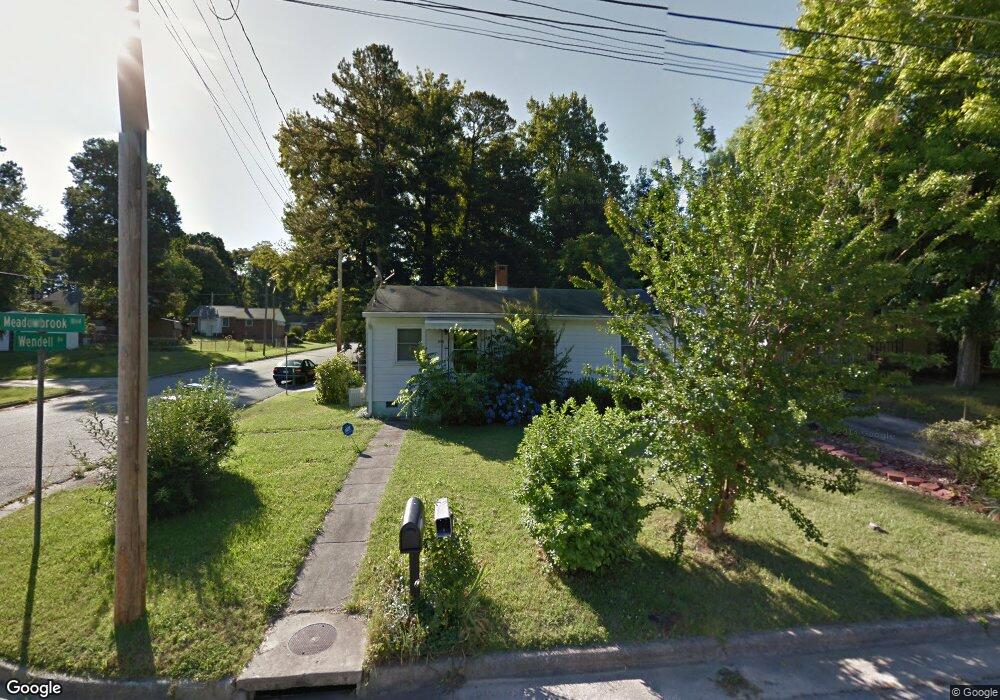
1030 Meadowbrook Blvd High Point, NC 27260
Greater High Point NeighborhoodEstimated Value: $116,000 - $142,000
2
Beds
1
Bath
900
Sq Ft
$140/Sq Ft
Est. Value
About This Home
This home is located at 1030 Meadowbrook Blvd, High Point, NC 27260 and is currently estimated at $126,192, approximately $140 per square foot. 1030 Meadowbrook Blvd is a home located in Guilford County with nearby schools including Parkview Village Elementary School, Southwest Guilford Middle School, and Southwest Guilford High School.
Ownership History
Date
Name
Owned For
Owner Type
Purchase Details
Closed on
May 12, 2006
Sold by
Hampton Evelyn
Bought by
Dockery Kelsie M
Current Estimated Value
Home Financials for this Owner
Home Financials are based on the most recent Mortgage that was taken out on this home.
Original Mortgage
$60,000
Outstanding Balance
$34,610
Interest Rate
6.33%
Mortgage Type
Purchase Money Mortgage
Estimated Equity
$91,582
Create a Home Valuation Report for This Property
The Home Valuation Report is an in-depth analysis detailing your home's value as well as a comparison with similar homes in the area
Home Values in the Area
Average Home Value in this Area
Purchase History
| Date | Buyer | Sale Price | Title Company |
|---|---|---|---|
| Dockery Kelsie M | $60,000 | None Available |
Source: Public Records
Mortgage History
| Date | Status | Borrower | Loan Amount |
|---|---|---|---|
| Open | Dockery Kelsie M | $60,000 |
Source: Public Records
Tax History Compared to Growth
Tax History
| Year | Tax Paid | Tax Assessment Tax Assessment Total Assessment is a certain percentage of the fair market value that is determined by local assessors to be the total taxable value of land and additions on the property. | Land | Improvement |
|---|---|---|---|---|
| 2025 | $690 | $50,100 | $15,000 | $35,100 |
| 2024 | $690 | $50,100 | $15,000 | $35,100 |
| 2023 | $690 | $50,100 | $15,000 | $35,100 |
| 2022 | $675 | $50,100 | $15,000 | $35,100 |
| 2021 | $456 | $33,100 | $8,000 | $25,100 |
| 2020 | $456 | $33,100 | $8,000 | $25,100 |
| 2019 | $456 | $33,100 | $0 | $0 |
| 2018 | $454 | $33,100 | $0 | $0 |
| 2017 | $456 | $33,100 | $0 | $0 |
| 2016 | $546 | $38,900 | $0 | $0 |
| 2015 | $548 | $38,900 | $0 | $0 |
| 2014 | $558 | $38,900 | $0 | $0 |
Source: Public Records
Map
Nearby Homes
- 901 Circle Dr
- 1508 Boundary Ave
- 1602 Boundary Ave
- 1604 Boundary Ave
- 1528 Graves Ave
- 1515 Graves Ave
- 1606 Boundary Ave
- 1711 Edmondson Place
- 1202 Dartmouth Ave
- 2406 Waverly Ct
- 1418 Wendell Ave
- 1702 E Martin Luther King Junior Dr
- 1007 Gordon St
- 1408 Wiltshire St
- 2410 Dallas Ave
- 2430 E Lexington Ave
- 1725 Lamb Ave
- 828 Willow Place
- 208 Hay St
- 408 Meredith St
- 1026 Meadowbrook Blvd
- 1100 Meadowbrook Blvd
- 531 Radford St
- 1024 Meadowbrook Blvd
- 529 Radford St
- 1102 Meadowbrook Blvd
- 601 Radford St
- 527 Radford St
- 1022 Meadowbrook Blvd
- 603 Radford St
- 1104 Meadowbrook Blvd
- 1025 Meadowbrook Blvd
- 525 Radford St
- 1027 Meadowbrook Blvd
- 1021 Meadowbrook Blvd
- 1020 Meadowbrook Blvd
- 1101 Meadowbrook Blvd
- 605 Radford St
- 1106 Meadowbrook Blvd
- 523 Radford St