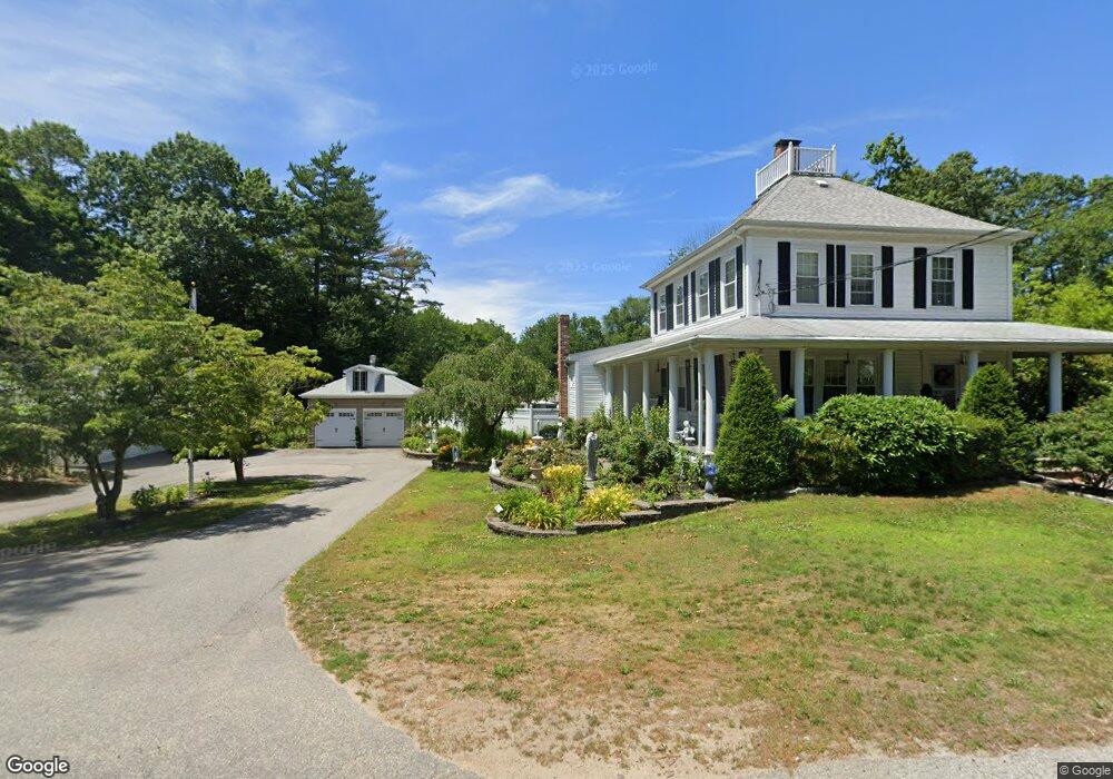
1030 Monponsett St Hanson, MA 02341
Estimated Value: $578,000 - $638,000
4
Beds
2
Baths
1,862
Sq Ft
$320/Sq Ft
Est. Value
About This Home
This home is located at 1030 Monponsett St, Hanson, MA 02341 and is currently estimated at $595,333, approximately $319 per square foot. 1030 Monponsett St is a home located in Plymouth County.
Ownership History
Date
Name
Owned For
Owner Type
Purchase Details
Closed on
Apr 3, 2025
Sold by
Puliafico Kenneth and Puliafico Geraldine M
Bought by
Pyliafico Irt and Puliafico
Current Estimated Value
Create a Home Valuation Report for This Property
The Home Valuation Report is an in-depth analysis detailing your home's value as well as a comparison with similar homes in the area
Home Values in the Area
Average Home Value in this Area
Purchase History
| Date | Buyer | Sale Price | Title Company |
|---|---|---|---|
| Pyliafico Irt | -- | None Available |
Source: Public Records
Tax History
| Year | Tax Paid | Tax Assessment Tax Assessment Total Assessment is a certain percentage of the fair market value that is determined by local assessors to be the total taxable value of land and additions on the property. | Land | Improvement |
|---|---|---|---|---|
| 2025 | $6,841 | $511,300 | $166,800 | $344,500 |
| 2024 | $6,646 | $496,700 | $162,000 | $334,700 |
| 2023 | $5,190 | $366,000 | $162,000 | $204,000 |
| 2022 | $5,081 | $336,700 | $147,200 | $189,500 |
| 2021 | $4,689 | $310,500 | $141,600 | $168,900 |
| 2020 | $4,485 | $293,700 | $136,800 | $156,900 |
| 2019 | $4,157 | $267,700 | $119,400 | $148,300 |
| 2018 | $4,132 | $261,000 | $114,800 | $146,200 |
| 2017 | $4,032 | $252,300 | $109,300 | $143,000 |
| 2016 | $4,060 | $245,300 | $109,300 | $136,000 |
| 2015 | $3,877 | $243,500 | $109,300 | $134,200 |
Source: Public Records
Map
Nearby Homes
- 0 Union Park St
- 115 Waltham St
- 102 Leon Ct
- 315 Twin Lakes Dr Unit 315
- 0 Thompson St
- 1 Poplar Rd
- 37 Annawon Dr
- 25 Lawrence Rd
- 102 Twin Lakes Dr
- 318 South St
- 143 Plymouth St
- 8 10th Ave
- 343 Monponsett St
- 151 Plymouth St Unit 151A
- 131 Elmer St
- 265 Monponsett St Unit 2210
- 265 Monponsett St Unit 2203
- 266 Monponsett St Unit 1103
- 266 Monponsett St Unit 1105
- 266 Monponsett St Unit 1201
- 1020 Monponsett St
- 1027 Monponsett St
- 1041 Monponsett St
- 1017 Monponsett St
- 1054 Monponsett St
- 1045 Monponsett St
- 48 Short St
- 1011 Monponsett St
- 1004 Monponsett St
- 1004 Monponsett St
- 1067 Monponsett St
- 26 Short St
- 6 Upton
- 20 Short St
- 1003 Monponsett St
- 3 Bow St
- 1066 Monponsett St
- 671 Monponsett St
- 58 Pine St N
- 20 Gold St
Your Personal Tour Guide
Ask me questions while you tour the home.