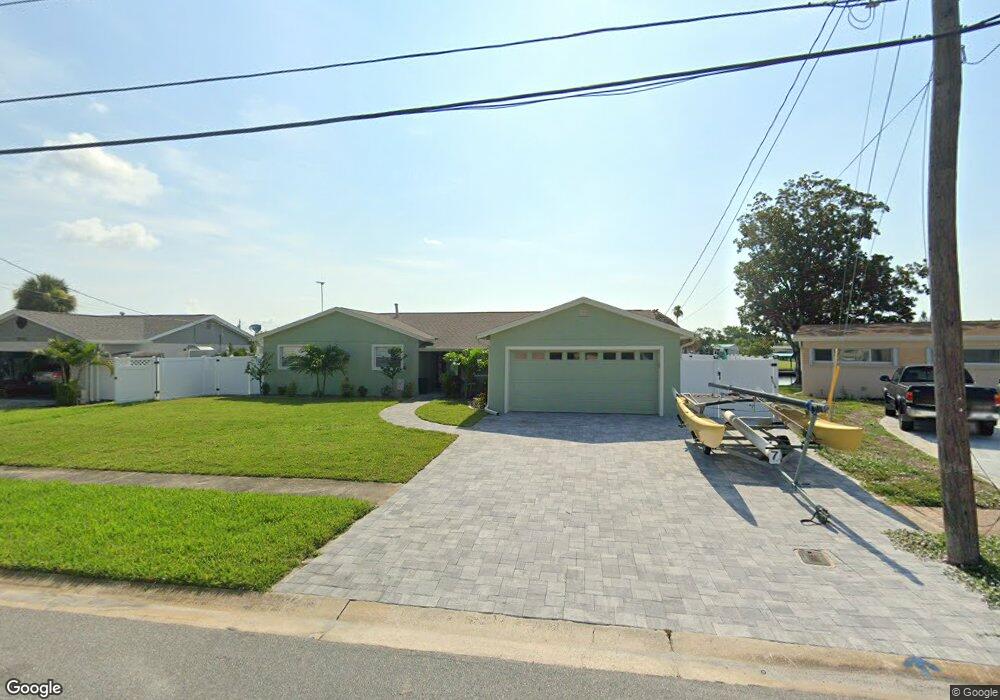
1030 Montego Bay Dr N Merritt Island, FL 32953
Estimated Value: $580,000 - $656,322
3
Beds
2
Baths
1,729
Sq Ft
$360/Sq Ft
Est. Value
About This Home
This home is located at 1030 Montego Bay Dr N, Merritt Island, FL 32953 and is currently estimated at $622,831, approximately $360 per square foot. 1030 Montego Bay Dr N is a home located in Brevard County with nearby schools including Audubon Elementary School, Thomas Jefferson Middle School, and Merritt Island High School.
Ownership History
Date
Name
Owned For
Owner Type
Purchase Details
Closed on
Apr 12, 2018
Sold by
Romine Roger C and Romine Sandy S
Bought by
Martin Frederick W
Current Estimated Value
Home Financials for this Owner
Home Financials are based on the most recent Mortgage that was taken out on this home.
Original Mortgage
$275,000
Outstanding Balance
$236,440
Interest Rate
4.43%
Estimated Equity
$386,391
Create a Home Valuation Report for This Property
The Home Valuation Report is an in-depth analysis detailing your home's value as well as a comparison with similar homes in the area
Home Values in the Area
Average Home Value in this Area
Purchase History
| Date | Buyer | Sale Price | Title Company |
|---|---|---|---|
| Martin Frederick W | $345,000 | Federal Title Ins Agency Inc |
Source: Public Records
Mortgage History
| Date | Status | Borrower | Loan Amount |
|---|---|---|---|
| Open | Martin Frederick W | $275,000 |
Source: Public Records
Tax History Compared to Growth
Tax History
| Year | Tax Paid | Tax Assessment Tax Assessment Total Assessment is a certain percentage of the fair market value that is determined by local assessors to be the total taxable value of land and additions on the property. | Land | Improvement |
|---|---|---|---|---|
| 2025 | $4,833 | $402,260 | -- | -- |
| 2024 | $4,799 | $390,930 | -- | -- |
| 2023 | $4,799 | $379,550 | $0 | $0 |
| 2022 | $3,612 | $294,260 | $0 | $0 |
| 2021 | $3,787 | $285,690 | $0 | $0 |
| 2020 | $3,758 | $281,750 | $170,000 | $111,750 |
| 2019 | $4,472 | $291,110 | $175,000 | $116,110 |
| 2018 | $1,953 | $144,900 | $0 | $0 |
| 2017 | $1,962 | $141,920 | $0 | $0 |
| 2016 | $1,985 | $139,010 | $128,000 | $11,010 |
| 2015 | $2,031 | $138,050 | $117,000 | $21,050 |
| 2014 | $2,041 | $136,960 | $117,000 | $19,960 |
Source: Public Records
Map
Nearby Homes
- 1035 Molaki Dr
- 270 Oahu Dr
- 1125 Outrigger Dr
- 325 Wainai Dr
- 900 Waikiki Dr
- 410 Caracas Dr
- 900 Richland Ave
- 330 Jacala Dr
- 1350 Taurus Ct
- 410 Carrioca Ct
- 1355 Scorpious Ct
- 1370 Scorpious Ct
- 755 Larkview St
- 1380 Mercury St
- 225 Richland Ave
- 135 Richland Ave
- 140 Queensland Ave
- 240 Riverside Ave
- 324 3rd St
- 1445 Taurus Ct
- 1040 Montego Bay Dr N
- 1020 Montego Bay Dr N
- 200 Trinidad Dr
- 1050 Montego Bay Dr N
- 215 Trinidad Dr
- 195 Becora Ave
- 205 Trinidad Dr
- 1060 Montego Bay Dr N
- 190 Trinidad Dr
- 1045 Molaki Dr
- 185 Becora Ave
- 195 Trinidad Dr
- 1055 Molaki Dr
- 1065 Montego Bay Dr N
- 180 Trinidad Dr
- 1070 Montego Bay Dr N
- 1065 Molaki Dr
- 175 Becora Ave
- 185 Trinidad Dr
- 190 Becora Ave