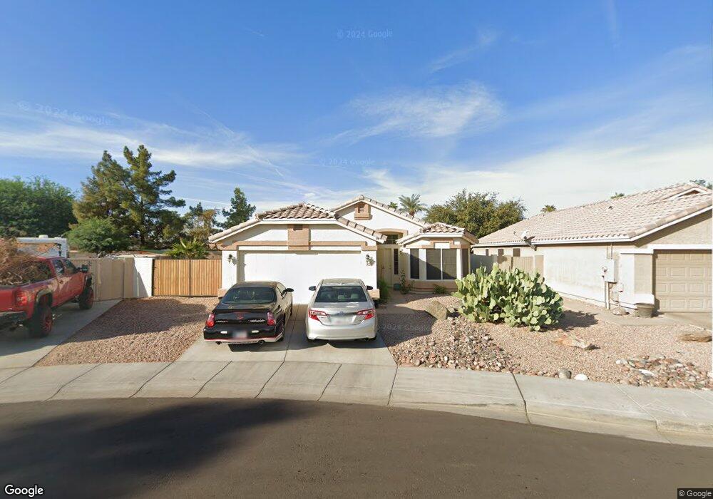
1030 N Robins Way Chandler, AZ 85225
The Islands NeighborhoodEstimated Value: $404,678 - $492,000
3
Beds
2
Baths
1,435
Sq Ft
$321/Sq Ft
Est. Value
About This Home
This home is located at 1030 N Robins Way, Chandler, AZ 85225 and is currently estimated at $460,420, approximately $320 per square foot. 1030 N Robins Way is a home located in Maricopa County with nearby schools including Rudy G Bologna Elementary School, Chandler High School, and Andersen Junior High School.
Ownership History
Date
Name
Owned For
Owner Type
Purchase Details
Closed on
Feb 9, 2009
Sold by
Perea Holdings Llc
Bought by
Boito Brian D
Current Estimated Value
Home Financials for this Owner
Home Financials are based on the most recent Mortgage that was taken out on this home.
Original Mortgage
$172,313
Outstanding Balance
$108,573
Interest Rate
5.04%
Mortgage Type
FHA
Estimated Equity
$351,847
Purchase Details
Closed on
Nov 6, 2008
Sold by
Miaa 44 Enterprises Llc
Bought by
Perea Holdings Llc
Purchase Details
Closed on
Oct 27, 2008
Sold by
Phares Richard M and Phares Tanna L
Bought by
Miaa 44 Enterprises
Purchase Details
Closed on
Nov 19, 2004
Sold by
Phares Tanna L and Phares Richard M
Bought by
Phares Richard M and Phares Tanna L
Home Financials for this Owner
Home Financials are based on the most recent Mortgage that was taken out on this home.
Original Mortgage
$168,000
Interest Rate
6.09%
Mortgage Type
New Conventional
Purchase Details
Closed on
Jul 9, 2002
Sold by
Lang Ronald E and Lang Kelli M
Bought by
Phares Richard M and Phares Tanna L
Home Financials for this Owner
Home Financials are based on the most recent Mortgage that was taken out on this home.
Original Mortgage
$152,700
Interest Rate
7.99%
Mortgage Type
New Conventional
Purchase Details
Closed on
Dec 21, 1994
Sold by
Woodside Homes Sales Corp
Bought by
Lang Ronald E and Lang Kelli M
Home Financials for this Owner
Home Financials are based on the most recent Mortgage that was taken out on this home.
Original Mortgage
$86,500
Interest Rate
9.25%
Mortgage Type
FHA
Create a Home Valuation Report for This Property
The Home Valuation Report is an in-depth analysis detailing your home's value as well as a comparison with similar homes in the area
Home Values in the Area
Average Home Value in this Area
Purchase History
| Date | Buyer | Sale Price | Title Company |
|---|---|---|---|
| Boito Brian D | $175,500 | Stewart Title & Trust Of Pho | |
| Perea Holdings Llc | -- | Stewart Title & Trust Of Pho | |
| Miaa 44 Enterprises | $146,000 | Stewart Title & Trust Of Pho | |
| Phares Richard M | -- | Fidelity National Title | |
| Phares Richard M | $152,700 | Security Title Agency | |
| Lang Ronald E | $115,389 | Security Title Agency | |
| Woodside Homes Sales Corp | $94,751 | Security Title Agency |
Source: Public Records
Mortgage History
| Date | Status | Borrower | Loan Amount |
|---|---|---|---|
| Open | Boito Brian D | $172,313 | |
| Previous Owner | Phares Richard M | $168,000 | |
| Previous Owner | Phares Richard M | $152,700 | |
| Previous Owner | Lang Ronald E | $86,500 |
Source: Public Records
Tax History Compared to Growth
Tax History
| Year | Tax Paid | Tax Assessment Tax Assessment Total Assessment is a certain percentage of the fair market value that is determined by local assessors to be the total taxable value of land and additions on the property. | Land | Improvement |
|---|---|---|---|---|
| 2025 | $1,533 | $19,679 | -- | -- |
| 2024 | $1,481 | $18,742 | -- | -- |
| 2023 | $1,481 | $35,320 | $7,060 | $28,260 |
| 2022 | $1,429 | $26,350 | $5,270 | $21,080 |
| 2021 | $1,497 | $24,220 | $4,840 | $19,380 |
| 2020 | $1,491 | $22,500 | $4,500 | $18,000 |
| 2019 | $1,434 | $20,650 | $4,130 | $16,520 |
| 2018 | $1,388 | $19,270 | $3,850 | $15,420 |
| 2017 | $1,294 | $18,010 | $3,600 | $14,410 |
| 2016 | $1,247 | $17,650 | $3,530 | $14,120 |
| 2015 | $1,208 | $16,360 | $3,270 | $13,090 |
Source: Public Records
Map
Nearby Homes
- 896 N Layman St
- 872 E Baylor Ln
- 625 E Gail Dr
- 860 N Mcqueen Rd Unit 1163
- 1014 E Golden Ct
- 865 E Del Rio St
- 501 E Ray Rd Unit 201
- 501 E Ray Rd Unit 230
- 955 E Knox Rd Unit 110
- 955 E Knox Rd Unit 137
- 853 E Manor Dr
- 932 E Manor Dr
- 1302 N Bedford Dr
- 625 N Hamilton St Unit 8
- 625 N Hamilton St Unit 41
- 625 N Hamilton St Unit 27
- 200 E Ivanhoe St Unit 60
- 721 N Delaware St
- 402 E Laredo St
- 966 E Rockwell Dr Unit 3
- 1040 N Robins Way
- 1020 N Robins Way
- 1050 N Robins Way
- 811 E Gary Dr
- 820 E Gary Dr
- 821 E Gary Dr
- 830 E Gary Dr
- 813 E Constitution Dr
- 831 E Gary Dr
- 1070 N Robins Way
- 823 E Constitution Dr
- 840 E Gary Dr
- 840 E Gary Dr Unit `
- 1011 N Layman Ct
- 841 E Gary Dr
- 1080 N Robins Way
- 1021 N Layman Ct
- 833 E Constitution Dr
- 850 E Gary Dr
- 851 E Gary Dr