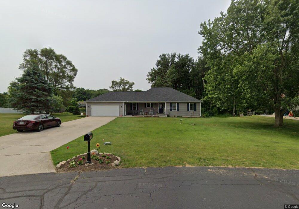
1030 N Stoneridge Dr Unit 12 Plainwell, MI 49080
Estimated Value: $325,000 - $413,000
3
Beds
2
Baths
1,500
Sq Ft
$240/Sq Ft
Est. Value
About This Home
This home is located at 1030 N Stoneridge Dr Unit 12, Plainwell, MI 49080 and is currently estimated at $360,007, approximately $240 per square foot. 1030 N Stoneridge Dr Unit 12 is a home located in Allegan County with nearby schools including Plainwell High School and Otsego Christian Academy.
Ownership History
Date
Name
Owned For
Owner Type
Purchase Details
Closed on
Oct 17, 2003
Sold by
Beard Wendell and Beard Sandra
Bought by
Oconnell Michael D and Oconnell Michelle K
Current Estimated Value
Home Financials for this Owner
Home Financials are based on the most recent Mortgage that was taken out on this home.
Original Mortgage
$167,475
Outstanding Balance
$77,134
Interest Rate
6.02%
Mortgage Type
Unknown
Estimated Equity
$282,873
Purchase Details
Closed on
Mar 12, 2003
Sold by
Pine Meadows Development Llc
Bought by
Beard Wendell
Create a Home Valuation Report for This Property
The Home Valuation Report is an in-depth analysis detailing your home's value as well as a comparison with similar homes in the area
Home Values in the Area
Average Home Value in this Area
Purchase History
| Date | Buyer | Sale Price | Title Company |
|---|---|---|---|
| Oconnell Michael D | $165,000 | Chicago Title | |
| Beard Wendell | $27,000 | Devon Title Agency | |
| Pine Meadows Development Llc | -- | Devon Title Agency |
Source: Public Records
Mortgage History
| Date | Status | Borrower | Loan Amount |
|---|---|---|---|
| Open | Oconnell Michael D | $167,475 |
Source: Public Records
Tax History Compared to Growth
Tax History
| Year | Tax Paid | Tax Assessment Tax Assessment Total Assessment is a certain percentage of the fair market value that is determined by local assessors to be the total taxable value of land and additions on the property. | Land | Improvement |
|---|---|---|---|---|
| 2025 | $2,902 | $137,600 | $10,200 | $127,400 |
| 2024 | $2,645 | $135,900 | $10,700 | $125,200 |
| 2023 | $2,688 | $129,900 | $11,000 | $118,900 |
| 2022 | $2,645 | $121,700 | $9,000 | $112,700 |
| 2021 | $2,472 | $139,500 | $12,000 | $127,500 |
| 2020 | $2,472 | $97,600 | $14,000 | $83,600 |
| 2019 | $0 | $90,200 | $15,000 | $75,200 |
| 2018 | $0 | $87,300 | $15,000 | $72,300 |
| 2017 | $0 | $84,800 | $15,000 | $69,800 |
| 2016 | $0 | $74,700 | $15,000 | $59,700 |
| 2015 | -- | $74,700 | $15,000 | $59,700 |
| 2014 | -- | $74,700 | $15,000 | $59,700 |
| 2013 | -- | $70,300 | $15,000 | $55,300 |
Source: Public Records
Map
Nearby Homes
- 518 Foxmoor Dr Unit 39
- 455 N 10th St
- 1036 Sir Knight Rd
- 965 Miller Rd
- 1081 Sir Knight Rd
- 771 N Main St
- 140 W 1st Ave
- 623 Glenview Cir
- 1183 Miller Rd
- 1177 106th Ave
- 950 Lafayette St
- 426 W Bridge St
- 204 N Sherwood Ave
- 1025 Allen Ct
- 390 12th St
- 551 W Bridge St
- 830 Miller Rd Unit 9.86 Acres
- 830 Miller Rd Unit 26.94 Acres
- 830 Miller Rd Unit 15 Acres
- 317 E Chart St
- 1034 N Stoneridge Dr Unit 11
- 1026 N Stoneridge Dr Unit 13
- 1033 N Stoneridge Dr Unit 10
- 492 E Stoneridge Dr
- 1022 N Stoneridge Dr Unit 14
- 488 E Stoneridge Dr Unit 18
- 1038 N Stoneridge Dr Unit 46
- 1037 N Stoneridge Dr Unit 26
- 496 E Stoneridge Dr Unit 16
- 1027 S Stoneridge Dr
- 1031 S Stoneridge Dr Unit 48
- 1029 N Stoneridge Dr
- 503 Foxmoor Dr
- 503 Foxmoor Dr Unit 27
- 484 E Stoneridge Dr Unit 19
- 500 E Stoneridge Dr
- 1042 N Stoneridge Dr
- 1023 S Stoneridge Dr
- 489 E Stoneridge Dr Unit 1
- 498 Foxmoor Dr Unit 44