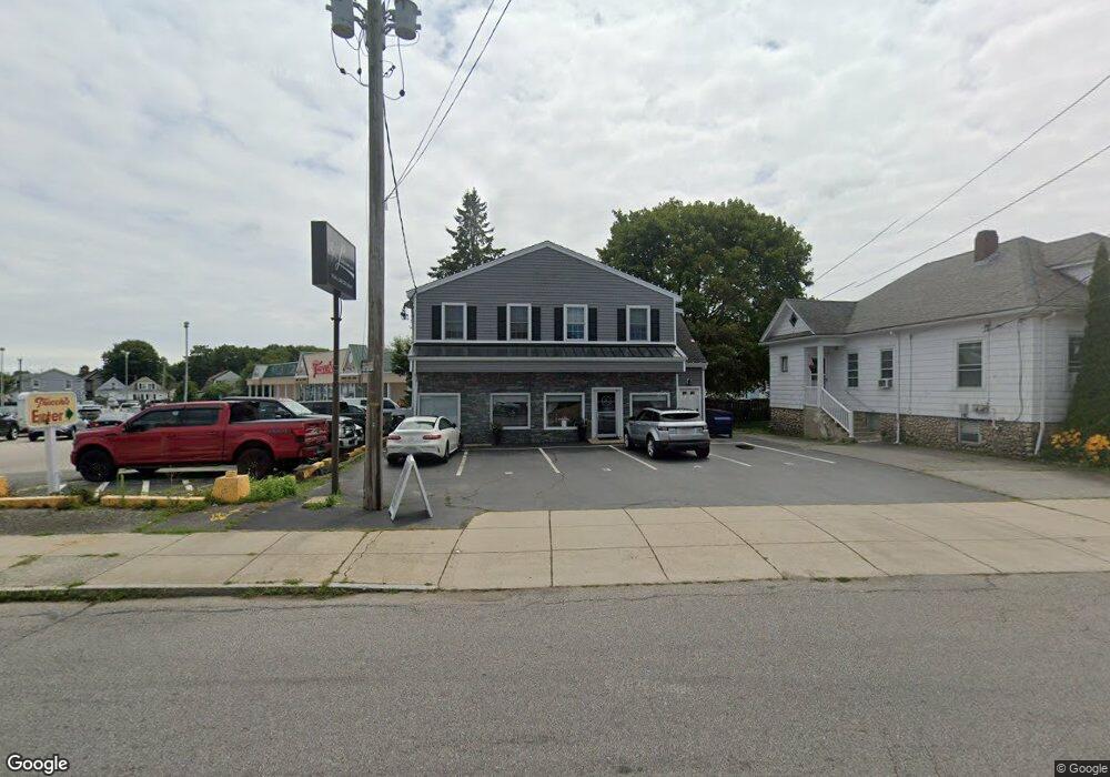
1030 Phillips Rd Unit 1 New Bedford, MA 02745
Acushnet-Pine Hill NeighborhoodEstimated Value: $515,435
2
Beds
1
Bath
2,822
Sq Ft
$183/Sq Ft
Est. Value
About This Home
This home is located at 1030 Phillips Rd Unit 1, New Bedford, MA 02745 and is currently estimated at $515,435, approximately $182 per square foot. 1030 Phillips Rd Unit 1 is a home located in Bristol County with nearby schools including Elwyn G. Campbell Elementary school, Normandin Middle School, and New Bedford High School.
Ownership History
Date
Name
Owned For
Owner Type
Purchase Details
Closed on
Mar 7, 2006
Sold by
Pelletier Alice
Bought by
Mello
Current Estimated Value
Purchase Details
Closed on
Nov 10, 1993
Sold by
Surprenant Domina
Bought by
Vieira John C and Pelletier Alice
Create a Home Valuation Report for This Property
The Home Valuation Report is an in-depth analysis detailing your home's value as well as a comparison with similar homes in the area
Home Values in the Area
Average Home Value in this Area
Purchase History
| Date | Buyer | Sale Price | Title Company |
|---|---|---|---|
| 1030 Phillips Rd Llc | $332,500 | None Available | |
| 1030 Phillips Rd Llc | $332,500 | None Available | |
| 1030 Phillips Rd Llc | $332,500 | None Available | |
| Mello | -- | -- | |
| Mello | -- | -- | |
| Vieira John C | $30,000 | -- | |
| Vieira John C | $30,000 | -- |
Source: Public Records
Mortgage History
| Date | Status | Borrower | Loan Amount |
|---|---|---|---|
| Open | 1030 Phillips Rd Llc | $299,250 | |
| Closed | 1030 Phillips Rd Llc | $299,250 | |
| Previous Owner | Vieira John C | $80,000 |
Source: Public Records
Tax History Compared to Growth
Tax History
| Year | Tax Paid | Tax Assessment Tax Assessment Total Assessment is a certain percentage of the fair market value that is determined by local assessors to be the total taxable value of land and additions on the property. | Land | Improvement |
|---|---|---|---|---|
| 2025 | $0 | $325,800 | $134,400 | $191,400 |
| 2024 | $0 | $376,600 | $134,400 | $242,200 |
| 2023 | $5,284 | $369,800 | $112,000 | $257,800 |
| 2022 | $6,033 | $314,600 | $107,100 | $207,500 |
| 2021 | $6,033 | $387,000 | $101,800 | $285,200 |
| 2020 | $5,780 | $357,700 | $101,800 | $255,900 |
| 2019 | $0 | $294,800 | $97,700 | $197,100 |
| 2018 | $0 | $290,700 | $97,700 | $193,000 |
| 2017 | -- | $290,700 | $97,700 | $193,000 |
| 2016 | -- | $290,700 | $97,700 | $193,000 |
| 2015 | -- | $276,900 | $97,700 | $179,200 |
| 2014 | -- | $267,200 | $93,600 | $173,600 |
Source: Public Records
Map
Nearby Homes
- 1044 Phillips Rd Unit 20
- 1044 Phillips Rd Unit 24
- 2981 Acushnet Ave
- 1023 Bowles St
- 2992 Acushnet Ave
- 1044 Victoria St Unit B-29
- 957 Glen St
- 1214 Church St
- 868 Phillips Rd
- ES Acushnet Ave
- 1158 Joyce St
- 1251 Church St Unit 10
- 0 Church Dutton & Chaffee Unit 73371719
- 1164 Victoria St
- 1261 Church St Unit 70
- 1261 Church St Unit 46
- 1261 Church St Unit 53
- 26 Rounseville St
- 40 Nancy St
- 1045 Forbes St
- 1030 Phillips Rd
- 1034 Phillips Rd
- 1044 Phillips Rd Unit 23
- 1044 Phillips Rd Unit 7
- 1044 Phillips Rd Unit 14
- 1044 Phillips Rd Unit 15
- 1044 Phillips Rd Unit 22
- 1044 Phillips Rd Unit 9
- 1044 Phillips Rd Unit 16
- 1044 Phillips Rd Unit 29
- 1044 Phillips Rd Unit 17
- 1044 Phillips Rd Unit 12
- 1044 Phillips Rd Unit 11
- 1044 Phillips Rd Unit 3
- 1044 Phillips Rd
- 1044 Phillips Rd Unit 18
- 1044 Phillips Rd Unit 2
- 1044 Phillips Rd Unit 26
- 1048 Phillips Rd
- 1054 Phillips Rd