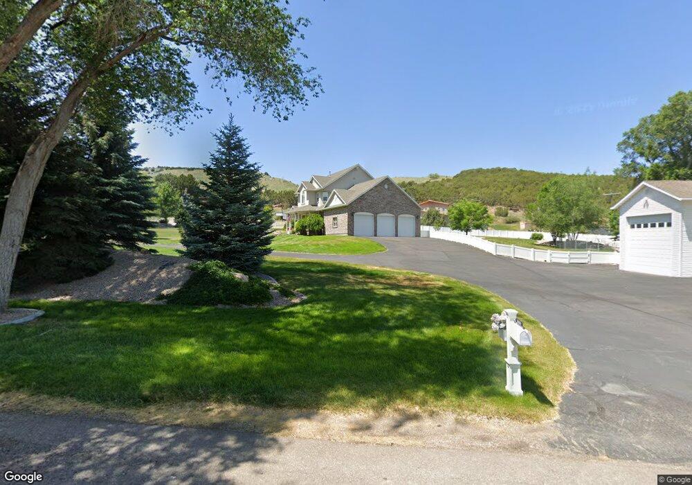
1030 Shale Dr Pocatello, ID 83204
West Pocatello NeighborhoodEstimated Value: $569,000 - $856,077
5
Beds
4
Baths
5,072
Sq Ft
$148/Sq Ft
Est. Value
About This Home
This home is located at 1030 Shale Dr, Pocatello, ID 83204 and is currently estimated at $749,026, approximately $147 per square foot. 1030 Shale Dr is a home located in Bannock County with nearby schools including Indian Hills Elementary School, Irving Middle School, and Pocatello High School.
Ownership History
Date
Name
Owned For
Owner Type
Purchase Details
Closed on
Dec 18, 2017
Sold by
Merrill Brock Cameron and Merrill Ashlie J
Bought by
Dodge Stanley Ross and Dodge Joann Louise
Current Estimated Value
Home Financials for this Owner
Home Financials are based on the most recent Mortgage that was taken out on this home.
Original Mortgage
$300,000
Outstanding Balance
$252,639
Interest Rate
3.95%
Mortgage Type
New Conventional
Estimated Equity
$496,387
Purchase Details
Closed on
May 14, 2015
Sold by
Johansen Thomas and Johansen Sandra
Bought by
Merrill Brock Cameron and Merrill Ashlie J
Home Financials for this Owner
Home Financials are based on the most recent Mortgage that was taken out on this home.
Original Mortgage
$308,750
Interest Rate
3.67%
Mortgage Type
New Conventional
Create a Home Valuation Report for This Property
The Home Valuation Report is an in-depth analysis detailing your home's value as well as a comparison with similar homes in the area
Home Values in the Area
Average Home Value in this Area
Purchase History
| Date | Buyer | Sale Price | Title Company |
|---|---|---|---|
| Dodge Stanley Ross | -- | Pioneer Title | |
| Merrill Brock Cameron | -- | Amerititle |
Source: Public Records
Mortgage History
| Date | Status | Borrower | Loan Amount |
|---|---|---|---|
| Open | Dodge Stanley Ross | $300,000 | |
| Previous Owner | Merrill Brock Cameron | $308,750 |
Source: Public Records
Tax History Compared to Growth
Tax History
| Year | Tax Paid | Tax Assessment Tax Assessment Total Assessment is a certain percentage of the fair market value that is determined by local assessors to be the total taxable value of land and additions on the property. | Land | Improvement |
|---|---|---|---|---|
| 2024 | $7,035 | $709,656 | $121,633 | $588,023 |
| 2023 | $6,230 | $742,419 | $121,633 | $620,786 |
| 2022 | $6,230 | $574,200 | $70,028 | $504,172 |
| 2021 | $7,502 | $574,200 | $70,028 | $504,172 |
| 2020 | $6,188 | $496,323 | $70,028 | $426,295 |
| 2019 | $6,548 | $405,705 | $35,014 | $370,691 |
| 2018 | $6,240 | $383,234 | $60,894 | $322,340 |
| 2017 | $6,191 | $383,234 | $60,894 | $322,340 |
| 2016 | $6,253 | $383,234 | $60,894 | $322,340 |
| 2015 | $6,429 | $0 | $0 | $0 |
| 2012 | -- | $380,660 | $60,894 | $319,766 |
Source: Public Records
Map
Nearby Homes
- 3560 Augusta Dr
- 930 Shale Dr
- 3625 Augusta Dr
- 850 Spy Glass Point
- 3595 Wild Mountain Dr
- Lot 14 Blk 1 Fieldstone Dr
- Lot 13 Blk 1 Fieldstone Dr
- 56 Cedar Hills Dr
- 3325 Duck Hook Dr
- 3161 Lundburg Ln
- 3336 Lundburg Ln
- 1325 Cedar Lake Rd
- 2850 Bannock Hwy
- 1420 Cedar Lake Rd
- 628 Double Eagle Dr
- TBD S Grant
- 506 Mulligan Rd
- 2225 Clinton St
- 615 Cree Ave
- 4780 Clearview Ave
- 1020 Shale Dr
- 3481 Johnny Creek Rd
- 1234 Field Dr
- 1250 Field Dr
- 1000 Shale Dr
- 3515 Johnny Creek Rd
- 3500 Johnny Creek Rd
- 875 Brookside Ln
- 861 Brookside Ln
- 3511 Augusta Dr
- 1177 Field Dr
- 874 Saw Grass Cir
- 855 Brookside Ln
- 862 Saw Grass Cir
- 837 Brookside Ln
- 878 Brookside Ln
- 1280 Field Dr
- 3510 Johnny Creek Rd
- 000 Brookside Ln
- 860 Brookside Ln