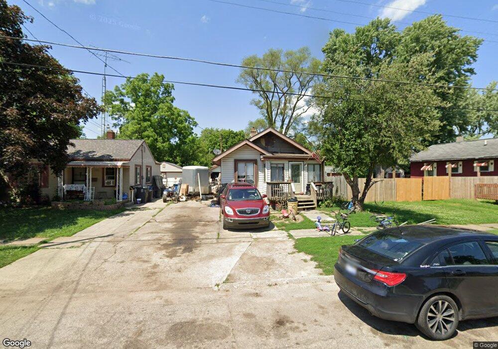
1030 SiMcOe Ave Flint, MI 48507
South Side NeighborhoodEstimated Value: $33,000 - $55,000
2
Beds
1
Bath
700
Sq Ft
$62/Sq Ft
Est. Value
About This Home
This home is located at 1030 SiMcOe Ave, Flint, MI 48507 and is currently estimated at $43,747, approximately $62 per square foot. 1030 SiMcOe Ave is a home located in Genesee County with nearby schools including Eisenhower School, Flint Southwestern Classical Academy, and International Academy of Flint (K-12).
Ownership History
Date
Name
Owned For
Owner Type
Purchase Details
Closed on
Sep 18, 2020
Sold by
Henderson Roy
Bought by
Wice Carl James Mass
Current Estimated Value
Purchase Details
Closed on
Nov 17, 2018
Sold by
Henderson Roy W
Bought by
Mass Wice Carl James
Home Financials for this Owner
Home Financials are based on the most recent Mortgage that was taken out on this home.
Original Mortgage
$12,000
Interest Rate
4.8%
Mortgage Type
Seller Take Back
Create a Home Valuation Report for This Property
The Home Valuation Report is an in-depth analysis detailing your home's value as well as a comparison with similar homes in the area
Home Values in the Area
Average Home Value in this Area
Purchase History
| Date | Buyer | Sale Price | Title Company |
|---|---|---|---|
| Wice Carl James Mass | $12,000 | Cislo Title Company | |
| Mass Wice Carl James | $12,000 | None Available |
Source: Public Records
Mortgage History
| Date | Status | Borrower | Loan Amount |
|---|---|---|---|
| Previous Owner | Mass Wice Carl James | $12,000 |
Source: Public Records
Tax History Compared to Growth
Tax History
| Year | Tax Paid | Tax Assessment Tax Assessment Total Assessment is a certain percentage of the fair market value that is determined by local assessors to be the total taxable value of land and additions on the property. | Land | Improvement |
|---|---|---|---|---|
| 2025 | $966 | $16,000 | $0 | $0 |
| 2024 | $899 | $16,200 | $0 | $0 |
| 2023 | $882 | $13,700 | $0 | $0 |
| 2022 | $0 | $11,600 | $0 | $0 |
| 2021 | $892 | $10,300 | $0 | $0 |
| 2020 | $825 | $8,500 | $0 | $0 |
| 2019 | $864 | $9,200 | $0 | $0 |
| 2018 | $712 | $9,500 | $0 | $0 |
| 2017 | $753 | $0 | $0 | $0 |
| 2016 | $748 | $0 | $0 | $0 |
| 2015 | -- | $0 | $0 | $0 |
| 2014 | -- | $0 | $0 | $0 |
| 2012 | -- | $14,000 | $0 | $0 |
Source: Public Records
Map
Nearby Homes
- 909 Barrie Ave
- 930 Bloor Ave
- 936 Lincoln Ave
- 839 SiMcOe Ave
- 1225 Vermilya Ave
- 825 Vermilya Ave
- 3116 Camden Ave
- 805 Vermilya Ave
- 834 Remington Ave
- 745 Freeman Ave
- 741 Barrie Ave
- 1130 W Atherton Rd
- 812 Remington Ave
- 730 Freeman Ave
- 1225 Waldman Ave
- 1028 Campbell St
- 657 Barrie Ave
- 822 Campbell St
- 727 Waldman Ave
- 1410 Berrywood Ln
- 1034 SiMcOe Ave
- 1022 SiMcOe Ave
- 1023 Barrie Ave
- 1035 Barrie Ave
- 1038 SiMcOe Ave
- 1031 Barrie Ave
- 1018 SiMcOe Ave
- 1102 SiMcOe Ave
- 1019 Barrie Ave
- 1101 Barrie Ave
- 1014 SiMcOe Ave
- 1029 SiMcOe Ave
- 1025 SiMcOe Ave
- 1110 SiMcOe Ave
- 1021 SiMcOe Ave
- 1037 SiMcOe Ave
- 1015 Barrie Ave
- 1011 Barrie Ave
- 1017 SiMcOe Ave
- 1109 Barrie Ave