
Seller's Agent in 2025
Christian Feeney
Lamacchia Realty, Inc.
(508) 981-7199
1 in this area
1 Total Sale
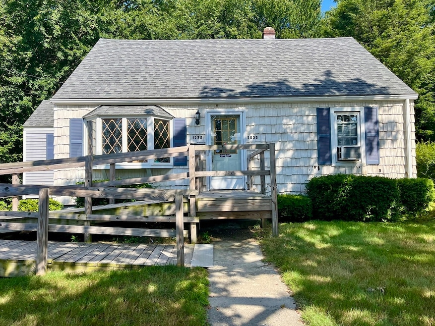
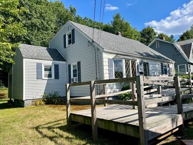
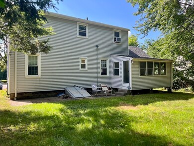
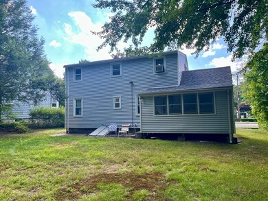
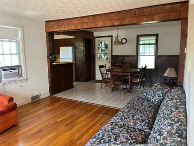
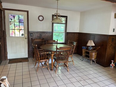
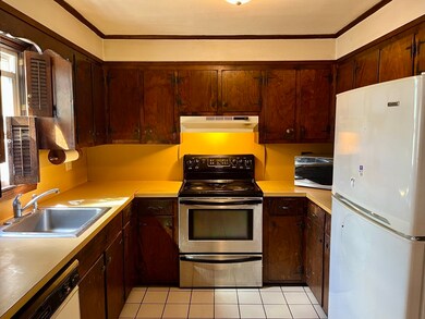
BACK ON MARKET DUE TO BUYER FINANCING. Well built 1950's cape cod style home with full rear dormer and hardwood floors throughout. This home is ready for your own personalized improvements. It features a newer roof (2021), vinyl replacement windows, vinyl siding, a newer oil tank, and a well maintained furnace. Conveniently located near rt. 190 and rt. 290. The first floor has an open floor plan living room, kitchen and dining area as well as 2 bedrooms and a full bathroom. The first floor also has a nice back porch. The upstairs features 2 good sized bedrooms, a half bath and plenty of closet space. This house has great potential and with a little vision and elbow grease it could be a real gem. Don't miss this outstanding investment opportunity. Schedule your showing today! OFFER DEADLINE: 9/1 5:00pm
| Date | Type | Sale Price | Title Company |
|---|---|---|---|
| Deed | $350,000 | -- |
| Date | Status | Loan Amount | Loan Type |
|---|---|---|---|
| Open | $245,000 | Purchase Money Mortgage |
| Date | Event | Price | List to Sale | Price per Sq Ft |
|---|---|---|---|---|
| 10/08/2025 10/08/25 | Sold | $350,000 | +6.1% | $257 / Sq Ft |
| 09/03/2025 09/03/25 | Pending | -- | -- | -- |
| 08/28/2025 08/28/25 | For Sale | $329,900 | 0.0% | $243 / Sq Ft |
| 07/31/2025 07/31/25 | Pending | -- | -- | -- |
| 07/24/2025 07/24/25 | For Sale | $329,900 | -- | $243 / Sq Ft |
| Year | Tax Paid | Tax Assessment Tax Assessment Total Assessment is a certain percentage of the fair market value that is determined by local assessors to be the total taxable value of land and additions on the property. | Land | Improvement |
|---|---|---|---|---|
| 2025 | $4,882 | $370,100 | $118,100 | $252,000 |
| 2024 | $4,788 | $348,200 | $118,100 | $230,100 |
| 2023 | $4,587 | $319,900 | $102,700 | $217,200 |
| 2022 | $4,282 | $281,500 | $82,200 | $199,300 |
| 2021 | $4,090 | $251,200 | $65,700 | $185,500 |
| 2020 | $3,983 | $234,300 | $65,700 | $168,600 |
| 2019 | $3,787 | $210,400 | $59,100 | $151,300 |
| 2018 | $3,795 | $200,700 | $59,100 | $141,600 |
| 2017 | $3,635 | $189,100 | $59,100 | $130,000 |
| 2016 | $3,570 | $173,200 | $43,200 | $130,000 |
| 2015 | $3,476 | $173,200 | $43,200 | $130,000 |
| 2014 | $3,384 | $173,200 | $43,200 | $130,000 |
Seller's Agent in 2025
Christian Feeney
Lamacchia Realty, Inc.
(508) 981-7199
1 in this area
1 Total Sale
Source: MLS Property Information Network (MLS PIN)
MLS Number: 73408956
APN: WORC-000032-000050-000008
Disclaimer: Certain information contained herein is derived from information provided by parties other than Homes.com. All information provided is deemed reliable, but is not guaranteed to be accurate and should be independently verified.
![]() The property listing data and information, or the Images, set forth herein were provided to MLS Property Information Network, Inc. from third party sources, including sellers, lessors and public records, and were compiled by MLS Property Information Network, Inc. The property listing data and information, and the Images, are for the personal, non-commercial use of consumers having a good faith interest in purchasing or leasing listed properties of the type displayed to them and may not be used for any purpose other than to identify prospective properties which such consumers may have a good faith interest in purchasing or leasing. MLS Property Information Network, Inc. and its subscribers disclaim any and all representations and warranties as to the accuracy of the property listing data and information, or as to the accuracy of any of the Images, set forth herein.
The property listing data and information, or the Images, set forth herein were provided to MLS Property Information Network, Inc. from third party sources, including sellers, lessors and public records, and were compiled by MLS Property Information Network, Inc. The property listing data and information, and the Images, are for the personal, non-commercial use of consumers having a good faith interest in purchasing or leasing listed properties of the type displayed to them and may not be used for any purpose other than to identify prospective properties which such consumers may have a good faith interest in purchasing or leasing. MLS Property Information Network, Inc. and its subscribers disclaim any and all representations and warranties as to the accuracy of the property listing data and information, or as to the accuracy of any of the Images, set forth herein.