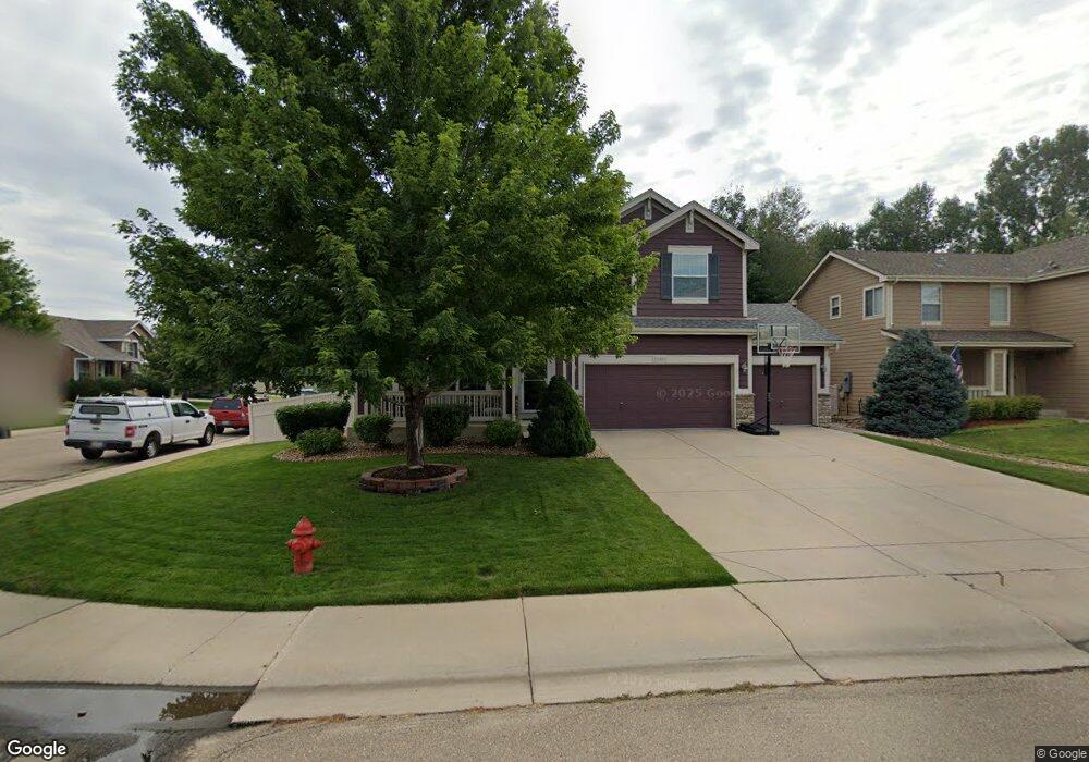
10300 Echo Cir Firestone, CO 80504
Estimated Value: $524,000 - $542,000
4
Beds
5
Baths
1,964
Sq Ft
$272/Sq Ft
Est. Value
About This Home
This home is located at 10300 Echo Cir, Firestone, CO 80504 and is currently estimated at $533,809, approximately $271 per square foot. 10300 Echo Cir is a home located in Weld County with nearby schools including Prairie Ridge Elementary School, Coal Ridge Middle School, and Frederick Senior High School.
Ownership History
Date
Name
Owned For
Owner Type
Purchase Details
Closed on
Mar 10, 2023
Sold by
Rawson Suzanne M
Bought by
Zoey Family Revocable Trust
Current Estimated Value
Purchase Details
Closed on
Oct 11, 2000
Sold by
The Ryland Group Inc
Bought by
Rawson Suzanne M and Rawson Kevin L
Home Financials for this Owner
Home Financials are based on the most recent Mortgage that was taken out on this home.
Original Mortgage
$184,350
Interest Rate
7.95%
Create a Home Valuation Report for This Property
The Home Valuation Report is an in-depth analysis detailing your home's value as well as a comparison with similar homes in the area
Home Values in the Area
Average Home Value in this Area
Purchase History
| Date | Buyer | Sale Price | Title Company |
|---|---|---|---|
| Zoey Family Revocable Trust | -- | None Listed On Document | |
| Rawson Suzanne M | $256,376 | Cornerstone Title Co |
Source: Public Records
Mortgage History
| Date | Status | Borrower | Loan Amount |
|---|---|---|---|
| Previous Owner | Rawson Suzanne M | $184,350 |
Source: Public Records
Tax History
| Year | Tax Paid | Tax Assessment Tax Assessment Total Assessment is a certain percentage of the fair market value that is determined by local assessors to be the total taxable value of land and additions on the property. | Land | Improvement |
|---|---|---|---|---|
| 2025 | $3,250 | $32,550 | $7,380 | $25,170 |
| 2024 | $3,250 | $32,550 | $7,380 | $25,170 |
| 2023 | $3,117 | $35,150 | $7,980 | $27,170 |
| 2022 | $2,780 | $26,580 | $5,700 | $20,880 |
| 2021 | $2,807 | $27,340 | $5,860 | $21,480 |
| 2020 | $2,687 | $26,380 | $4,290 | $22,090 |
| 2019 | $2,726 | $26,380 | $4,290 | $22,090 |
| 2018 | $2,337 | $23,470 | $4,320 | $19,150 |
| 2017 | $2,389 | $23,470 | $4,320 | $19,150 |
| 2016 | $2,218 | $21,440 | $4,780 | $16,660 |
| 2015 | $2,150 | $21,440 | $4,780 | $16,660 |
| 2014 | $1,699 | $16,960 | $2,310 | $14,650 |
Source: Public Records
Map
Nearby Homes
- 10302 Eastview St
- 6471 St Vrain Ranch Blvd
- 6685 Sage Ave
- 6805 Quincy Ave
- 10245 Dusk St
- 6510 Stagecoach Ave
- 6650 Stagecoach Ave
- 10490 Falcon St
- 10289 Dresden St
- 10255 Dresden St
- 10473 Sunburst Ave
- 10516 Sunburst Ave
- 10489 Devonshire St
- 10529 Taylor Ave
- 6727 Thistle Ridge Ave
- 6718 Thistle Ridge Ave
- 0 County Road 15 Unit IRE1051142
- 00 County Road 15
- 0 Sable Ave and Colorado Blvd Unit IRE1022922
- 10750 County Road 15
Your Personal Tour Guide
Ask me questions while you tour the home.