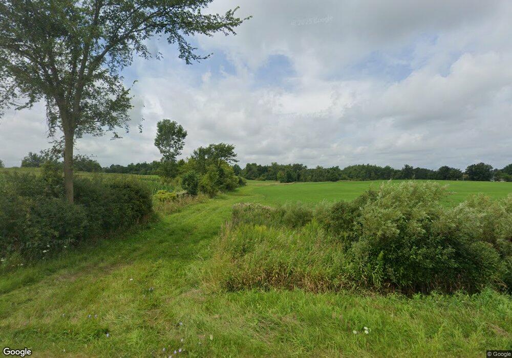
10300 S Edon Rd Camden, MI 49232
Estimated Value: $129,828
--
Bed
--
Bath
--
Sq Ft
30.29
Acres
About This Home
This home is located at 10300 S Edon Rd, Camden, MI 49232 and is currently estimated at $129,828. 10300 S Edon Rd is a home located in Hillsdale County with nearby schools including Camden-Frontier K-8 School, Camden-Frontier High School, and Ridgeview Camden School.
Ownership History
Date
Name
Owned For
Owner Type
Purchase Details
Closed on
May 31, 2012
Sold by
Goodband Patrick H and Goodband Lori A
Bought by
Goodband Patrick H and Goodband Lori A
Current Estimated Value
Purchase Details
Closed on
Sep 27, 2011
Sold by
Hoard Charles D and Hoard Cindy S
Bought by
Goodband Patrick H and Goodband Lori A
Home Financials for this Owner
Home Financials are based on the most recent Mortgage that was taken out on this home.
Original Mortgage
$39,800
Interest Rate
4.32%
Mortgage Type
Future Advance Clause Open End Mortgage
Create a Home Valuation Report for This Property
The Home Valuation Report is an in-depth analysis detailing your home's value as well as a comparison with similar homes in the area
Home Values in the Area
Average Home Value in this Area
Purchase History
| Date | Buyer | Sale Price | Title Company |
|---|---|---|---|
| Goodband Patrick H | -- | None Available | |
| Goodband Patrick H | $56,000 | Wolverine Abstract |
Source: Public Records
Mortgage History
| Date | Status | Borrower | Loan Amount |
|---|---|---|---|
| Closed | Goodband Patrick H | $39,800 |
Source: Public Records
Tax History Compared to Growth
Tax History
| Year | Tax Paid | Tax Assessment Tax Assessment Total Assessment is a certain percentage of the fair market value that is determined by local assessors to be the total taxable value of land and additions on the property. | Land | Improvement |
|---|---|---|---|---|
| 2025 | $940 | $79,000 | $0 | $0 |
| 2024 | $427 | $69,500 | $0 | $0 |
| 2023 | $407 | $61,000 | $0 | $0 |
| 2022 | $856 | $50,500 | $0 | $0 |
| 2021 | $1,112 | $51,200 | $0 | $0 |
| 2020 | $1,131 | $53,400 | $0 | $0 |
| 2019 | $1,110 | $52,800 | $0 | $0 |
| 2018 | $1,094 | $53,200 | $0 | $0 |
| 2017 | $763 | $51,930 | $0 | $0 |
| 2016 | $752 | $43,530 | $0 | $0 |
| 2015 | $343 | $43,530 | $0 | $0 |
| 2013 | -- | $31,740 | $0 | $0 |
| 2012 | $324 | $37,510 | $0 | $0 |
Source: Public Records
Map
Nearby Homes
- 6524 W Montgomery Rd
- 107 Mary St
- 115 N Michigan St
- 219 N Hayward St
- 0 Dimmers Rd
- 7944 Gilmore Rd
- 9677 W Camden Rd
- 9949 Indian Trail
- 5411 Lilac Rd
- 7841 Topinabee Dr
- 309 S Main St
- 0 W Silver St Unit 25044322
- 108 Lynn St
- 203 E Michigan St
- 4421 Carpenter Rd
- 7410 Cambria Rd
- 7441 Cambria Rd
- 5211 Long Lake Rd
- 0 W Territorial Rd Unit 25043960
- 0 W Territorial Rd Unit 11603977
- 10200 S Edon Rd
- 7321 W Montgomery Rd
- 7170 W Montgomery Rd
- 6991 W Montgomery Rd
- 9900 S Edon Rd
- 10380 S Edon Rd
- 7401 W Montgomery Rd
- 7411 W Montgomery Rd
- 6846 W Montgomery Rd
- 10491 S Edon Rd
- 6811 W Montgomery Rd
- 6766 W Montgomery Rd
- 7511 W Montgomery Rd
- 9631 S Edon Rd
- 9594 S Edon Rd
- 6640 W Montgomery Rd
- 7651 W Montgomery Rd
- 7651 W Montgomery Rd
- 10690 S Edon Rd
- 10711 S Edon Rd
