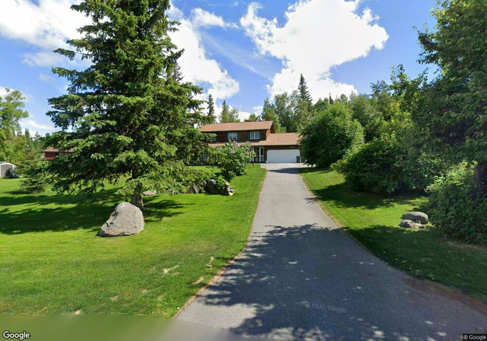
10301 Tree Top Ln Anchorage, AK 99507
Mid-Hillside NeighborhoodEstimated Value: $567,000 - $781,000
3
Beds
3
Baths
2,654
Sq Ft
$265/Sq Ft
Est. Value
About This Home
This home is located at 10301 Tree Top Ln, Anchorage, AK 99507 and is currently estimated at $703,762, approximately $265 per square foot. 10301 Tree Top Ln is a home located in Anchorage Municipality with nearby schools including O'Malley Elementary School, Hanshew Middle School, and Service High School.
Ownership History
Date
Name
Owned For
Owner Type
Purchase Details
Closed on
Oct 4, 2002
Sold by
Wesevich John W and Wesevich Fondi C
Bought by
Schimschat Chris M and Bink Jonda J
Current Estimated Value
Home Financials for this Owner
Home Financials are based on the most recent Mortgage that was taken out on this home.
Original Mortgage
$276,300
Interest Rate
5.93%
Create a Home Valuation Report for This Property
The Home Valuation Report is an in-depth analysis detailing your home's value as well as a comparison with similar homes in the area
Home Values in the Area
Average Home Value in this Area
Purchase History
| Date | Buyer | Sale Price | Title Company |
|---|---|---|---|
| Schimschat Chris M | -- | -- |
Source: Public Records
Mortgage History
| Date | Status | Borrower | Loan Amount |
|---|---|---|---|
| Previous Owner | Schimschat Chris M | $276,300 |
Source: Public Records
Tax History Compared to Growth
Tax History
| Year | Tax Paid | Tax Assessment Tax Assessment Total Assessment is a certain percentage of the fair market value that is determined by local assessors to be the total taxable value of land and additions on the property. | Land | Improvement |
|---|---|---|---|---|
| 2025 | $8,324 | $657,800 | $134,200 | $523,600 |
| 2024 | $8,324 | $612,700 | $134,200 | $478,500 |
| 2023 | $7,675 | $542,400 | $128,700 | $413,700 |
| 2022 | $7,681 | $537,100 | $128,600 | $408,500 |
| 2021 | $7,735 | $500,000 | $128,600 | $371,400 |
| 2020 | $6,724 | $480,300 | $128,600 | $351,700 |
| 2019 | $6,689 | $486,500 | $128,600 | $357,900 |
| 2018 | $6,303 | $458,700 | $128,600 | $330,100 |
| 2017 | $5,815 | $452,700 | $128,600 | $324,100 |
| 2016 | $4,997 | $460,900 | $128,600 | $332,300 |
| 2015 | $4,997 | $447,100 | $124,600 | $322,500 |
| 2014 | $4,997 | $422,800 | $104,000 | $318,800 |
Source: Public Records
Map
Nearby Homes
- 6815 Double Tree Ct
- 6411 Ridge Tree Cir
- 6460 Limestone Cir
- L7 Panorama Dr
- L13 Panorama Dr
- L3 Panorama Dr
- L6 Panorama Dr
- L11 Panorama Dr
- L2 Panorama Dr
- L10 Panorama Dr
- 5900 Orth Cir
- 6550 Rockridge Dr
- 11800 Nebesna Dr
- 10341 Stroganof Dr
- 11840 Coughlan Way
- 9900 Hillhaven Cir
- L1 B1 E Klatt Rd
- L3 Totem Rd
- 11831 Moose Rd
- 10960 Totem Rd
- 10341 Tree Top Ln
- 7200 Tree Top Cir
- 10381 Tree Top Ln
- 10381 Tree Top Ln Unit A
- 10381 Tree Top Ln Unit B
- 10300 Hillside Dr
- 7280 Tree Top Cir
- 10280 Hillside Dr
- 7121 Crooked Tree Dr
- 10200 Hillside Dr
- 10380 Hillside Dr
- 7101 Crooked Tree Dr
- 7281 Tree Top Cir
- 7201 Tree Top Cir
- 7241 Tree Top Cir
- 7141 Crooked Tree Dr
- 7141 Tree Top Cir
- 7081 Crooked Tree Dr
- 7101 Tree Top Cir
- 7100 Crooked Tree Dr